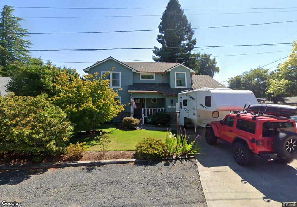
3930 5th Ave N Keizer, OR 97303
Estimated Value: $571,000 - $890,000
4
Beds
3
Baths
2,155
Sq Ft
$352/Sq Ft
Est. Value
About This Home
This home is located at 3930 5th Ave N, Keizer, OR 97303 and is currently estimated at $757,670, approximately $351 per square foot. 3930 5th Ave N is a home located in Marion County with nearby schools including Cummings Elementary School, Claggett Creek Middle School, and McNary High School.
Ownership History
Date
Name
Owned For
Owner Type
Purchase Details
Closed on
Feb 28, 2002
Sold by
Hermansen Paul R and Hermansen Susan C
Bought by
Bornstedt Jack B and Bornstedt Ruth E
Current Estimated Value
Home Financials for this Owner
Home Financials are based on the most recent Mortgage that was taken out on this home.
Original Mortgage
$194,650
Outstanding Balance
$78,184
Interest Rate
6.8%
Mortgage Type
VA
Estimated Equity
$679,486
Create a Home Valuation Report for This Property
The Home Valuation Report is an in-depth analysis detailing your home's value as well as a comparison with similar homes in the area
Home Values in the Area
Average Home Value in this Area
Purchase History
| Date | Buyer | Sale Price | Title Company |
|---|---|---|---|
| Bornstedt Jack B | $189,000 | Amerititle Inc |
Source: Public Records
Mortgage History
| Date | Status | Borrower | Loan Amount |
|---|---|---|---|
| Open | Bornstedt Jack B | $194,650 |
Source: Public Records
Tax History Compared to Growth
Tax History
| Year | Tax Paid | Tax Assessment Tax Assessment Total Assessment is a certain percentage of the fair market value that is determined by local assessors to be the total taxable value of land and additions on the property. | Land | Improvement |
|---|---|---|---|---|
| 2025 | $3,716 | $289,370 | -- | -- |
| 2024 | $3,716 | $280,950 | -- | -- |
| 2023 | $3,537 | $272,770 | $0 | $0 |
| 2022 | $3,331 | $264,830 | $0 | $0 |
| 2021 | $3,225 | $257,120 | $0 | $0 |
| 2020 | $3,139 | $195,180 | $0 | $0 |
| 2019 | $3,017 | $189,490 | $0 | $0 |
| 2018 | $2,846 | $0 | $0 | $0 |
| 2017 | $2,553 | $0 | $0 | $0 |
| 2016 | $2,445 | $0 | $0 | $0 |
| 2015 | $2,473 | $0 | $0 | $0 |
| 2014 | $2,372 | $0 | $0 | $0 |
Source: Public Records
Map
Nearby Homes
- 530 Larry Ave N
- 211 Sunset Ave N
- 132 Sunset Ave N Unit 168
- 3796 Hart Dr N
- 4407 Toni Ave N
- 500 Bever Dr NE
- 382 Cummings Ln N
- 1001 Ring St NE Unit 1007
- 1009 Ring St NE Unit 1015
- 1202 Leo St NE
- 359 Apple Blossom Ave N
- 870 Rafael Ave N
- 4575 Clark Ave NE
- 3774 Homestead Ct NE
- 220 Gardenia Dr N Unit 222
- 3515 Brooks Ave NE
- 3297 River Rd N
- 550 Churchdale Ave N Unit 570
- 1377 Krysti Ct NE
- 4670 Thorman Ave NE
- 3950 5th Ave N
- 429 Dennis Ln N
- 427 Dennis Ln N
- 3945 5th Ave N
- 430 Sunset Ave N
- 470 Sunset Ave N
- 420 Sunset Ave N
- 450 Sunset Ave N
- 509 Dennis Ln N
- 419 Dennis Ln N
- 510 Sunset Ave N
- 410 Sunset Ave N
- 550 Sunset Ave N
- 409 Dennis Ln N
- 390 Sunset Ave N
- 4001 12th (5) St
- 438 Dennis Ln N
- 428 Dennis Ln N
- 570 Sunset Ave N
- 529 Dennis Ln N