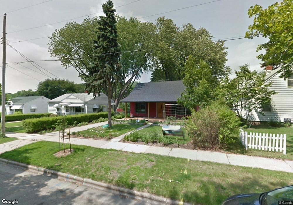
3930 Anchor Dr Madison, WI 53714
Eastmorland NeighborhoodEstimated Value: $318,000 - $391,000
4
Beds
1
Bath
1,116
Sq Ft
$312/Sq Ft
Est. Value
About This Home
This home is located at 3930 Anchor Dr, Madison, WI 53714 and is currently estimated at $348,286, approximately $312 per square foot. 3930 Anchor Dr is a home located in Dane County with nearby schools including Schenk Elementary School, Whitehorse Middle School, and La Follette High School.
Ownership History
Date
Name
Owned For
Owner Type
Purchase Details
Closed on
Mar 28, 2024
Sold by
Foster Grant
Bought by
Foster Grant and Williams Olivia R
Current Estimated Value
Purchase Details
Closed on
Jan 17, 2024
Sold by
Foster Jennifer E
Bought by
Foster Grant A
Purchase Details
Closed on
Mar 30, 2007
Sold by
Cafferty Michael P and Thiel Jan
Bought by
Foster Grant A and Foster Jennifer E
Home Financials for this Owner
Home Financials are based on the most recent Mortgage that was taken out on this home.
Original Mortgage
$111,200
Interest Rate
6.5%
Mortgage Type
Purchase Money Mortgage
Create a Home Valuation Report for This Property
The Home Valuation Report is an in-depth analysis detailing your home's value as well as a comparison with similar homes in the area
Home Values in the Area
Average Home Value in this Area
Purchase History
| Date | Buyer | Sale Price | Title Company |
|---|---|---|---|
| Foster Grant | $144,800 | None Listed On Document | |
| Foster Grant A | -- | None Listed On Document | |
| Foster Grant A | $139,000 | None Available |
Source: Public Records
Mortgage History
| Date | Status | Borrower | Loan Amount |
|---|---|---|---|
| Previous Owner | Foster Grant A | $111,200 |
Source: Public Records
Tax History Compared to Growth
Tax History
| Year | Tax Paid | Tax Assessment Tax Assessment Total Assessment is a certain percentage of the fair market value that is determined by local assessors to be the total taxable value of land and additions on the property. | Land | Improvement |
|---|---|---|---|---|
| 2024 | $9,998 | $302,300 | $73,900 | $228,400 |
| 2023 | $4,846 | $287,900 | $70,400 | $217,500 |
| 2021 | $4,390 | $222,300 | $62,000 | $160,300 |
| 2020 | $4,308 | $203,900 | $56,900 | $147,000 |
| 2019 | $4,126 | $196,100 | $54,700 | $141,400 |
| 2018 | $3,786 | $179,900 | $54,700 | $125,200 |
| 2017 | $3,704 | $168,100 | $49,700 | $118,400 |
| 2016 | $3,433 | $152,800 | $45,200 | $107,600 |
| 2015 | $3,352 | $142,600 | $45,200 | $97,400 |
| 2014 | $3,246 | $142,600 | $45,200 | $97,400 |
| 2013 | $3,387 | $139,800 | $45,200 | $94,600 |
Source: Public Records
Map
Nearby Homes
- 3910 Tulane Ave
- 835 Silas St
- 839 Silas St
- 125 Silver Rd
- 3818 Johns St
- 3822 Johns St
- 4210 Dempsey Rd
- 4233 Portland Pkwy
- 4302 Drexel Ave
- 4515 Martha Ln
- 4525 Martha Ln
- 506 Bowman Ave
- 3606 Atwood Ave
- 4310 Hegg Ave
- 5126 Walbridge Ave
- 4705 Agate Ln
- 9 N Fair Oaks Ave
- Lot 3 Bellevine Ct
- 4525 Easley Ln
- 3261 Milwaukee St
- 3926 Anchor Dr
- 610 Dempsey Rd
- 3922 Anchor Dr
- 3933 Margaret St
- 3937 Margaret St
- 3925 Margaret St
- 3918 Anchor Dr
- 3933 Anchor Dr
- 3929 Anchor Dr
- 3921 Margaret St
- 702 Dempsey Rd
- 3925 Anchor Dr
- 3914 Anchor Dr
- 3921 Anchor Dr
- 3913 Margaret St
- 701 Dempsey Rd
- 3917 Anchor Dr
- 3910 Anchor Dr
- 4005 Anchor Dr
- 3913 Anchor Dr