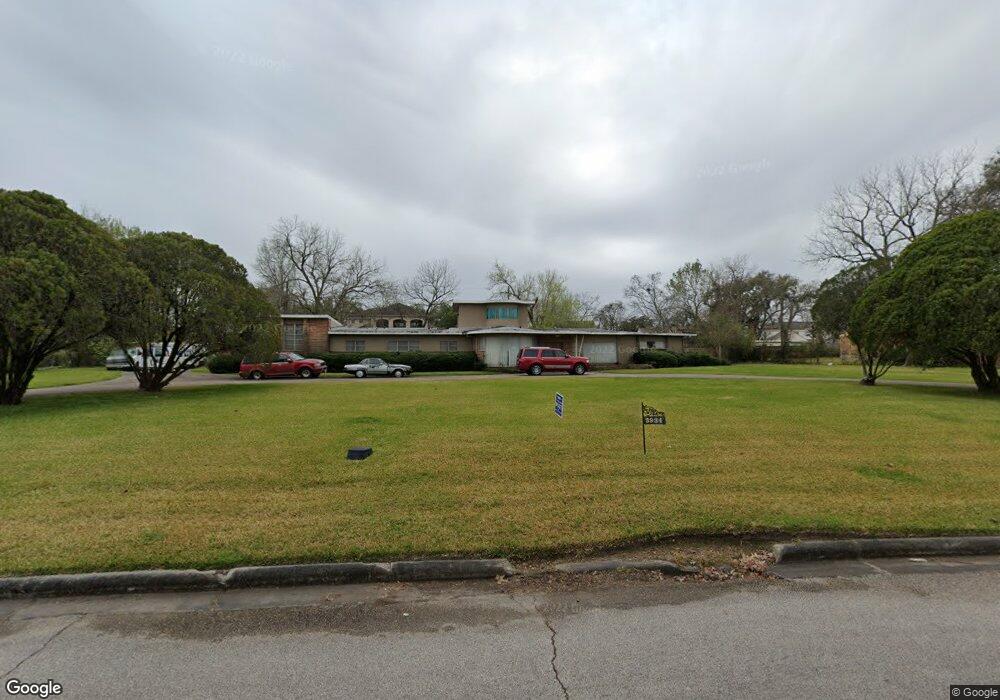
3934 Roseneath Dr Houston, TX 77021
MacGregor NeighborhoodEstimated Value: $821,000 - $863,000
3
Beds
3
Baths
4,330
Sq Ft
$196/Sq Ft
Est. Value
About This Home
This home is located at 3934 Roseneath Dr, Houston, TX 77021 and is currently estimated at $847,730, approximately $195 per square foot. 3934 Roseneath Dr is a home located in Harris County with nearby schools including Peck Elementary School, Cullen Middle School, and Yates High School.
Ownership History
Date
Name
Owned For
Owner Type
Purchase Details
Closed on
Nov 11, 1997
Sold by
Offenburger G W and Offenburger Catherine F
Bought by
Dickson Ii Robert Lee and Dickson Robbie A
Current Estimated Value
Purchase Details
Closed on
Jan 31, 1997
Sold by
Tmw Interest Inc and Woodford Cassandra
Bought by
Dickson Ii Robert Lee and Dickson Robbie A
Purchase Details
Closed on
Aug 28, 1996
Sold by
Va
Bought by
Dickson Ii Robert Lee and Dickson Robbie A
Purchase Details
Closed on
Nov 17, 1995
Sold by
Roosevelt Bank
Bought by
Dickson Ii Robert Lee and Dickson Robbie A
Purchase Details
Closed on
Nov 3, 1995
Sold by
Bankers Trust Company
Bought by
Dickson Ii Robert Lee and Dickson Robbie A
Purchase Details
Closed on
May 17, 1995
Sold by
Hub Of The Plains Vi Ltd
Bought by
Dickson Ii Robert Lee and Dickson Robbie
Purchase Details
Closed on
Mar 8, 1995
Sold by
Sterling Bank
Bought by
Dickson Robert and Dickson Robbie A
Purchase Details
Closed on
Dec 19, 1994
Sold by
Dow Rodrick and Dow Angela
Bought by
Dickson Ii Robert Lee and Dickson Robbie
Home Financials for this Owner
Home Financials are based on the most recent Mortgage that was taken out on this home.
Original Mortgage
$70,000
Interest Rate
9.19%
Mortgage Type
Seller Take Back
Purchase Details
Closed on
Dec 15, 1994
Sold by
Marques Henicy D and Marques Elaine
Bought by
Dickson Ii Robert and Dickson Robbie A
Home Financials for this Owner
Home Financials are based on the most recent Mortgage that was taken out on this home.
Original Mortgage
$70,000
Interest Rate
9.19%
Mortgage Type
Seller Take Back
Purchase Details
Closed on
Jan 14, 1994
Sold by
Hilal Danny
Bought by
Dickson Ii Robert Lee and Dickson Robbie A
Purchase Details
Closed on
Dec 7, 1993
Sold by
Mortgage Properties Corp
Bought by
Dickson Robbie Ann
Purchase Details
Closed on
Oct 5, 1993
Sold by
Palmer Jack
Bought by
Dickson Ii Robert Lee and Dickson Robbie A
Purchase Details
Closed on
Jan 24, 1992
Sold by
American Teachers Associates Inc
Bought by
Dickson Ii Robert L
Create a Home Valuation Report for This Property
The Home Valuation Report is an in-depth analysis detailing your home's value as well as a comparison with similar homes in the area
Home Values in the Area
Average Home Value in this Area
Purchase History
| Date | Buyer | Sale Price | Title Company |
|---|---|---|---|
| Dickson Ii Robert Lee | -- | South Land Title Company | |
| Dickson Ii Robert Lee | $8,450 | -- | |
| Dickson Ii Robert Lee | -- | -- | |
| Dickson Ii Robert Lee | -- | Stewart Title | |
| Dickson Ii Robert Lee | -- | -- | |
| Dickson Ii Robert Lee | -- | -- | |
| Dickson Robert | -- | -- | |
| Dickson Ii Robert Lee | -- | Fort Bend Title Company | |
| Dickson Ii Robert | -- | Stewart Title | |
| Dickson Ii Robert Lee | -- | -- | |
| Dickson Ii Robert Lee | -- | -- | |
| Dickson Ii Robert Lee | -- | -- | |
| Dickson Ii Robert Lee | -- | -- | |
| Dickson Ii Robert Lee | -- | -- | |
| Dickson Robbie Ann | -- | Houston Title/Clear Lake | |
| Dickson Ii Robert Lee | -- | -- | |
| Dickson Ii Robert L | -- | -- |
Source: Public Records
Mortgage History
| Date | Status | Borrower | Loan Amount |
|---|---|---|---|
| Previous Owner | Dickson Ii Robert | $70,000 |
Source: Public Records
Tax History Compared to Growth
Tax History
| Year | Tax Paid | Tax Assessment Tax Assessment Total Assessment is a certain percentage of the fair market value that is determined by local assessors to be the total taxable value of land and additions on the property. | Land | Improvement |
|---|---|---|---|---|
| 2025 | $4,881 | $785,134 | $593,274 | $191,860 |
| 2024 | $4,881 | $790,182 | $593,274 | $196,908 |
| 2023 | $4,881 | $771,731 | $593,274 | $178,457 |
| 2022 | $14,833 | $763,900 | $593,274 | $170,626 |
| 2021 | $13,564 | $582,001 | $431,472 | $150,529 |
| 2020 | $13,481 | $548,047 | $431,472 | $116,575 |
| 2019 | $12,782 | $493,000 | $431,472 | $61,528 |
| 2018 | $5,362 | $493,000 | $431,472 | $61,528 |
| 2017 | $10,556 | $493,000 | $431,472 | $61,528 |
| 2016 | $9,596 | $493,000 | $431,472 | $61,528 |
| 2015 | $4,224 | $569,698 | $431,472 | $138,226 |
| 2014 | $4,224 | $300,000 | $269,670 | $30,330 |
Source: Public Records
Map
Nearby Homes
- 4031 Fernwood Dr
- 4013 Griggs Rd Unit E
- 4013 Griggs Rd Unit D
- 3827 Julius Ln
- 3902 Charleston St
- 4107 Charleston St
- 4014 England Ct E
- 4211 Charleston St
- 5908 Saint Augustine St Unit B
- 5908 Saint Augustine St Unit C
- 0 S Macgregor Way Unit 94380145
- 5920 Conley St
- 3729 Rio Vista St
- 4327 Alconbury Ln
- 4302 Fernwood Dr
- 6019 England St
- 0 Southmore Blvd
- 5811 Eastwood St
- 4310 Fernwood Dr
- 4315 Fernwood Dr
- 4002 Roseneath Dr
- 3922 Roseneath Dr
- 3935 Fernwood Dr
- 3931 Fernwood Dr
- 3943 Fernwood Dr
- 3927 Fernwood Dr
- 3947 Fernwood Dr
- 4006 Roseneath Dr
- 3951 Fernwood Dr
- 3945 Roseneath Dr
- 3923 Fernwood Dr
- 3939 Roseneath Dr
- 4001 Fernwood Dr
- 3912 Roseneath Dr
- 4003 Roseneath Dr
- 3917 Fernwood Dr
- 4005 Fernwood Dr
- 3938 Fernwood Dr
- 3934 Fernwood Dr
- 3934 Fernwood Dr Unit A