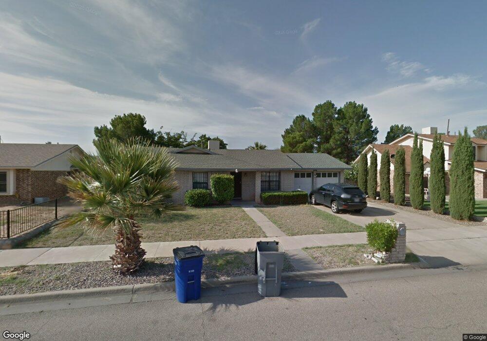
3936 Breckenridge Dr El Paso, TX 79936
Indian Ridge NeighborhoodEstimated Value: $215,000 - $269,000
3
Beds
2
Baths
1,800
Sq Ft
$137/Sq Ft
Est. Value
About This Home
This home is located at 3936 Breckenridge Dr, El Paso, TX 79936 and is currently estimated at $246,327, approximately $136 per square foot. 3936 Breckenridge Dr is a home located in El Paso County with nearby schools including Pebble Hills Elementary School, J.M. Hanks Middle School, and J M Hanks High School.
Ownership History
Date
Name
Owned For
Owner Type
Purchase Details
Closed on
Feb 9, 2005
Sold by
Chavez Robert P
Bought by
Carrillo Tito
Current Estimated Value
Home Financials for this Owner
Home Financials are based on the most recent Mortgage that was taken out on this home.
Original Mortgage
$79,800
Outstanding Balance
$40,614
Interest Rate
5.77%
Mortgage Type
Purchase Money Mortgage
Estimated Equity
$205,713
Purchase Details
Closed on
May 16, 2003
Sold by
Chavez Angie
Bought by
Chavez Robert
Purchase Details
Closed on
Jan 29, 1998
Sold by
Cowan Anne E and Cowan Anne Nugent
Bought by
Chavez Robert P and Chavez Angie
Home Financials for this Owner
Home Financials are based on the most recent Mortgage that was taken out on this home.
Original Mortgage
$92,300
Interest Rate
6.25%
Mortgage Type
VA
Create a Home Valuation Report for This Property
The Home Valuation Report is an in-depth analysis detailing your home's value as well as a comparison with similar homes in the area
Home Values in the Area
Average Home Value in this Area
Purchase History
| Date | Buyer | Sale Price | Title Company |
|---|---|---|---|
| Carrillo Tito | -- | -- | |
| Chavez Robert | -- | -- | |
| Chavez Robert P | -- | -- |
Source: Public Records
Mortgage History
| Date | Status | Borrower | Loan Amount |
|---|---|---|---|
| Open | Carrillo Tito | $79,800 | |
| Previous Owner | Chavez Robert P | $92,300 |
Source: Public Records
Tax History Compared to Growth
Tax History
| Year | Tax Paid | Tax Assessment Tax Assessment Total Assessment is a certain percentage of the fair market value that is determined by local assessors to be the total taxable value of land and additions on the property. | Land | Improvement |
|---|---|---|---|---|
| 2025 | $4,520 | $216,700 | $52,209 | $164,491 |
| 2024 | $4,520 | $164,553 | $26,134 | $138,419 |
| 2023 | $4,789 | $164,553 | $26,134 | $138,419 |
| 2022 | $4,192 | $135,000 | $26,134 | $108,866 |
| 2021 | $4,388 | $135,000 | $26,134 | $108,866 |
| 2020 | $2,994 | $94,790 | $20,347 | $74,443 |
| 2018 | $2,968 | $95,439 | $20,347 | $75,092 |
| 2017 | $2,770 | $90,628 | $20,347 | $70,281 |
| 2016 | $2,770 | $90,628 | $20,347 | $70,281 |
| 2015 | $2,631 | $90,628 | $20,347 | $70,281 |
| 2014 | $2,631 | $91,969 | $20,347 | $71,622 |
Source: Public Records
Map
Nearby Homes
- 3651 George Dieter Dr
- 11189 Childress Ave
- 11254 Montana Ave
- 11165 Shiner Ave
- 11298 Montana Ave
- 11272 Ivanhoe Dr
- 11273 Ivanhoe Dr
- 11334 Jasso Ct
- 11338 Jasso
- 11337 Ardelle Ave
- 3352 Broken Bow St
- 3428 Itasca St
- 11342 Jasso
- 11346 Jasso Ct
- 11312 Ardelle Ave
- 11025 Sunshine Ct
- 3332 Mclean St
- 11016 Aqua Ct
- 3309 Broken Bow St
- 11549 MacAw Palm Dr
- 3940 Breckenridge Dr
- 3932 3932 Dr
- 11237 Signal Ridge Dr
- 11235 Signal Ridge Dr
- 3944 Breckenridge Dr
- 3928 Breckenridge Dr
- 3937 Breckenridge Dr
- 3941 Breckenridge Dr
- 3933 Breckenridge Dr
- 11229 Signal Ridge Dr
- 11239 Signal Ridge Dr
- 3945 Breckenridge Dr
- 3948 Breckenridge Dr
- 3924 Breckenridge Dr
- 3929 Breckenridge Dr
- 11233 Signal Ridge Dr
- 3509 Red Fox Way
- 11225 Signal Ridge Dr
- 3604 Soaring Eagle Place
- 3949 Breckenridge Dr