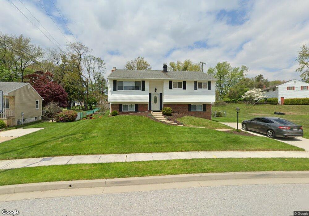
3936 Sybil Rd Randallstown, MD 21133
Estimated Value: $309,084 - $393,000
Studio
3
Baths
1,221
Sq Ft
$285/Sq Ft
Est. Value
About This Home
This home is located at 3936 Sybil Rd, Randallstown, MD 21133 and is currently estimated at $347,771, approximately $284 per square foot. 3936 Sybil Rd is a home located in Baltimore County with nearby schools including Winand Elementary School, Northwest Academy of Health Sciences, and Randallstown High School.
Ownership History
Date
Name
Owned For
Owner Type
Purchase Details
Closed on
Mar 5, 2024
Sold by
Harryman Beverly N
Bought by
Harryman Beverly N and Harryman Alexandra Y
Current Estimated Value
Create a Home Valuation Report for This Property
The Home Valuation Report is an in-depth analysis detailing your home's value as well as a comparison with similar homes in the area
Home Values in the Area
Average Home Value in this Area
Purchase History
| Date | Buyer | Sale Price | Title Company |
|---|---|---|---|
| Harryman Beverly N | -- | None Listed On Document |
Source: Public Records
Tax History Compared to Growth
Tax History
| Year | Tax Paid | Tax Assessment Tax Assessment Total Assessment is a certain percentage of the fair market value that is determined by local assessors to be the total taxable value of land and additions on the property. | Land | Improvement |
|---|---|---|---|---|
| 2025 | $3,381 | $283,967 | -- | -- |
| 2024 | $3,381 | $268,100 | $75,000 | $193,100 |
| 2023 | $1,597 | $252,800 | $0 | $0 |
| 2022 | $3,127 | $237,500 | $0 | $0 |
| 2021 | $2,891 | $222,200 | $57,000 | $165,200 |
| 2020 | $2,891 | $214,867 | $0 | $0 |
| 2019 | $2,775 | $207,533 | $0 | $0 |
| 2018 | $2,820 | $200,200 | $57,000 | $143,200 |
| 2017 | $2,717 | $185,633 | $0 | $0 |
| 2016 | $2,568 | $171,067 | $0 | $0 |
| 2015 | $2,568 | $156,500 | $0 | $0 |
| 2014 | $2,568 | $156,500 | $0 | $0 |
Source: Public Records
Map
Nearby Homes
- 8802 Falcon Ridge Dr
- 3950 Chaffey Rd
- 8829 Sigrid Rd
- 5 Windy Meadow Ct
- 4210 Mary Ridge Dr
- 4226 Huntshire Rd
- 28 Sunrise Ct
- 1205/99 Winands Rd
- 8809 Stone Ridge Cir Unit 204
- 8803 Stone Ridge Cir Unit 301
- 4228 Brookside Oaks
- 9012 Allenswood Rd
- 9104 Marlove Oaks Ln
- 3729 Offutt Rd
- 9110 Meadow Heights Rd
- 9130 Marlove Oaks Ln
- 9112 Meadow Heights Rd
- 4104 Brad Jacob Ct
- 4816 Valley Forge Rd
- 4812 Valley Forge Rd