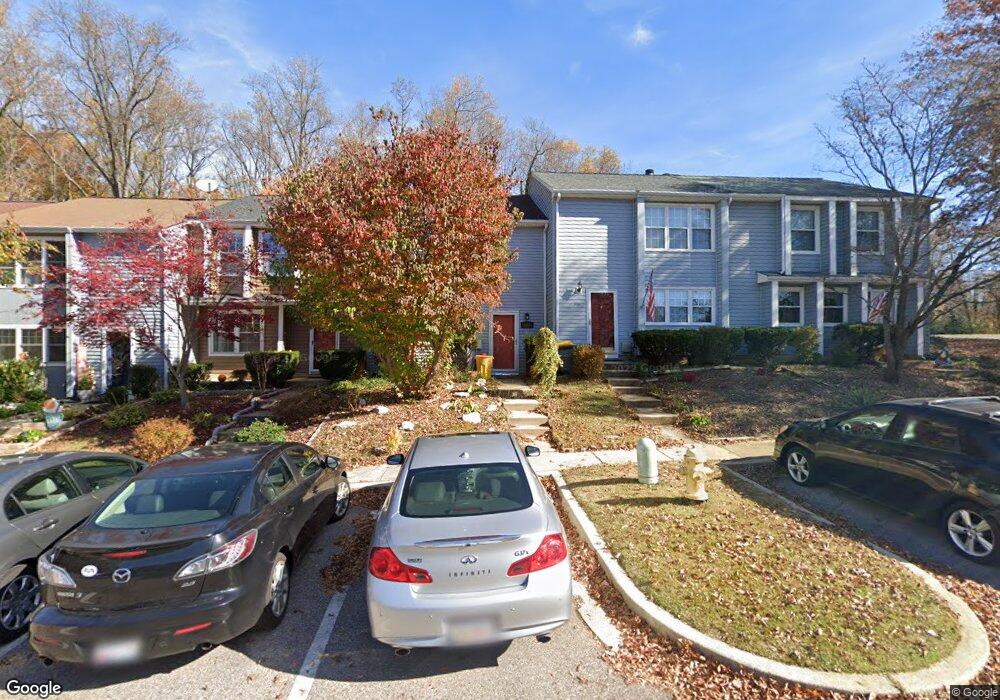
394 Carronade Way Arnold, MD 21012
Estimated Value: $339,708 - $370,000
--
Bed
2
Baths
1,360
Sq Ft
$265/Sq Ft
Est. Value
About This Home
This home is located at 394 Carronade Way, Arnold, MD 21012 and is currently estimated at $360,427, approximately $265 per square foot. 394 Carronade Way is a home located in Anne Arundel County with nearby schools including Windsor Farm Elementary School, Severn River Middle School, and Broadneck High School.
Ownership History
Date
Name
Owned For
Owner Type
Purchase Details
Closed on
Mar 23, 2018
Sold by
Grow Robin G and Mangold Robin G
Bought by
Mangold Robin G
Current Estimated Value
Home Financials for this Owner
Home Financials are based on the most recent Mortgage that was taken out on this home.
Original Mortgage
$148,000
Outstanding Balance
$126,884
Interest Rate
4.4%
Mortgage Type
New Conventional
Estimated Equity
$233,543
Purchase Details
Closed on
May 17, 2002
Sold by
Grow Robin G
Bought by
Grow Robin G
Purchase Details
Closed on
Apr 26, 1999
Sold by
Secretary Of H U D
Bought by
Grow Robin G and Baggett Wilma J
Purchase Details
Closed on
Feb 16, 1999
Sold by
Collier Zenora D
Bought by
Secretary Of H U D
Purchase Details
Closed on
Nov 12, 1996
Sold by
Briscoe Richard J
Bought by
Briscoe Sheri L
Create a Home Valuation Report for This Property
The Home Valuation Report is an in-depth analysis detailing your home's value as well as a comparison with similar homes in the area
Home Values in the Area
Average Home Value in this Area
Purchase History
| Date | Buyer | Sale Price | Title Company |
|---|---|---|---|
| Mangold Robin G | -- | Surety Lender Services Llc | |
| Grow Robin G | -- | -- | |
| Grow Robin G | $91,200 | -- | |
| Secretary Of H U D | $117,000 | -- | |
| Briscoe Sheri L | $105,000 | -- |
Source: Public Records
Mortgage History
| Date | Status | Borrower | Loan Amount |
|---|---|---|---|
| Open | Mangold Robin G | $148,000 | |
| Closed | Briscoe Sheri L | -- |
Source: Public Records
Tax History Compared to Growth
Tax History
| Year | Tax Paid | Tax Assessment Tax Assessment Total Assessment is a certain percentage of the fair market value that is determined by local assessors to be the total taxable value of land and additions on the property. | Land | Improvement |
|---|---|---|---|---|
| 2025 | $3,750 | $267,400 | -- | -- |
| 2024 | $3,750 | $249,600 | $140,000 | $109,600 |
| 2023 | $3,592 | $242,933 | $0 | $0 |
| 2022 | $2,846 | $236,267 | $0 | $0 |
| 2021 | $6,418 | $229,600 | $125,000 | $104,600 |
| 2020 | $2,983 | $215,633 | $0 | $0 |
| 2019 | $2,803 | $201,667 | $0 | $0 |
| 2018 | $1,903 | $187,700 | $85,000 | $102,700 |
| 2017 | $2,432 | $182,933 | $0 | $0 |
| 2016 | -- | $178,167 | $0 | $0 |
| 2015 | -- | $173,400 | $0 | $0 |
| 2014 | -- | $173,400 | $0 | $0 |
Source: Public Records
Map
Nearby Homes
- 1553 Star Pine Dr
- 1512 Winterberry Dr
- 332 Carronade Way
- 1583 Star Pine Dr
- 1116 Riverboat Ct
- 1424 Millwood Ct
- 1742 Woodtree Cir
- 332 Charred Oak Ct
- 349 Candle Ridge Ct
- 478 Bay Green Dr
- 493 Colonial Ridge Ln
- 0 Shot Town Rd Unit MDAA2113200
- P. 317 Shot Town Rd
- 1410 Greendale Ct Unit 2-1410
- 1447 Falcon Nest Ct Unit 45
- 618 Andrew Hill Rd
- 1455 Falcon Nest Ct
- 633 Andrew Hill Rd
- 543 Bay Green Dr
- 78 Old Mill Bottom Rd N
- 392 Carronade Way
- 396 Carronade Way
- 390 Carronade Way
- 398 Carronade Way
- 388 Carronade Way
- 386 Carronade Way
- 384 Carronade Way
- 393 Carronade Way
- 391 Carronade Way
- 397 Carronade Way
- 399 Carronade Way
- 380 Carronade Way
- 376 Carronade Way
- 371 Capetowne Rd
- 372 Carronade Way
- 369 Capetowne Rd
- 370 Carronade Way
- 367 Capetowne Rd
- 368 Carronade Way
- 365 Capetowne Rd