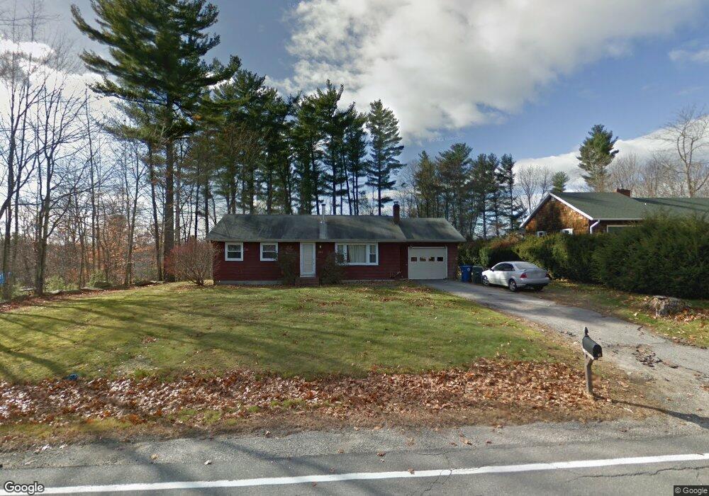
394 Duck Pond Rd Westbrook, ME 04092
Estimated Value: $394,000 - $446,000
2
Beds
1
Bath
1,040
Sq Ft
$397/Sq Ft
Est. Value
About This Home
This home is located at 394 Duck Pond Rd, Westbrook, ME 04092 and is currently estimated at $412,907, approximately $397 per square foot. 394 Duck Pond Rd is a home located in Cumberland County with nearby schools including Westbrook High School and St. Brigid School.
Ownership History
Date
Name
Owned For
Owner Type
Purchase Details
Closed on
May 24, 2010
Sold by
Brown Rebecca
Bought by
Rogan James T
Current Estimated Value
Home Financials for this Owner
Home Financials are based on the most recent Mortgage that was taken out on this home.
Original Mortgage
$148,750
Outstanding Balance
$100,576
Interest Rate
5.23%
Mortgage Type
FHA
Estimated Equity
$312,331
Purchase Details
Closed on
May 2, 2006
Sold by
Mileski David M
Bought by
Brown Rebecca
Create a Home Valuation Report for This Property
The Home Valuation Report is an in-depth analysis detailing your home's value as well as a comparison with similar homes in the area
Home Values in the Area
Average Home Value in this Area
Purchase History
| Date | Buyer | Sale Price | Title Company |
|---|---|---|---|
| Rogan James T | -- | -- | |
| Brown Rebecca | -- | -- |
Source: Public Records
Mortgage History
| Date | Status | Borrower | Loan Amount |
|---|---|---|---|
| Open | Rogan James T | $148,750 | |
| Previous Owner | Rogan James T | $215,000 |
Source: Public Records
Tax History Compared to Growth
Tax History
| Year | Tax Paid | Tax Assessment Tax Assessment Total Assessment is a certain percentage of the fair market value that is determined by local assessors to be the total taxable value of land and additions on the property. | Land | Improvement |
|---|---|---|---|---|
| 2023 | $3,858 | $231,300 | $80,500 | $150,800 |
| 2022 | $3,488 | $192,700 | $67,000 | $125,700 |
| 2021 | $3,436 | $192,700 | $67,000 | $125,700 |
| 2020 | $3,442 | $192,700 | $67,000 | $125,700 |
| 2019 | $3,442 | $192,700 | $67,000 | $125,700 |
| 2018 | $3,292 | $165,000 | $58,300 | $106,700 |
| 2017 | $3,115 | $165,000 | $58,300 | $106,700 |
| 2016 | $3,036 | $165,000 | $58,300 | $106,700 |
| 2015 | $2,963 | $165,000 | $58,300 | $106,700 |
| 2014 | $2,838 | $165,000 | $58,300 | $106,700 |
| 2013 | $2,838 | $165,000 | $58,300 | $106,700 |
Source: Public Records
Map
Nearby Homes
- 214 Duck Pond Rd
- 400 Brook St
- 20 Elmwood Ave
- 171 Brook St Unit 2
- 171 Brook St Unit 41
- 171 Brook St Unit 42
- 171 Brook St Unit 76
- 171 Brook St Unit 1
- 171 Brook St Unit 45
- 21 Cummings Way
- 117 Blackstrap Rd
- 159 Brook Rd
- 98 Blackstrap Rd
- 375 Bridgton Rd Unit 43
- 151 Brooks Edge Farm Rd Unit 68
- 15 Susan Ln
- 153 Brooks Edge Farm Rd Unit 69
- 290 Bridgton Rd Unit 1
- 41 Villa Rd
- 12 Hamlin Rd
- 398 Duck Pond Rd
- 386 Duck Pond Rd
- 51 Old Farm Rd
- 25 Old Farm Rd
- 59 Old Farm Rd
- 407 Duck Pond Rd
- 410 Duck Pond Rd
- 4 Nelsen Rd
- 0 Old Farm Rd
- 414 Duck Pond Rd
- 429 Duck Pond Rd
- 67 Old Farm Rd
- Lot2 Nelsen Rd
- 1 Lillian Place
- 3 Lillian Place
- 435 Duck Pond Rd Unit 435
- 420 Duck Pond Rd
- 2 Lillian Place
- 4 Lillian Place
- 36 Old Farm Rd