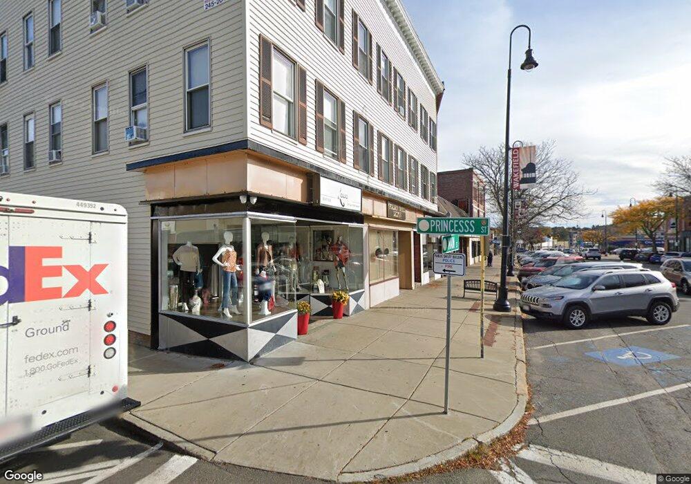
394 Main St Unit 400 Wakefield, MA 01880
Downtown Wakefield NeighborhoodEstimated Value: $2,880,873
20
Beds
8
Baths
12,531
Sq Ft
$230/Sq Ft
Est. Value
About This Home
This home is located at 394 Main St Unit 400, Wakefield, MA 01880 and is currently estimated at $2,880,873, approximately $229 per square foot. 394 Main St Unit 400 is a home located in Middlesex County with nearby schools including Wakefield Memorial High School, St Joseph School, and Odyssey Day School.
Ownership History
Date
Name
Owned For
Owner Type
Purchase Details
Closed on
Mar 2, 2016
Sold by
Manor Rt and Sutherland
Bought by
Main Street T and Main Sutherland
Current Estimated Value
Home Financials for this Owner
Home Financials are based on the most recent Mortgage that was taken out on this home.
Original Mortgage
$1,075,000
Outstanding Balance
$843,785
Interest Rate
3.81%
Mortgage Type
Commercial
Estimated Equity
$2,037,088
Purchase Details
Closed on
Aug 18, 1987
Sold by
Decristoforo Mary C
Bought by
Manor Rt
Home Financials for this Owner
Home Financials are based on the most recent Mortgage that was taken out on this home.
Original Mortgage
$490,000
Interest Rate
10.4%
Mortgage Type
Commercial
Create a Home Valuation Report for This Property
The Home Valuation Report is an in-depth analysis detailing your home's value as well as a comparison with similar homes in the area
Home Values in the Area
Average Home Value in this Area
Purchase History
| Date | Buyer | Sale Price | Title Company |
|---|---|---|---|
| Main Street T | $480,000 | -- | |
| Manor Rt | $600,000 | -- |
Source: Public Records
Mortgage History
| Date | Status | Borrower | Loan Amount |
|---|---|---|---|
| Open | Main Street T | $1,075,000 | |
| Previous Owner | Manor Rt | $490,000 |
Source: Public Records
Tax History
| Year | Tax Paid | Tax Assessment Tax Assessment Total Assessment is a certain percentage of the fair market value that is determined by local assessors to be the total taxable value of land and additions on the property. | Land | Improvement |
|---|---|---|---|---|
| 2025 | -- | $2,061,000 | $306,100 | $1,754,900 |
| 2024 | -- | $2,040,600 | $303,100 | $1,737,500 |
| 2023 | $0 | $1,853,500 | $275,300 | $1,578,200 |
| 2022 | $0 | $1,446,400 | $252,500 | $1,193,900 |
| 2021 | $0 | $1,538,900 | $228,000 | $1,310,900 |
| 2020 | $0 | $1,470,800 | $217,900 | $1,252,900 |
| 2019 | $0 | $1,387,600 | $205,600 | $1,182,000 |
| 2018 | $0 | $1,247,200 | $193,400 | $1,053,800 |
| 2017 | -- | $1,205,100 | $186,900 | $1,018,200 |
| 2016 | -- | $1,214,200 | $183,800 | $1,030,400 |
| 2015 | -- | $846,600 | $175,200 | $671,400 |
| 2014 | -- | $829,900 | $171,700 | $658,200 |
Source: Public Records
Map
Nearby Homes
- 43-45 Crescent St
- 16 Pleasant St
- 10 Wakefield Ave Unit B
- 35 Richardson St Unit 2
- 62 Foundry St Unit 310
- 62 Foundry St Unit 204
- 62 Foundry St Unit 402
- 62 Foundry St Unit 507
- 62 Foundry St Unit 208
- 62 Foundry St Unit 414
- 62 Foundry St Unit 210
- 69 Foundry St Unit 310
- 69 Foundry St Unit 416
- 1 Traverse St Unit E
- 248 Albion St Unit 231
- 248 Albion St Unit 321
- 21 Herbert St Unit A
- 39 Cedar St
- 61 Nahant St
- 68 Preston St Unit 6D
- 404 Main St
- 408 Main St
- 406 Main St
- 410 Main St
- 12 Princess St
- 395 Main St Unit 2
- 395 Main St
- 1 Lincoln St
- 391 Main St Unit 391
- 391 Main St Unit 1
- 391 Main St
- 389 Main St Unit 3
- 389 Main St Unit 2
- 7 Lincoln St Unit 200
- 9 Princess St
- 16 Princess St Unit 1R
- 16 Princess St
- 16 Princess St Unit 2
- 385 Main St
- 380 - 382 Main
Your Personal Tour Guide
Ask me questions while you tour the home.