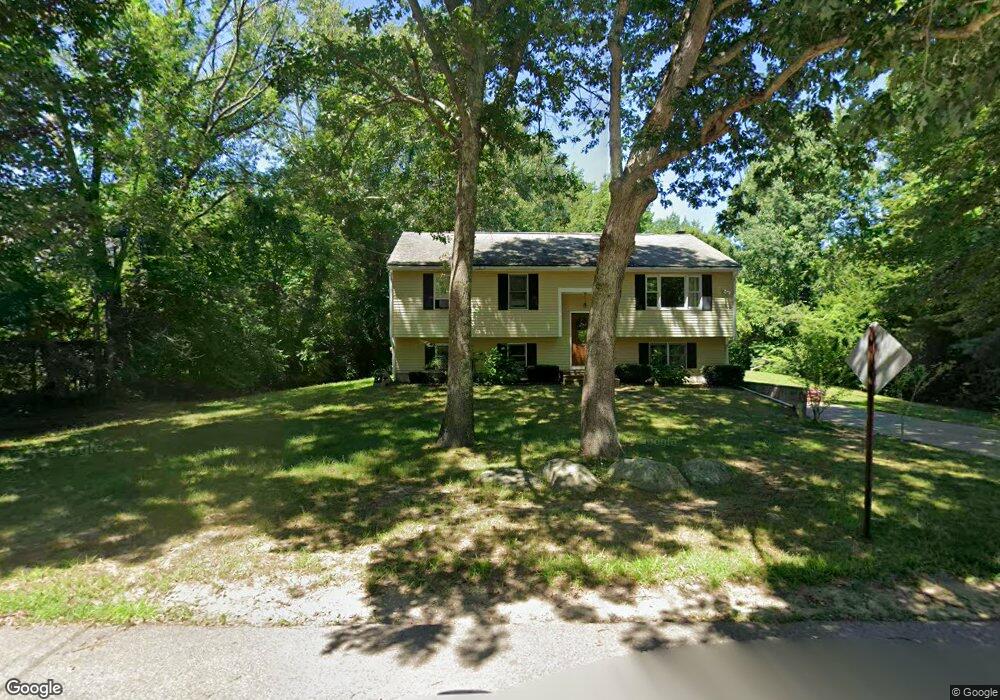
394 Richardson Ave Attleboro, MA 02703
Estimated Value: $522,205 - $551,000
3
Beds
2
Baths
1,080
Sq Ft
$497/Sq Ft
Est. Value
About This Home
This home is located at 394 Richardson Ave, Attleboro, MA 02703 and is currently estimated at $536,801, approximately $497 per square foot. 394 Richardson Ave is a home located in Bristol County with nearby schools including Thomas E. Willett School, Cyril K. Brennan Middle School, and Attleboro High School.
Ownership History
Date
Name
Owned For
Owner Type
Purchase Details
Closed on
Jan 20, 1995
Sold by
Pleman Iii Ptnshp
Bought by
Correia Zelia M
Current Estimated Value
Create a Home Valuation Report for This Property
The Home Valuation Report is an in-depth analysis detailing your home's value as well as a comparison with similar homes in the area
Home Values in the Area
Average Home Value in this Area
Purchase History
| Date | Buyer | Sale Price | Title Company |
|---|---|---|---|
| Correia Zelia M | $50,000 | -- | |
| Correia Zelia M | $50,000 | -- |
Source: Public Records
Mortgage History
| Date | Status | Borrower | Loan Amount |
|---|---|---|---|
| Open | Correia Zelia M | $10,000 | |
| Open | Correia Zelia M | $82,200 |
Source: Public Records
Tax History
| Year | Tax Paid | Tax Assessment Tax Assessment Total Assessment is a certain percentage of the fair market value that is determined by local assessors to be the total taxable value of land and additions on the property. | Land | Improvement |
|---|---|---|---|---|
| 2025 | $5,669 | $451,700 | $145,200 | $306,500 |
| 2024 | $5,644 | $443,400 | $145,200 | $298,200 |
| 2023 | $5,308 | $387,700 | $132,000 | $255,700 |
| 2022 | $5,026 | $347,800 | $125,800 | $222,000 |
| 2021 | $4,671 | $315,600 | $121,000 | $194,600 |
| 2020 | $4,409 | $302,800 | $117,400 | $185,400 |
| 2019 | $4,164 | $294,100 | $115,200 | $178,900 |
| 2018 | $3,984 | $268,800 | $111,800 | $157,000 |
| 2017 | $3,918 | $269,300 | $111,800 | $157,500 |
| 2016 | $3,712 | $250,500 | $109,600 | $140,900 |
| 2015 | $3,664 | $249,100 | $109,600 | $139,500 |
| 2014 | $3,506 | $236,100 | $104,400 | $131,700 |
Source: Public Records
Map
Nearby Homes
- 345 Richardson Ave
- 71 Richardson Ave
- 10 Walter St
- 20 John F. Kennedy Dr
- 49 Pheasant Hill Rd
- 4 Village Way Unit F
- 933 Pleasant St
- 451R Gilbert St
- 123 Pike Ave
- 10 Hazelwood Ct
- 180 Pike Ave
- 63 Hope St
- 678 N Main St
- 747 N Main St
- 21 Shady Ln
- 0 Pike Ave
- 143 Oak St Unit 10
- 2 Oak St Unit 2A
- 2 Oak St Unit 2B
- 11 Cherry Tree Ln
- 404 Richardson Ave
- 390 Richardson Ave
- 397 Richardson Ave
- 16 Frontier Dr
- 19 Frontier Dr
- 30 Frontier Dr
- 29 Frontier Dr
- 31 Frontier Dr
- 428 Richardson Ave
- 386 Richardson Ave
- 18 Frontier Dr
- 361 Richardson Ave
- 369 Richardson Ave
- 353 Richardson Ave
- 389 Richardson Ave
- 389 Richardson Ave Unit House
- 377 Richardson Ave
- 3 Plain St
- 5 Plain St
- 436 Richardson Ave
Your Personal Tour Guide
Ask me questions while you tour the home.