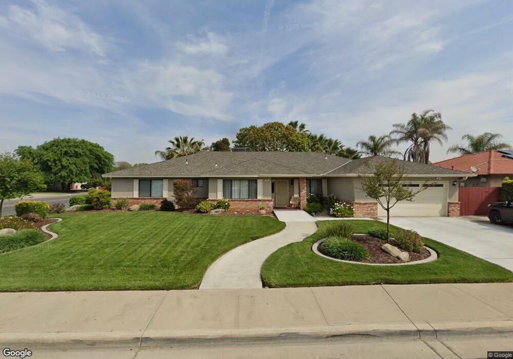
394 W Fargo Ave Hanford, CA 93230
Estimated Value: $444,000 - $487,000
3
Beds
2
Baths
2,463
Sq Ft
$188/Sq Ft
Est. Value
About This Home
This home is located at 394 W Fargo Ave, Hanford, CA 93230 and is currently estimated at $463,258, approximately $188 per square foot. 394 W Fargo Ave is a home located in Kings County with nearby schools including Hanford West High School, Pioneer Elementary School, and Pioneer Middle School.
Ownership History
Date
Name
Owned For
Owner Type
Purchase Details
Closed on
Feb 23, 2024
Sold by
Johnston Michael B and Johnston Mary H
Bought by
Johnston Family Revocable Living Trust and Johnston
Current Estimated Value
Purchase Details
Closed on
Feb 21, 2024
Sold by
Johnston Michael B and Johnston Mary H
Bought by
Johnston Family Revocable Living Trust and Johnston
Create a Home Valuation Report for This Property
The Home Valuation Report is an in-depth analysis detailing your home's value as well as a comparison with similar homes in the area
Home Values in the Area
Average Home Value in this Area
Purchase History
| Date | Buyer | Sale Price | Title Company |
|---|---|---|---|
| Johnston Family Revocable Living Trust | -- | None Listed On Document | |
| Johnston Family Revocable Living Trust | -- | None Listed On Document |
Source: Public Records
Tax History Compared to Growth
Tax History
| Year | Tax Paid | Tax Assessment Tax Assessment Total Assessment is a certain percentage of the fair market value that is determined by local assessors to be the total taxable value of land and additions on the property. | Land | Improvement |
|---|---|---|---|---|
| 2025 | $2,269 | $218,062 | $31,859 | $186,203 |
| 2023 | $2,269 | $209,596 | $30,623 | $178,973 |
| 2022 | $2,195 | $205,487 | $30,023 | $175,464 |
| 2021 | $2,155 | $201,459 | $29,435 | $172,024 |
| 2020 | $2,159 | $199,393 | $29,133 | $170,260 |
| 2019 | $2,124 | $195,484 | $28,562 | $166,922 |
| 2018 | $2,110 | $191,651 | $28,002 | $163,649 |
| 2017 | $2,072 | $187,893 | $27,453 | $160,440 |
| 2016 | $1,959 | $184,209 | $26,915 | $157,294 |
| 2015 | $1,897 | $181,442 | $26,511 | $154,931 |
| 2014 | $1,910 | $177,888 | $25,992 | $151,896 |
Source: Public Records
Map
Nearby Homes
- 2612 Aspen St
- 314 W Birch Ave
- 2352 Cabrillo Way
- 710 Northstar Dr
- 165 W Magnolia Ave
- 496 W Earl Way
- 850 Northstar Dr
- 2234 Carter Way
- 2475 Santa Lucia Ct
- 2210 N Douty St
- 332 E Ash Ave
- 216 Palm Ct
- 2127 N 11th Ave
- 2851 Julia Cir
- 3026 Sage Ct
- 325 E Amber Way
- 2821 Stonecrest Way
- 2020 Short Dr
- 450 E Birch Ave
- 405 E Magnolia Ave
- 393 Tamarack Ct
- 2495 Aspen St
- 378 W Fargo Ave
- 2504 Aspen St Unit 9
- 2520 Aspen St
- 361 Tamarack Ct
- 2496 Aspen St
- 340 W Fargo Ave
- 2498 Cabrillo Ct
- 2548 Aspen St
- 337 Tamarack Ct
- 2480 Cabrillo Ct
- 322 W Fargo Ave
- 2467 Aspen St
- 2480 Aspen St
- 390 Tamarack Ct
- 2497 Cabrillo Ct
- 433 W Fargo Ave
- 362 Tamarack Ct
- 2462 Cabrillo Ct