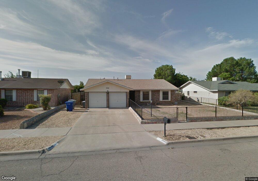
3940 Breckenridge Dr El Paso, TX 79936
Indian Ridge NeighborhoodEstimated Value: $218,000 - $246,000
--
Bed
2
Baths
1,494
Sq Ft
$152/Sq Ft
Est. Value
About This Home
This home is located at 3940 Breckenridge Dr, El Paso, TX 79936 and is currently estimated at $227,581, approximately $152 per square foot. 3940 Breckenridge Dr is a home located in El Paso County with nearby schools including Pebble Hills Elementary School, J.M. Hanks Middle School, and J M Hanks High School.
Ownership History
Date
Name
Owned For
Owner Type
Purchase Details
Closed on
Dec 10, 2014
Sold by
Carrasco Rosaiba
Bought by
Carrasco Alfonso I
Current Estimated Value
Home Financials for this Owner
Home Financials are based on the most recent Mortgage that was taken out on this home.
Original Mortgage
$81,600
Outstanding Balance
$62,666
Interest Rate
3.99%
Mortgage Type
Purchase Money Mortgage
Estimated Equity
$164,915
Purchase Details
Closed on
May 1, 1999
Sold by
Dinolti Charlotte M
Bought by
Carrasco Alfonso I and Aragon Rosalba
Home Financials for this Owner
Home Financials are based on the most recent Mortgage that was taken out on this home.
Original Mortgage
$81,600
Interest Rate
6.89%
Mortgage Type
VA
Create a Home Valuation Report for This Property
The Home Valuation Report is an in-depth analysis detailing your home's value as well as a comparison with similar homes in the area
Home Values in the Area
Average Home Value in this Area
Purchase History
| Date | Buyer | Sale Price | Title Company |
|---|---|---|---|
| Carrasco Alfonso I | -- | None Available | |
| Carrasco Alfonso I | -- | -- |
Source: Public Records
Mortgage History
| Date | Status | Borrower | Loan Amount |
|---|---|---|---|
| Open | Carrasco Alfonso I | $81,600 | |
| Closed | Carrasco Alfonso I | $81,600 |
Source: Public Records
Tax History Compared to Growth
Tax History
| Year | Tax Paid | Tax Assessment Tax Assessment Total Assessment is a certain percentage of the fair market value that is determined by local assessors to be the total taxable value of land and additions on the property. | Land | Improvement |
|---|---|---|---|---|
| 2025 | $3,406 | $209,163 | -- | -- |
| 2024 | $3,406 | $190,148 | -- | -- |
| 2023 | $3,162 | $172,862 | $0 | $0 |
| 2022 | $4,880 | $157,147 | $0 | $0 |
| 2021 | $4,644 | $154,994 | $26,134 | $128,860 |
| 2020 | $4,102 | $129,874 | $20,347 | $109,527 |
| 2018 | $4,007 | $128,864 | $20,347 | $108,517 |
| 2017 | $3,705 | $121,212 | $20,347 | $100,865 |
| 2016 | $3,705 | $121,212 | $20,347 | $100,865 |
| 2015 | $2,861 | $121,212 | $20,347 | $100,865 |
| 2014 | $2,861 | $120,579 | $20,347 | $100,232 |
Source: Public Records
Map
Nearby Homes
- 3651 George Dieter Dr
- 11189 Childress Ave
- 11254 Montana Ave
- 11165 Shiner Ave
- 11298 Montana Ave
- 11272 Ivanhoe Dr
- 11273 Ivanhoe Dr
- 11334 Jasso Ct
- 11338 Jasso
- 11337 Ardelle Ave
- 3352 Broken Bow St
- 3428 Itasca St
- 11342 Jasso
- 11346 Jasso Ct
- 11312 Ardelle Ave
- 11025 Sunshine Ct
- 3332 Mclean St
- 11016 Aqua Ct
- 3309 Broken Bow St
- 11549 MacAw Palm Dr
- 3944 Breckenridge Dr
- 3936 Breckenridge Dr
- 11237 Signal Ridge Dr
- 3948 Breckenridge Dr
- 3932 3932 Dr
- 3941 Breckenridge Dr
- 11235 Signal Ridge Dr
- 3945 Breckenridge Dr
- 3937 Breckenridge Dr
- 11239 Signal Ridge Dr
- 3509 Red Fox Way
- 3949 Breckenridge Dr
- 3952 Breckenridge Dr
- 3928 Breckenridge Dr
- 3933 Breckenridge Dr
- 11233 Signal Ridge Dr
- 3505 Red Fox Way
- 3953 Breckenridge Dr
- 11229 Signal Ridge Dr
- 3608 Soaring Eagle Place