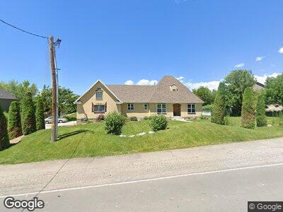
3945 N 900 W Pleasant Grove, UT 84062
Estimated Value: $789,000 - $873,000
4
Beds
4
Baths
3,378
Sq Ft
$244/Sq Ft
Est. Value
About This Home
This home is located at 3945 N 900 W, Pleasant Grove, UT 84062 and is currently estimated at $822,828, approximately $243 per square foot. 3945 N 900 W is a home located in Utah County with nearby schools including Deerfield Elementary School, Mountain Ridge Junior High School, and Lone Peak High School.
Ownership History
Date
Name
Owned For
Owner Type
Purchase Details
Closed on
Aug 20, 2020
Sold by
Hardy George H and Hardy Sondi L
Bought by
Hardy George and Hardy Sondi
Current Estimated Value
Purchase Details
Closed on
Nov 30, 2010
Sold by
Holmstead Hal E and Holmstead Kathryn S
Bought by
Hardy Sondi L and Hardy George H
Home Financials for this Owner
Home Financials are based on the most recent Mortgage that was taken out on this home.
Original Mortgage
$269,100
Outstanding Balance
$21,707
Interest Rate
4.18%
Mortgage Type
New Conventional
Estimated Equity
$807,295
Purchase Details
Closed on
Jun 28, 2005
Sold by
Holmstead Hal E and Holmstead Kathryn S
Bought by
Holmstead Hal E and Holmstead Kathryn S
Home Financials for this Owner
Home Financials are based on the most recent Mortgage that was taken out on this home.
Original Mortgage
$256,000
Interest Rate
5.58%
Mortgage Type
Fannie Mae Freddie Mac
Purchase Details
Closed on
Apr 7, 2005
Sold by
Morse Anthony T and Holmstead Hal E
Bought by
Holmstead Hal E and Holmstead Kathryn S
Home Financials for this Owner
Home Financials are based on the most recent Mortgage that was taken out on this home.
Original Mortgage
$280,000
Interest Rate
5.72%
Mortgage Type
Unknown
Purchase Details
Closed on
Dec 21, 2004
Sold by
Bronson Mark and First Hoirizon Home Loan Corp
Bought by
Federal National Mortgage Association
Purchase Details
Closed on
Jan 22, 2002
Sold by
Bronson Mark
Bought by
Bronson Mark A and Bronson Kimberly D
Purchase Details
Closed on
Sep 17, 2001
Sold by
Wadley Don F
Bought by
Bronson Mark A and Bronson Kimberly D
Home Financials for this Owner
Home Financials are based on the most recent Mortgage that was taken out on this home.
Original Mortgage
$85,000
Interest Rate
7%
Mortgage Type
Seller Take Back
Purchase Details
Closed on
May 30, 2001
Sold by
Bronson Mark A and Bronson Kimberly D
Bought by
Wadley Don F
Home Financials for this Owner
Home Financials are based on the most recent Mortgage that was taken out on this home.
Original Mortgage
$85,000
Interest Rate
7.24%
Mortgage Type
Seller Take Back
Create a Home Valuation Report for This Property
The Home Valuation Report is an in-depth analysis detailing your home's value as well as a comparison with similar homes in the area
Home Values in the Area
Average Home Value in this Area
Purchase History
| Date | Buyer | Sale Price | Title Company |
|---|---|---|---|
| Hardy George | -- | None Available | |
| Hardy Sondi L | -- | Horizon Title Insurance | |
| Holmstead Hal E | -- | Utah Standard Title | |
| Holmstead Hal E | -- | Utah Standard Title | |
| Holmstead Hal E | -- | Empire Land Title Company | |
| Morse Anthony T | -- | Empire Land Title Company | |
| Federal National Mortgage Association | $234,463 | -- | |
| Bronson Mark A | -- | Signature Title | |
| Bronson Mark | -- | Signature Title | |
| Bronson Mark A | -- | Signature Title | |
| Wadley Don F | -- | Signature Title | |
| Bronson Mark A | -- | Signature Title |
Source: Public Records
Mortgage History
| Date | Status | Borrower | Loan Amount |
|---|---|---|---|
| Open | Hardy Sondi L | $269,100 | |
| Previous Owner | Holmstead Hal E | $243,000 | |
| Previous Owner | Holmstead Hal E | $65,500 | |
| Previous Owner | Holmstead Hal E | $256,000 | |
| Previous Owner | Holmstead Hal E | $280,000 | |
| Previous Owner | Bronson Mark A | $85,000 | |
| Previous Owner | Bronson Mark A | $85,000 |
Source: Public Records
Tax History Compared to Growth
Tax History
| Year | Tax Paid | Tax Assessment Tax Assessment Total Assessment is a certain percentage of the fair market value that is determined by local assessors to be the total taxable value of land and additions on the property. | Land | Improvement |
|---|---|---|---|---|
| 2024 | $3,356 | $400,180 | $0 | $0 |
| 2023 | $3,142 | $383,900 | $0 | $0 |
| 2022 | $3,576 | $434,775 | $0 | $0 |
| 2021 | $2,951 | $546,200 | $216,600 | $329,600 |
| 2020 | $2,803 | $508,600 | $200,600 | $308,000 |
| 2019 | $2,512 | $471,300 | $186,900 | $284,400 |
| 2018 | $2,484 | $440,800 | $182,300 | $258,500 |
| 2017 | $2,451 | $231,495 | $0 | $0 |
| 2016 | $2,381 | $217,140 | $0 | $0 |
| 2015 | $2,319 | $200,310 | $0 | $0 |
| 2014 | $2,012 | $172,095 | $0 | $0 |
Source: Public Records
Map
Nearby Homes
- 1047 W 4230 N Unit 6
- 9575 Aztec Dr
- 9788 N Canyon Rd
- 4552 Wedgewood Dr
- 3851 W Mountaintop Cir Unit 5
- 1532 W 3500 N
- 12192 N Meadow Dr Unit 431
- 12167 N Meadow Dr Unit 434
- 248 N Deerfield Ln
- 3832 Mountaintop Cir
- 3870 Mountaintop Cir
- 9470 N Canyon Heights Dr
- 1587 W 3500 N
- 9587 N 4500 W
- 4202 W Cedar Hills Dr
- 10046 N Sage Rd W
- 10063 N Poplar Ct
- 9147 N Renaissance Dr
- 3049 N 1550 W
- 4625 W Harvey Blvd
- 3945 N 900 W
- 3985 N 900 W
- 3905 N 900 W
- 9575 N 4000 W
- 9562 N 4000 W
- 9561 N 4000 W Unit 1
- 9576 N 4000 W Unit 1
- 9576 N 4000 W Unit 3
- 9576 N 4000 W
- 3988 W 9530 N
- 9536 N 4000 W
- 9654 N 4000 W
- 3865 N 900 W
- 9591 N 4000 W Unit 3
- 4019 N 900 W
- 3972 W 9530 N
- 3972 Monson Place
- 9600 N 4000 W
- 9574 N Landon Cir
- 1041 W 4000 N