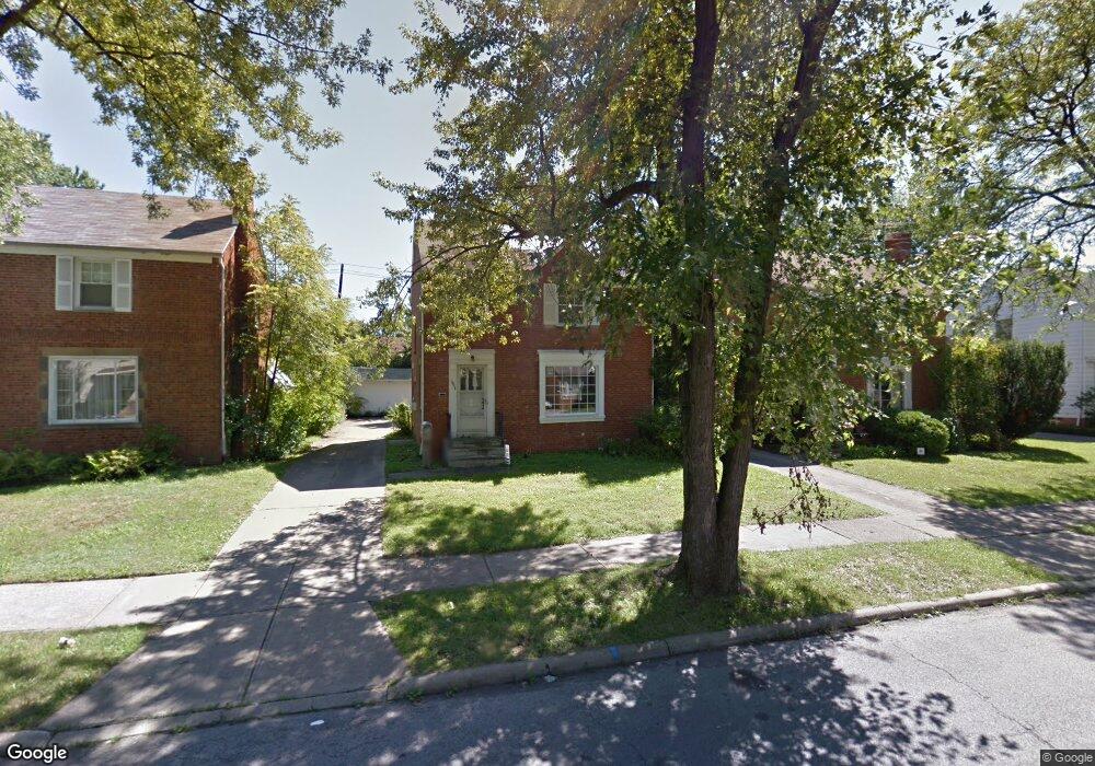
3948 E Antisdale Rd Cleveland, OH 44118
Estimated Value: $122,000 - $160,000
3
Beds
1
Bath
1,300
Sq Ft
$111/Sq Ft
Est. Value
About This Home
This home is located at 3948 E Antisdale Rd, Cleveland, OH 44118 and is currently estimated at $144,768, approximately $111 per square foot. 3948 E Antisdale Rd is a home located in Cuyahoga County with nearby schools including Gearity Professional Development School, Monticello Middle School, and Cleveland Heights High School.
Ownership History
Date
Name
Owned For
Owner Type
Purchase Details
Closed on
Jul 22, 2011
Sold by
Owb Reo Llc
Bought by
Breger Dmitriy
Current Estimated Value
Purchase Details
Closed on
Jun 23, 2011
Sold by
Irby Emanuel E
Bought by
Owb Reo Llc
Purchase Details
Closed on
Mar 28, 2007
Sold by
Morrison Randolph T
Bought by
Irby Emanuel E
Home Financials for this Owner
Home Financials are based on the most recent Mortgage that was taken out on this home.
Original Mortgage
$80,750
Interest Rate
6.75%
Mortgage Type
Purchase Money Mortgage
Purchase Details
Closed on
Jun 21, 1977
Sold by
Wright Jerry
Bought by
Morrison Randolph T
Purchase Details
Closed on
Jan 1, 1975
Bought by
Wright Jerry
Create a Home Valuation Report for This Property
The Home Valuation Report is an in-depth analysis detailing your home's value as well as a comparison with similar homes in the area
Home Values in the Area
Average Home Value in this Area
Purchase History
| Date | Buyer | Sale Price | Title Company |
|---|---|---|---|
| Breger Dmitriy | $24,700 | Resource Title Agency | |
| Owb Reo Llc | $63,000 | None Available | |
| Irby Emanuel E | $85,000 | Signature Title | |
| Morrison Randolph T | $36,500 | -- | |
| Wright Jerry | -- | -- |
Source: Public Records
Mortgage History
| Date | Status | Borrower | Loan Amount |
|---|---|---|---|
| Previous Owner | Irby Emanuel E | $80,750 |
Source: Public Records
Tax History
| Year | Tax Paid | Tax Assessment Tax Assessment Total Assessment is a certain percentage of the fair market value that is determined by local assessors to be the total taxable value of land and additions on the property. | Land | Improvement |
|---|---|---|---|---|
| 2025 | $3,863 | $41,160 | $9,485 | $31,675 |
| 2024 | $3,939 | $41,160 | $9,485 | $31,675 |
| 2023 | $3,717 | $30,420 | $6,900 | $23,520 |
| 2022 | $3,700 | $30,415 | $6,895 | $23,520 |
| 2021 | $3,635 | $30,420 | $6,900 | $23,520 |
| 2020 | $3,440 | $24,710 | $5,600 | $19,110 |
| 2019 | $4,047 | $70,600 | $16,000 | $54,600 |
| 2018 | $2,976 | $24,710 | $5,600 | $19,110 |
| 2017 | $3,028 | $21,980 | $4,410 | $17,570 |
| 2016 | $2,994 | $21,980 | $4,410 | $17,570 |
| 2015 | $2,935 | $21,980 | $4,410 | $17,570 |
| 2014 | $2,935 | $23,140 | $4,660 | $18,480 |
Source: Public Records
Map
Nearby Homes
- 4019 Okalona Rd
- 4041 Wilmington Rd
- 3798 Grosvenor Rd
- 4130 Wyncote Rd
- 3742 E Antisdale Rd
- 4142 Eastway Rd
- 3961 Lansdale Rd
- 3787 Bainbridge Rd
- 3733 E Antisdale Rd
- 3730 E Antisdale Rd
- 3841 Washington Blvd
- 4158 Wyncote Rd
- 4157 Verona Rd
- 1985 Revere Rd
- 3750 Bainbridge Rd
- 2223 Fenwick Rd
- 2176 Edgerton Rd
- 3738 Bendemeer Rd
- 4069 Bushnell Rd
- 1948 Staunton Rd
- 3954 E Antisdale Rd
- 3944 E Antisdale Rd
- 3958 E Antisdale Rd
- 3938 E Antisdale Rd
- 3945 Grosvenor Rd
- 3941 Grosvenor Rd
- 3949 Grosvenor Rd
- 3962 E Antisdale Rd
- 3934 E Antisdale Rd
- 3937 Grosvenor Rd
- 3957 Grosvenor Rd
- 3947 E Antisdale Rd
- 3951 E Antisdale Rd
- 3943 E Antisdale Rd
- 3933 Grosvenor Rd
- 3957 E Antisdale Rd
- 3966 E Antisdale Rd
- 3941 E Antisdale Rd
- 3961 Grosvenor Rd
- 3930 E Antisdale Rd
Your Personal Tour Guide
Ask me questions while you tour the home.