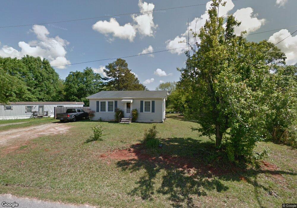
395 Caroline St West Union, SC 29696
Estimated Value: $100,000 - $225,000
2
Beds
1
Bath
896
Sq Ft
$168/Sq Ft
Est. Value
About This Home
This home is located at 395 Caroline St, West Union, SC 29696 and is currently estimated at $150,799, approximately $168 per square foot. 395 Caroline St is a home with nearby schools including Walhalla Elementary School, Walhalla Middle School, and Walhalla High School.
Ownership History
Date
Name
Owned For
Owner Type
Purchase Details
Closed on
Sep 4, 2025
Sold by
Laye Lois Selma and Hunnicutt Nee
Bought by
Laye Family Revocable Trust and Crow
Current Estimated Value
Purchase Details
Closed on
Jun 4, 2014
Sold by
Estate Of Lois Selma Laye Nee Hunnicutt
Bought by
Will Of Lois Selma Laye Nee Hunnicutt
Purchase Details
Closed on
Jun 24, 2013
Sold by
Estate Of John Sam Laye Jr
Bought by
Estate Of Lois Selma Laye
Create a Home Valuation Report for This Property
The Home Valuation Report is an in-depth analysis detailing your home's value as well as a comparison with similar homes in the area
Home Values in the Area
Average Home Value in this Area
Purchase History
| Date | Buyer | Sale Price | Title Company |
|---|---|---|---|
| Laye Family Revocable Trust | -- | None Listed On Document | |
| Will Of Lois Selma Laye Nee Hunnicutt | -- | -- | |
| Estate Of Lois Selma Laye | -- | -- |
Source: Public Records
Tax History Compared to Growth
Tax History
| Year | Tax Paid | Tax Assessment Tax Assessment Total Assessment is a certain percentage of the fair market value that is determined by local assessors to be the total taxable value of land and additions on the property. | Land | Improvement |
|---|---|---|---|---|
| 2025 | $626 | $1,532 | $680 | $852 |
| 2024 | $626 | $1,532 | $680 | $852 |
| 2023 | $612 | $1,532 | $680 | $852 |
| 2022 | $614 | $1,532 | $680 | $852 |
| 2021 | $577 | $1,496 | $690 | $806 |
| 2020 | $504 | $0 | $0 | $0 |
| 2019 | $504 | $0 | $0 | $0 |
| 2018 | $491 | $0 | $0 | $0 |
| 2017 | $577 | $0 | $0 | $0 |
| 2016 | $577 | $0 | $0 | $0 |
| 2015 | -- | $0 | $0 | $0 |
| 2014 | -- | $2,210 | $1,242 | $969 |
| 2013 | -- | $0 | $0 | $0 |
Source: Public Records
Map
Nearby Homes
- 000 Anderson St
- 115 Burns Mill Rd
- 2539 Blue Ridge Blvd
- 204 Friendship Dr
- 209 Moore Ave
- 1198 Anderson St
- 00 Branch St
- 146 Jefferson Rd
- 208 Branch St
- 00 Keowee St
- 117 Edney Dr
- 320 Jaynes St
- 00 S Spring St
- 412 N Spring St
- 825 & 833 Armada Way
- 141 W Waters Edge Ln
- 130 Raleighs Ln
- 137 W Waters Edge Ln
- 209 Castlebrook Dr
- 213 Castlebrook Dr
- 629 Anderson St
- 701 Anderson St
- 625 Anderson St
- 623 Anderson St
- 627 Anderson St
- 613 Anderson St
- 215 Church St
- 220 E Main St
- 787 Anderson St
- 213 Church St
- 300 E Main St
- 211 Church St
- 103 Peninsula Dr
- 321 E Main St
- 416 E Main St
- 00 S Highway 11
- 501 Puddles Way
- 426A E Main St
- 420 E Main St
- 500 Puddles Way