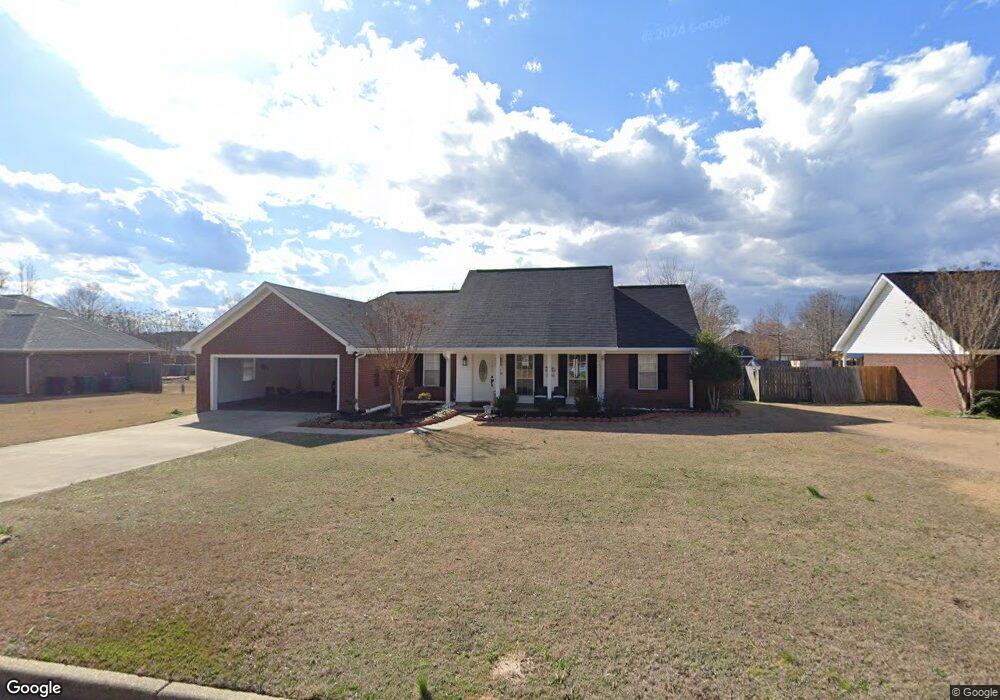
395 Cheryl Dr Columbus, MS 39702
Estimated Value: $277,000 - $331,000
--
Bed
--
Bath
2,252
Sq Ft
$131/Sq Ft
Est. Value
About This Home
This home is located at 395 Cheryl Dr, Columbus, MS 39702 and is currently estimated at $295,988, approximately $131 per square foot. 395 Cheryl Dr is a home.
Ownership History
Date
Name
Owned For
Owner Type
Purchase Details
Closed on
Sep 7, 2012
Sold by
Tate Tanner Lee
Bought by
Tate Christopher A
Current Estimated Value
Home Financials for this Owner
Home Financials are based on the most recent Mortgage that was taken out on this home.
Original Mortgage
$127,000
Outstanding Balance
$88,457
Interest Rate
3.71%
Mortgage Type
Stand Alone Refi Refinance Of Original Loan
Estimated Equity
$207,531
Purchase Details
Closed on
Sep 14, 2006
Sold by
Chism Christopher A and Chism Ashley S
Bought by
Tate Christopher A
Home Financials for this Owner
Home Financials are based on the most recent Mortgage that was taken out on this home.
Original Mortgage
$135,500
Interest Rate
6.48%
Create a Home Valuation Report for This Property
The Home Valuation Report is an in-depth analysis detailing your home's value as well as a comparison with similar homes in the area
Home Values in the Area
Average Home Value in this Area
Purchase History
| Date | Buyer | Sale Price | Title Company |
|---|---|---|---|
| Tate Christopher A | -- | -- | |
| Tate Christopher A | -- | -- |
Source: Public Records
Mortgage History
| Date | Status | Borrower | Loan Amount |
|---|---|---|---|
| Open | Tate Christopher A | $127,000 | |
| Previous Owner | Tate Christopher A | $135,500 |
Source: Public Records
Tax History Compared to Growth
Tax History
| Year | Tax Paid | Tax Assessment Tax Assessment Total Assessment is a certain percentage of the fair market value that is determined by local assessors to be the total taxable value of land and additions on the property. | Land | Improvement |
|---|---|---|---|---|
| 2025 | $1,068 | $18,412 | $0 | $0 |
| 2024 | $1,487 | $18,412 | $0 | $0 |
| 2023 | $1,257 | $16,112 | $0 | $0 |
| 2022 | $1,258 | $16,112 | $0 | $0 |
| 2021 | $1,201 | $16,112 | $0 | $0 |
| 2020 | $939 | $14,074 | $0 | $0 |
| 2019 | $934 | $13,947 | $0 | $0 |
| 2018 | $934 | $13,597 | $0 | $0 |
| 2017 | $879 | $13,597 | $0 | $0 |
| 2016 | $879 | $13,597 | $0 | $0 |
| 2015 | $907 | $13,915 | $0 | $0 |
| 2014 | $885 | $13,669 | $0 | $0 |
Source: Public Records
Map
Nearby Homes