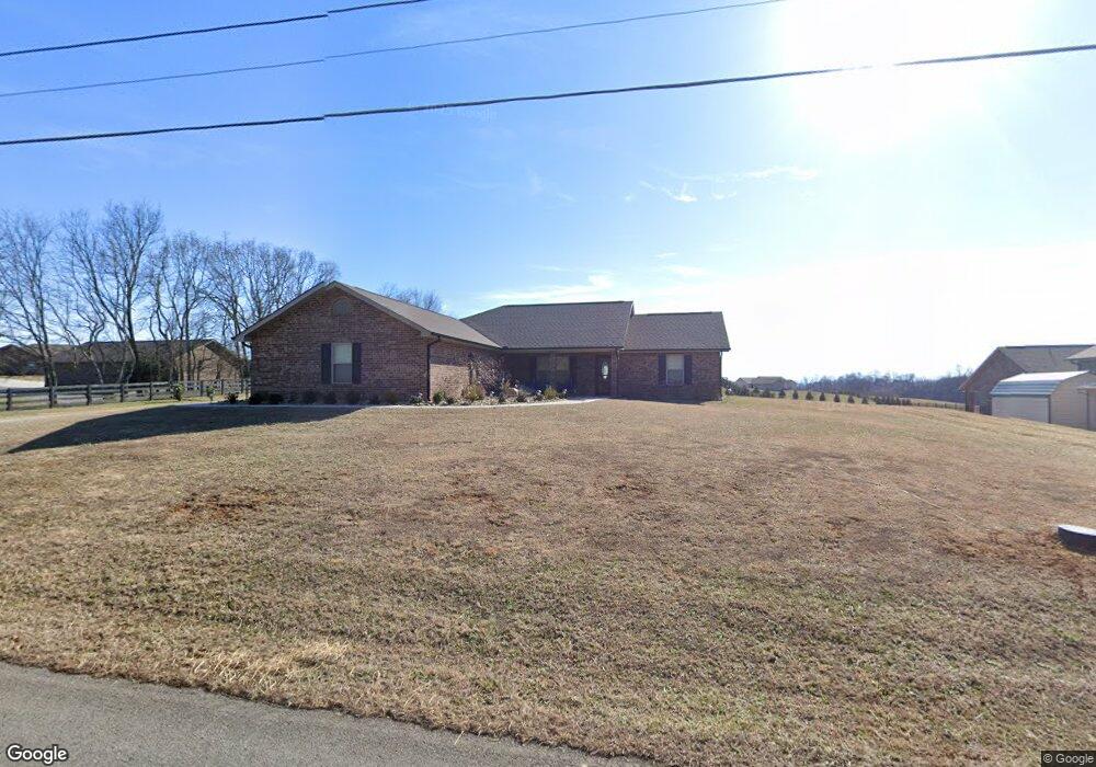
395 Morie Rd Dandridge, TN 37725
Estimated Value: $355,000 - $527,000
--
Bed
--
Bath
1,711
Sq Ft
$262/Sq Ft
Est. Value
About This Home
This home is located at 395 Morie Rd, Dandridge, TN 37725 and is currently estimated at $448,500, approximately $262 per square foot. 395 Morie Rd is a home.
Ownership History
Date
Name
Owned For
Owner Type
Purchase Details
Closed on
Jan 19, 2022
Sold by
Chad Dixon Construction Inc
Bought by
Wood William Robert and Marketti Justine A
Current Estimated Value
Home Financials for this Owner
Home Financials are based on the most recent Mortgage that was taken out on this home.
Original Mortgage
$351,215
Outstanding Balance
$323,688
Interest Rate
3.11%
Mortgage Type
New Conventional
Estimated Equity
$124,812
Purchase Details
Closed on
Oct 16, 2018
Sold by
Flynn Wanda
Bought by
Chad Dixon Construction Inc
Purchase Details
Closed on
Jul 20, 2018
Sold by
Farrar Jack
Bought by
Chad Dixon Construction Inc
Purchase Details
Closed on
Jul 9, 2018
Sold by
Graves Michael L and Graves Amy S
Bought by
Chad Dixon Construction Inc
Purchase Details
Closed on
Feb 12, 2013
Sold by
Graves Michael L
Bought by
Flynn Johnny R
Purchase Details
Closed on
Jul 16, 2004
Sold by
Johnnie Flynn
Bought by
Graves Michael L
Create a Home Valuation Report for This Property
The Home Valuation Report is an in-depth analysis detailing your home's value as well as a comparison with similar homes in the area
Home Values in the Area
Average Home Value in this Area
Purchase History
| Date | Buyer | Sale Price | Title Company |
|---|---|---|---|
| Wood William Robert | $369,700 | Jefferson Title | |
| Chad Dixon Construction Inc | -- | Jefferson Title Inc | |
| Chad Dixon Construction Inc | $17,000 | Jefferson Title Inc | |
| Chad Dixon Construction Inc | -- | Jefferson Title Inc | |
| Flynn Johnny R | $10,000 | -- | |
| Graves Michael L | $5,000 | -- |
Source: Public Records
Mortgage History
| Date | Status | Borrower | Loan Amount |
|---|---|---|---|
| Open | Wood William Robert | $351,215 |
Source: Public Records
Tax History Compared to Growth
Tax History
| Year | Tax Paid | Tax Assessment Tax Assessment Total Assessment is a certain percentage of the fair market value that is determined by local assessors to be the total taxable value of land and additions on the property. | Land | Improvement |
|---|---|---|---|---|
| 2025 | $1,318 | $128,425 | $14,800 | $113,625 |
| 2023 | $1,318 | $57,325 | $0 | $0 |
| 2022 | $991 | $45,250 | $8,850 | $36,400 |
| 2021 | $159 | $8,850 | $8,850 | $0 |
| 2020 | $159 | $7,250 | $7,250 | $0 |
| 2019 | $227 | $10,375 | $7,250 | $3,125 |
| 2018 | $205 | $8,725 | $5,325 | $3,400 |
| 2017 | $205 | $8,725 | $5,325 | $3,400 |
| 2016 | $125 | $5,325 | $5,325 | $0 |
| 2015 | $125 | $5,325 | $5,325 | $0 |
| 2014 | $125 | $5,325 | $5,325 | $0 |
Source: Public Records
Map
Nearby Homes
- 1018 Southwind Cir
- 136 Crosslake Ln
- 1045 Southwind Cir
- 417 Little Cove Dr
- 1806 Pheasant Crossing Dr
- 344 Economy Cir
- 1830 Pheasant Crossing Dr
- 1988 Lakebrook Cir
- 1991 Lakebrook Cir
- 312 Economy Cir
- 1614 Sams Dr
- 1635 Sams Dr
- 1710 Ferry Hill Rd
- 1887 Lakebrook Cir
- 539 Morie Rd
- 1928 Bouldercrest Dr
- Lots 1&2 Ferry Hill Rd
- 1920 Mountain Lake Dr
- 621 Highway 139
- 626 Briarwood Dr
- 401 Morie Rd
- 1022 Southwind Cir
- 1020 Southwind Cir
- 1024 Southwind Cir
- 1026 Southwind Cir
- 415 Morie Rd
- 176 Crosslake Ln
- 2945 Crosslake Ln
- 1023 Southwind Cir
- 410 Morie Rd
- 1016 Southwind Cir
- 1028 Southwind Cir
- 419 Morie Rd
- 1015 Southwind Cir
- 1027 Southwind Cir
- 372 Morie Rd
- 400 Morie Rd
- 1014 Southwind Cir
- 156 Crosslake Ln
- 434 Little Cove Dr