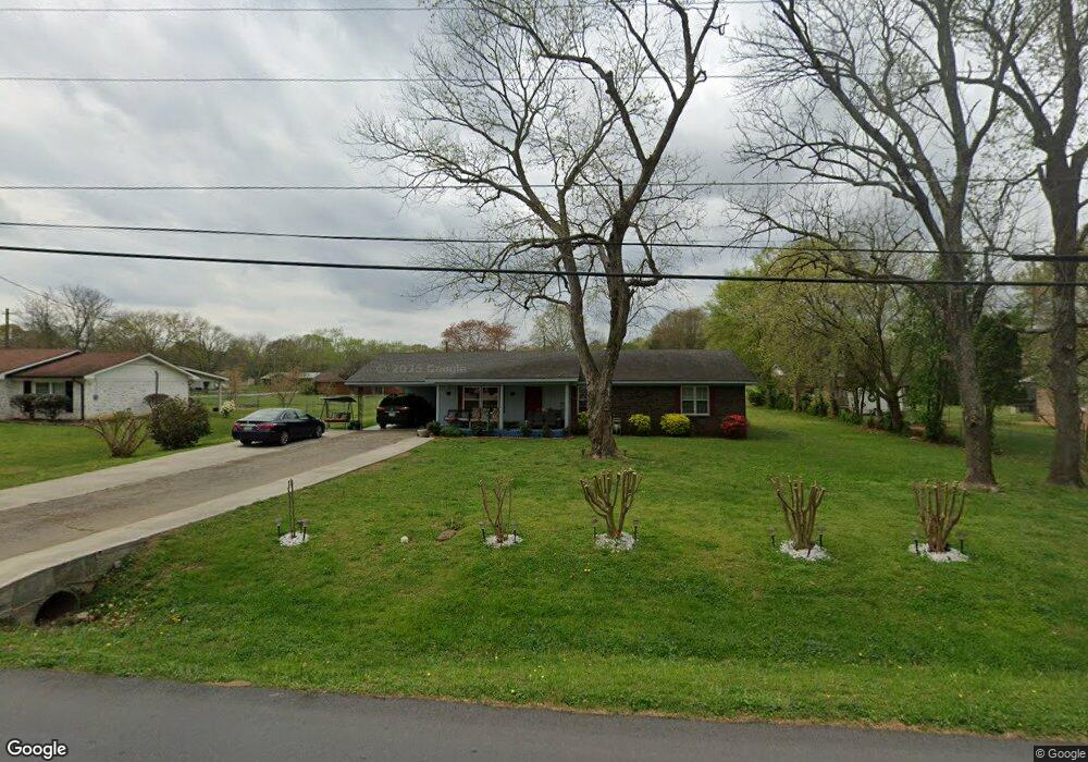
395 Stewart Dr SW Calhoun, GA 30701
Estimated Value: $213,266 - $254,000
3
Beds
2
Baths
1,470
Sq Ft
$163/Sq Ft
Est. Value
About This Home
This home is located at 395 Stewart Dr SW, Calhoun, GA 30701 and is currently estimated at $239,567, approximately $162 per square foot. 395 Stewart Dr SW is a home located in Gordon County with nearby schools including Calhoun Primary School, Calhoun Elementary School, and Calhoun Middle School.
Ownership History
Date
Name
Owned For
Owner Type
Purchase Details
Closed on
Jun 29, 2018
Sold by
Baig Mizra Muhammad Ali
Bought by
Baig Mirza Z and Baig Rukhar A
Current Estimated Value
Home Financials for this Owner
Home Financials are based on the most recent Mortgage that was taken out on this home.
Original Mortgage
$10,400
Outstanding Balance
$6,293
Interest Rate
4.5%
Mortgage Type
New Conventional
Estimated Equity
$233,274
Purchase Details
Closed on
Dec 16, 2016
Sold by
Franklin James A
Bought by
Baig Mizraz Muhannad Ali and Sahar Najmus
Home Financials for this Owner
Home Financials are based on the most recent Mortgage that was taken out on this home.
Original Mortgage
$114,000
Interest Rate
3.94%
Mortgage Type
New Conventional
Purchase Details
Closed on
Apr 16, 1983
Sold by
Wilson James
Bought by
Franklin James A
Create a Home Valuation Report for This Property
The Home Valuation Report is an in-depth analysis detailing your home's value as well as a comparison with similar homes in the area
Home Values in the Area
Average Home Value in this Area
Purchase History
| Date | Buyer | Sale Price | Title Company |
|---|---|---|---|
| Baig Mirza Z | $130,000 | -- | |
| Baig Mizraz Muhannad Ali | $129,000 | -- | |
| Franklin James A | $33,700 | -- |
Source: Public Records
Mortgage History
| Date | Status | Borrower | Loan Amount |
|---|---|---|---|
| Open | Baig Mirza Z | $10,400 | |
| Previous Owner | Baig Mizraz Muhannad Ali | $114,000 |
Source: Public Records
Tax History Compared to Growth
Tax History
| Year | Tax Paid | Tax Assessment Tax Assessment Total Assessment is a certain percentage of the fair market value that is determined by local assessors to be the total taxable value of land and additions on the property. | Land | Improvement |
|---|---|---|---|---|
| 2024 | $1,132 | $40,920 | $2,098 | $38,822 |
| 2023 | $1,132 | $40,920 | $2,600 | $38,320 |
| 2022 | $999 | $33,280 | $2,600 | $30,680 |
| 2021 | $893 | $30,640 | $2,600 | $28,040 |
| 2020 | $1,047 | $31,080 | $2,600 | $28,480 |
| 2019 | $1,233 | $41,800 | $5,200 | $36,600 |
| 2018 | $279 | $30,976 | $5,040 | $25,936 |
| 2017 | $285 | $30,976 | $5,040 | $25,936 |
| 2016 | $307 | $31,176 | $5,040 | $26,136 |
| 2015 | $311 | $31,176 | $5,040 | $26,136 |
| 2014 | $334 | $33,968 | $5,040 | $28,928 |
Source: Public Records
Map
Nearby Homes
- 0 Highway 53 Spur SW Unit 7529096
- 261 Liberty Ln SW
- 490 McDaniel Station Rd SW
- 506 McDaniel Station Rd SW
- 458 McDaniel Station Rd SW
- 474 McDaniel Station Rd SW
- 121 Foxhall Dr SW
- 00 Belmont Dr
- 0 Reeves Station Rd SW Unit 10548197
- 0 Reeves Station Rd SW Unit 7601645
- 130 Brookstone Dr SW
- 137 Regency Row SW
- 1401 U S 41
- 1311 Us Highway 41
- 139 Red Oak Ln
- 0 W Belmont Dr Unit 10489910
- 413 Beamer Rd SW
- 108 Mac Ave
- The Pearson Plan at Creekview
- The Coleman Plan at Creekview
- 375 Stewart Dr SW
- 419 Stewart Dr SW
- 220 Brian Dr SW
- 208 Brian Dr SW
- 247 Brian Dr SW
- 396 Stewart Dr SW
- 482 Stewart Dr SW
- 363 Stewart Dr SW
- 406 Stewart Dr SW
- 382 Stewart Dr SW
- 232 Brian Dr SW
- 109 Flora Dr SW
- 108 Flora Dr SW
- 351 Stewart Dr SW
- 412 Stewart Dr SW
- 196 Brian Dr SW
- 231 Brian Dr SW
- 219 Brian Dr SW
- 246 Brian Dr SW
- 118 Flora Dr SW