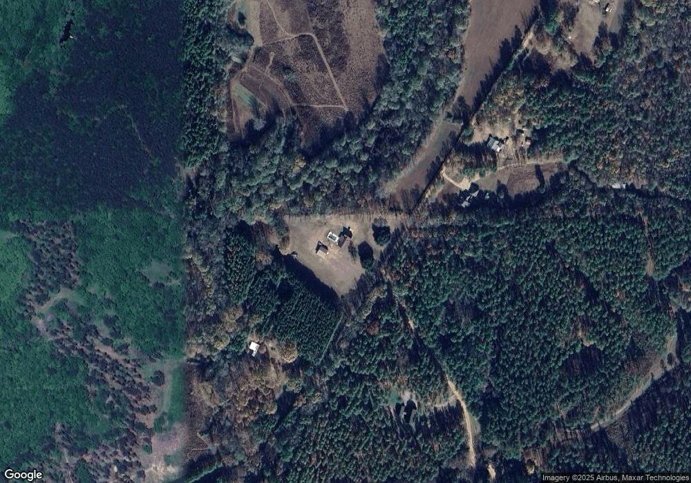
395 Thornton Rd Carthage, MS 39051
Estimated Value: $209,000 - $224,000
4
Beds
2
Baths
2,452
Sq Ft
$88/Sq Ft
Est. Value
About This Home
This home is located at 395 Thornton Rd, Carthage, MS 39051 and is currently estimated at $216,500, approximately $88 per square foot. 395 Thornton Rd is a home with nearby schools including Leake Central Elementary, Leake Central Junior High School, and Leake Central High School.
Ownership History
Date
Name
Owned For
Owner Type
Purchase Details
Closed on
May 7, 2008
Sold by
Adams Lem and Perry Laruth
Bought by
Wilcher Rusty D and Wilcher Helen T
Current Estimated Value
Home Financials for this Owner
Home Financials are based on the most recent Mortgage that was taken out on this home.
Original Mortgage
$145,663
Interest Rate
5.86%
Purchase Details
Closed on
Dec 13, 2005
Sold by
Perry Laruth
Bought by
Perry Laruth
Create a Home Valuation Report for This Property
The Home Valuation Report is an in-depth analysis detailing your home's value as well as a comparison with similar homes in the area
Home Values in the Area
Average Home Value in this Area
Purchase History
| Date | Buyer | Sale Price | Title Company |
|---|---|---|---|
| Wilcher Rusty D | $84,801 | -- | |
| Perry Laruth | -- | -- |
Source: Public Records
Mortgage History
| Date | Status | Borrower | Loan Amount |
|---|---|---|---|
| Closed | Perry Laruth | $145,663 |
Source: Public Records
Tax History Compared to Growth
Tax History
| Year | Tax Paid | Tax Assessment Tax Assessment Total Assessment is a certain percentage of the fair market value that is determined by local assessors to be the total taxable value of land and additions on the property. | Land | Improvement |
|---|---|---|---|---|
| 2024 | $1,481 | $14,365 | $847 | $13,518 |
| 2023 | $1,251 | $12,673 | $847 | $11,826 |
| 2022 | $1,233 | $12,683 | $857 | $11,826 |
| 2021 | $1,121 | $12,175 | $857 | $11,318 |
| 2020 | $1,122 | $12,183 | $865 | $11,318 |
| 2019 | $727 | $9,178 | $873 | $8,305 |
| 2018 | $690 | $9,172 | $867 | $8,305 |
| 2017 | $718 | $9,428 | $896 | $8,532 |
| 2016 | $0 | $9,413 | $881 | $8,532 |
| 2015 | $666 | $9,398 | $866 | $8,532 |
| 2014 | $666 | $9,386 | $854 | $8,532 |
Source: Public Records
Map
Nearby Homes
- 2445 Highway 16 E
- 0 Hwy 16 E Unit 25065774
- 625 Camp Rd
- 2985 Martin Rd
- 0 Galilee Rd
- 0 Woodhaven Dr Unit 4104068
- 01 N Jordan St
- 0 E Franklin St Unit 4058543
- 1211 N Jordan St
- 1204 N Jordan St
- 0 Walnut Rd Unit 4052865
- 3953 Standing Pine Rd
- 514 Northwest St
- 412 N Saint Matthew St
- 0 St Anne Rd Unit 18059597
- 811 Mississippi 16
- None Mississippi 16
- 205 Mississippi 35
- 0 Mississippi 35
- 0000 Mississippi 35
- 269 Thornton Rd
- 760 Thornton Rd
- 780 Thornton Rd
- 63 Thornton Rd
- 78 Thornton Rd
- 2428 Highway 16 E
- 816 Thornton Rd
- 753 Thornton Rd
- 883 Thornton Rd
- 891 Thornton Rd
- 2450 Mississippi 16
- 2450 E Highway 16 Hwy
- 900 Thornton Rd
- 0 Hwy 16 E Unit 307925
- 0 Hwy 16 E Unit 4076702
- 0 Hwy 16 E Unit 4033352
- 0 Hwy 16 E Unit 343237
- 2453 Highway 16 E
- 935 Thornton Rd
- 2465 Highway 16 E
