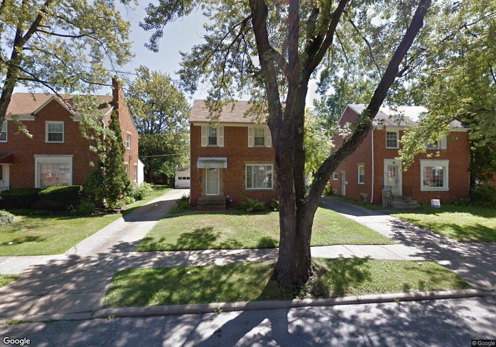
3954 E Antisdale Rd Cleveland, OH 44118
Estimated Value: $156,000 - $181,000
3
Beds
1
Bath
1,300
Sq Ft
$129/Sq Ft
Est. Value
About This Home
This home is located at 3954 E Antisdale Rd, Cleveland, OH 44118 and is currently estimated at $168,120, approximately $129 per square foot. 3954 E Antisdale Rd is a home located in Cuyahoga County with nearby schools including Gearity Professional Development School, Monticello Middle School, and Cleveland Heights High School.
Ownership History
Date
Name
Owned For
Owner Type
Purchase Details
Closed on
Dec 6, 2013
Sold by
Byrd Allison R
Bought by
Evans Philmore
Current Estimated Value
Home Financials for this Owner
Home Financials are based on the most recent Mortgage that was taken out on this home.
Original Mortgage
$76,000
Outstanding Balance
$56,648
Interest Rate
4.14%
Mortgage Type
New Conventional
Estimated Equity
$111,472
Purchase Details
Closed on
Aug 13, 2001
Sold by
Flowers Charles
Bought by
Hud
Purchase Details
Closed on
Aug 22, 1988
Sold by
Friedman Miriam
Bought by
Flowers Charles
Purchase Details
Closed on
Jan 1, 1975
Bought by
Friedman Miriam
Create a Home Valuation Report for This Property
The Home Valuation Report is an in-depth analysis detailing your home's value as well as a comparison with similar homes in the area
Home Values in the Area
Average Home Value in this Area
Purchase History
| Date | Buyer | Sale Price | Title Company |
|---|---|---|---|
| Evans Philmore | $80,000 | Attorney | |
| Hud | $70,000 | -- | |
| Flowers Charles | $56,900 | -- | |
| Friedman Miriam | -- | -- |
Source: Public Records
Mortgage History
| Date | Status | Borrower | Loan Amount |
|---|---|---|---|
| Open | Evans Philmore | $76,000 |
Source: Public Records
Tax History Compared to Growth
Tax History
| Year | Tax Paid | Tax Assessment Tax Assessment Total Assessment is a certain percentage of the fair market value that is determined by local assessors to be the total taxable value of land and additions on the property. | Land | Improvement |
|---|---|---|---|---|
| 2024 | $4,191 | $44,940 | $9,485 | $35,455 |
| 2023 | $4,297 | $36,270 | $6,900 | $29,370 |
| 2022 | $4,277 | $36,260 | $6,895 | $29,365 |
| 2021 | $4,197 | $36,260 | $6,900 | $29,370 |
| 2020 | $3,817 | $29,470 | $5,600 | $23,870 |
| 2019 | $3,625 | $84,200 | $16,000 | $68,200 |
| 2018 | $3,626 | $29,470 | $5,600 | $23,870 |
| 2017 | $3,174 | $23,660 | $4,410 | $19,250 |
| 2016 | $3,137 | $23,660 | $4,410 | $19,250 |
| 2015 | $3,074 | $23,660 | $4,410 | $19,250 |
| 2014 | $3,074 | $24,930 | $4,660 | $20,270 |
Source: Public Records
Map
Nearby Homes
- 4045 Colony Rd
- 3778 E Antisdale Rd
- 4033 Stonehaven Rd
- 13801 Cedar Rd Unit 102
- 4040 Bayard Rd
- 13805 Cedar Rd Unit 203
- 1819 Warrensville Center Rd
- 4106 Colony Rd
- 3733 E Antisdale Rd
- 3787 Bainbridge Rd
- 3841 Washington Blvd
- 13765 Cedar Rd Unit 303C
- 4158 Wyncote Rd
- 1779 Warrensville Center Rd
- 3843 Bendemeer Rd
- 3874 Washington Blvd
- 4124 Bayard Rd
- 2223 Fenwick Rd
- 3797 Bushnell Rd
- 4190 Wyncote Rd
- 3948 E Antisdale Rd
- 3958 E Antisdale Rd
- 3962 E Antisdale Rd
- 3949 Grosvenor Rd
- 3944 E Antisdale Rd
- 3945 Grosvenor Rd
- 3957 Grosvenor Rd
- 3966 E Antisdale Rd
- 3938 E Antisdale Rd
- 3941 Grosvenor Rd
- 3961 Grosvenor Rd
- 3951 E Antisdale Rd
- 3957 E Antisdale Rd
- 3947 E Antisdale Rd
- 3937 Grosvenor Rd
- 3961 E Antisdale Rd
- 3943 E Antisdale Rd
- 3934 E Antisdale Rd
- 3965 E Antisdale Rd
- 3941 E Antisdale Rd
