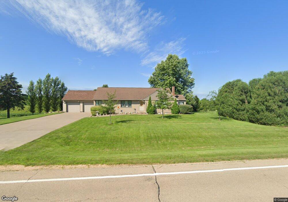
3955 Highway 136 Bryant, IA 52727
Estimated Value: $272,000 - $314,000
3
Beds
3
Baths
1,432
Sq Ft
$203/Sq Ft
Est. Value
About This Home
This home is located at 3955 Highway 136, Bryant, IA 52727 and is currently estimated at $290,410, approximately $202 per square foot. 3955 Highway 136 is a home located in Clinton County with nearby schools including Northeast Elementary School and Northeast Middle/High School.
Ownership History
Date
Name
Owned For
Owner Type
Purchase Details
Closed on
Feb 18, 2020
Sold by
Claussen Karen J
Bought by
Bierman Paul E
Current Estimated Value
Purchase Details
Closed on
Sep 21, 2017
Sold by
Steven Cundiff
Bought by
Claussen Karen
Home Financials for this Owner
Home Financials are based on the most recent Mortgage that was taken out on this home.
Original Mortgage
$156,000
Interest Rate
3.83%
Purchase Details
Closed on
Oct 9, 2015
Sold by
Sander David Richard and Sander Kathleen Dee
Bought by
Cundiff Steven L
Home Financials for this Owner
Home Financials are based on the most recent Mortgage that was taken out on this home.
Original Mortgage
$166,400
Interest Rate
3.88%
Mortgage Type
New Conventional
Create a Home Valuation Report for This Property
The Home Valuation Report is an in-depth analysis detailing your home's value as well as a comparison with similar homes in the area
Home Values in the Area
Average Home Value in this Area
Purchase History
| Date | Buyer | Sale Price | Title Company |
|---|---|---|---|
| Bierman Paul E | $215,000 | None Available | |
| Claussen Karen | -- | -- | |
| Cundiff Steven L | $208,000 | None Available |
Source: Public Records
Mortgage History
| Date | Status | Borrower | Loan Amount |
|---|---|---|---|
| Previous Owner | Claussen Karen | $156,000 | |
| Previous Owner | Claussen Karen | -- | |
| Previous Owner | Cundiff Steven L | $166,400 |
Source: Public Records
Tax History Compared to Growth
Tax History
| Year | Tax Paid | Tax Assessment Tax Assessment Total Assessment is a certain percentage of the fair market value that is determined by local assessors to be the total taxable value of land and additions on the property. | Land | Improvement |
|---|---|---|---|---|
| 2024 | $2,808 | $232,260 | $41,760 | $190,500 |
| 2023 | $2,770 | $232,260 | $41,760 | $190,500 |
| 2022 | $2,560 | $219,110 | $41,760 | $177,350 |
| 2021 | $2,550 | $180,390 | $23,650 | $156,740 |
| 2020 | $2,550 | $172,920 | $23,650 | $149,270 |
| 2019 | $2,698 | $172,920 | $0 | $0 |
| 2018 | $2,516 | $172,920 | $0 | $0 |
| 2017 | $2,108 | $172,920 | $0 | $0 |
| 2016 | $2,010 | $141,100 | $0 | $0 |
| 2015 | $2,010 | $129,280 | $0 | $0 |
| 2014 | $1,836 | $126,060 | $0 | $0 |
| 2013 | $1,754 | $0 | $0 | $0 |
Source: Public Records
Map
Nearby Homes
- 3794 170th St
- 4118 Us Hwy 136 Hwy
- 411 Jackson Blvd
- 3983 120th St
- 1770 442nd Ave
- 4460 160th St
- 3451 125th St
- 4581 180th St
- 4610 8th St NW
- 886 Riverstone Ct
- 601 Green Hills Dr
- 967 Riverstone Rd
- 955 Riverstone Rd
- 943 Riverstone Rd
- 931 Riverstone Rd
- 927 Riverstone Rd
- 925 Riverstone Rd
- 921 Riverstone Rd
- 919 Riverstone Rd
- 917 Riverstone Rd
- 3943 Highway 136
- 3947 Highway 136
- 3977 Highway 136
- 3959 Highway 136
- 3960 170th St
- 3936 170th St
- 3948 170th St
- 3961 170th St
- 3970 170th St
- 3925 Highway 136
- 3923 Highway 136
- 1652 400th Ave
- 1698 400th Ave
- 1688 390th Ave
- 4004 170th St
- 1641 400th Ave
- 1713 390th Ave
- 1706 390th Ave
- 1647 400th Ave
- 1631 400th Ave