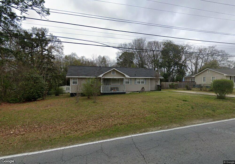
3961 Reese Rd Columbus, GA 31907
Eastern Columbus NeighborhoodEstimated Value: $148,000 - $184,000
3
Beds
2
Baths
1,385
Sq Ft
$117/Sq Ft
Est. Value
About This Home
This home is located at 3961 Reese Rd, Columbus, GA 31907 and is currently estimated at $162,229, approximately $117 per square foot. 3961 Reese Rd is a home located in Muscogee County with nearby schools including Gentian Elementary School, Fort Middle School, and Hardaway High School.
Ownership History
Date
Name
Owned For
Owner Type
Purchase Details
Closed on
Jan 19, 2017
Bought by
Thomas Gerald D
Current Estimated Value
Home Financials for this Owner
Home Financials are based on the most recent Mortgage that was taken out on this home.
Original Mortgage
$81,298
Outstanding Balance
$67,712
Interest Rate
4.5%
Mortgage Type
FHA
Estimated Equity
$94,517
Purchase Details
Closed on
Jun 13, 2016
Sold by
Sec Of Veterans Affairs
Bought by
Powers Investments Llc
Home Financials for this Owner
Home Financials are based on the most recent Mortgage that was taken out on this home.
Original Mortgage
$47,450
Interest Rate
3.64%
Mortgage Type
New Conventional
Purchase Details
Closed on
Feb 2, 2016
Sold by
Pitt Keith
Bought by
Jpmorgan Chase Bank National A
Create a Home Valuation Report for This Property
The Home Valuation Report is an in-depth analysis detailing your home's value as well as a comparison with similar homes in the area
Home Values in the Area
Average Home Value in this Area
Purchase History
| Date | Buyer | Sale Price | Title Company |
|---|---|---|---|
| Thomas Gerald D | $85,000 | -- | |
| Powers Investments Llc | $40,501 | -- | |
| Jpmorgan Chase Bank National A | $46,228 | -- | |
| Sec Of Veterans Affairs | $46,228 | -- |
Source: Public Records
Mortgage History
| Date | Status | Borrower | Loan Amount |
|---|---|---|---|
| Open | Thomas Gerald D | $81,298 | |
| Previous Owner | Powers Investments Llc | $47,450 |
Source: Public Records
Tax History Compared to Growth
Tax History
| Year | Tax Paid | Tax Assessment Tax Assessment Total Assessment is a certain percentage of the fair market value that is determined by local assessors to be the total taxable value of land and additions on the property. | Land | Improvement |
|---|---|---|---|---|
| 2025 | $815 | $39,944 | $7,296 | $32,648 |
| 2024 | $814 | $39,944 | $7,296 | $32,648 |
| 2023 | $125 | $39,944 | $7,296 | $32,648 |
| 2022 | $848 | $37,520 | $7,296 | $30,224 |
| 2021 | $841 | $33,692 | $7,296 | $26,396 |
| 2020 | $842 | $33,692 | $7,296 | $26,396 |
| 2019 | $846 | $33,692 | $7,296 | $26,396 |
| 2018 | $846 | $34,000 | $7,080 | $26,920 |
| 2017 | $1,555 | $16,200 | $2,880 | $13,320 |
| 2016 | $865 | $20,976 | $2,555 | $18,421 |
| 2015 | $866 | $20,976 | $2,555 | $18,421 |
| 2014 | $867 | $20,976 | $2,555 | $18,421 |
| 2013 | -- | $20,976 | $2,555 | $18,421 |
Source: Public Records
Map
Nearby Homes
- 4520 Marci Ct
- 4419 Anglin Rd
- 4017 River Rock Way
- 4110 Norwood Dr
- 4047 Sealy Ln
- 3935 Tifton Dr
- 4004 Tifton Dr
- 3727 Claymore Rd
- 3816 Anglin Rd
- 4133 Pickering Dr
- 3504 Vernon Dr
- 3872 E Britt David Rd
- 4709 Rowland Ave
- 5216 Moon Rd
- 4807 Fairview Dr
- 4813 Rowland Ct
- 10 Conisburgh Ct
- 3834 Rockdale Dr
- 4524 Hedingham Ln
- 3409 Primrose Rd