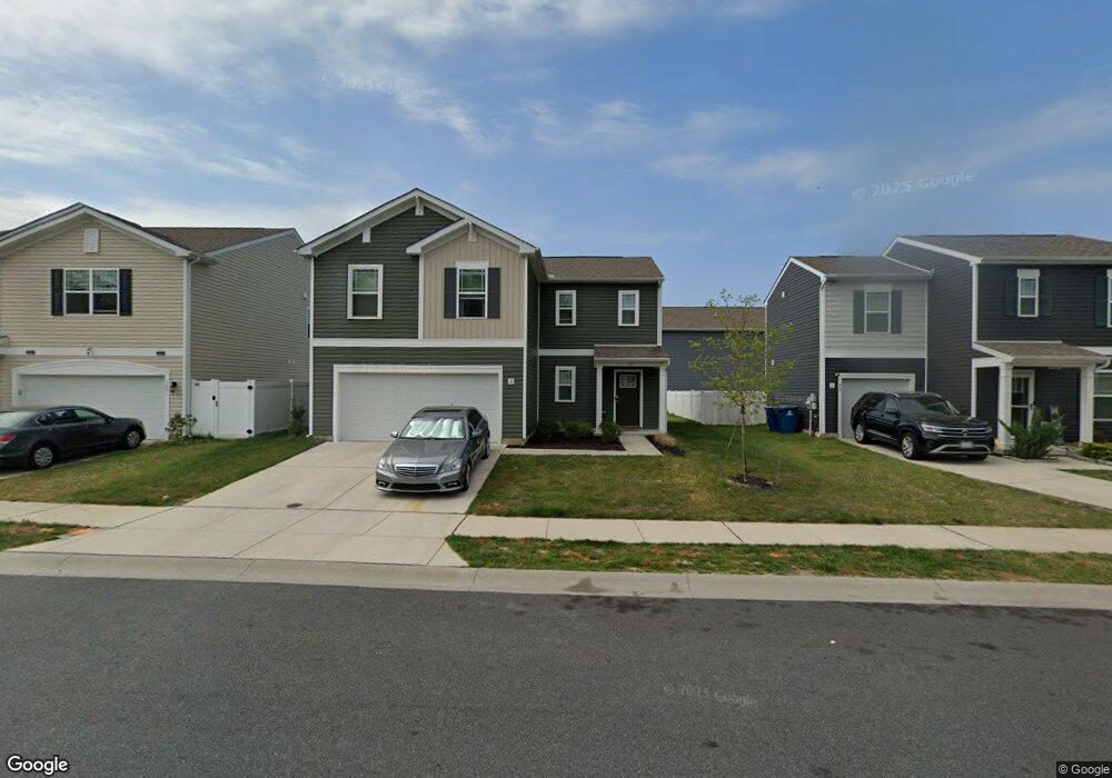
397 Mardella Dr Camden Wyoming, DE 19934
Estimated Value: $341,367 - $399,000
4
Beds
3
Baths
1,981
Sq Ft
$187/Sq Ft
Est. Value
About This Home
This home is located at 397 Mardella Dr, Camden Wyoming, DE 19934 and is currently estimated at $370,592, approximately $187 per square foot. 397 Mardella Dr is a home with nearby schools including Nellie Hughes Stokes Elementary School, Fred Fifer Middle School, and Caesar Rodney High School.
Ownership History
Date
Name
Owned For
Owner Type
Purchase Details
Closed on
Sep 23, 2020
Sold by
Dr Horton Inc
Bought by
Philips James Thomas and Philips Zina Lynette
Current Estimated Value
Home Financials for this Owner
Home Financials are based on the most recent Mortgage that was taken out on this home.
Original Mortgage
$106,490
Outstanding Balance
$94,503
Interest Rate
2.9%
Mortgage Type
New Conventional
Estimated Equity
$276,089
Purchase Details
Closed on
May 8, 2020
Sold by
Tidbury Crossing 104 Lots Llc
Bought by
D R Horton Inc
Create a Home Valuation Report for This Property
The Home Valuation Report is an in-depth analysis detailing your home's value as well as a comparison with similar homes in the area
Home Values in the Area
Average Home Value in this Area
Purchase History
| Date | Buyer | Sale Price | Title Company |
|---|---|---|---|
| Philips James Thomas | $242,490 | None Available | |
| D R Horton Inc | $47,500 | None Available |
Source: Public Records
Mortgage History
| Date | Status | Borrower | Loan Amount |
|---|---|---|---|
| Open | Philips James Thomas | $106,490 |
Source: Public Records
Tax History Compared to Growth
Tax History
| Year | Tax Paid | Tax Assessment Tax Assessment Total Assessment is a certain percentage of the fair market value that is determined by local assessors to be the total taxable value of land and additions on the property. | Land | Improvement |
|---|---|---|---|---|
| 2025 | $1,313 | $332,300 | $64,700 | $267,600 |
| 2024 | $1,313 | $332,300 | $64,700 | $267,600 |
| 2023 | $1,102 | $43,600 | $4,400 | $39,200 |
| 2022 | $1,040 | $43,600 | $4,400 | $39,200 |
| 2021 | $1,031 | $43,600 | $4,400 | $39,200 |
| 2020 | $102 | $4,400 | $4,400 | $0 |
| 2019 | $9 | $400 | $400 | $0 |
| 2018 | $9 | $400 | $400 | $0 |
| 2017 | $8 | $400 | $0 | $0 |
| 2016 | $8 | $400 | $0 | $0 |
| 2015 | -- | $400 | $0 | $0 |
| 2014 | -- | $400 | $0 | $0 |
Source: Public Records
Map
Nearby Homes
- 113 Dyer Dr
- 79 Tyndall Trail
- 32 Nanticoke Dr
- 108 Lochmeath Way
- 11 N Kimmer Ln Unit 265
- 16 Lone Tree Dr
- 35 N Jerman Ln Unit 271
- 107 S Hairgrove Ln Unit 86
- 107 S Ellison Ln Unit 78
- 12 Catts Ln Unit 21
- 21 Catts Ln Unit 27
- 68 Carey Ln Unit 15
- 272 King Henry Ct
- 256 Headstart Ln
- Lot 22 Bee Brookfield Dr
- 224 King Henry Ct
- 870 Brookfield Dr
- 11939 Willow Grove Rd
- 850 Brookfield Dr
- 78 Cove Rd