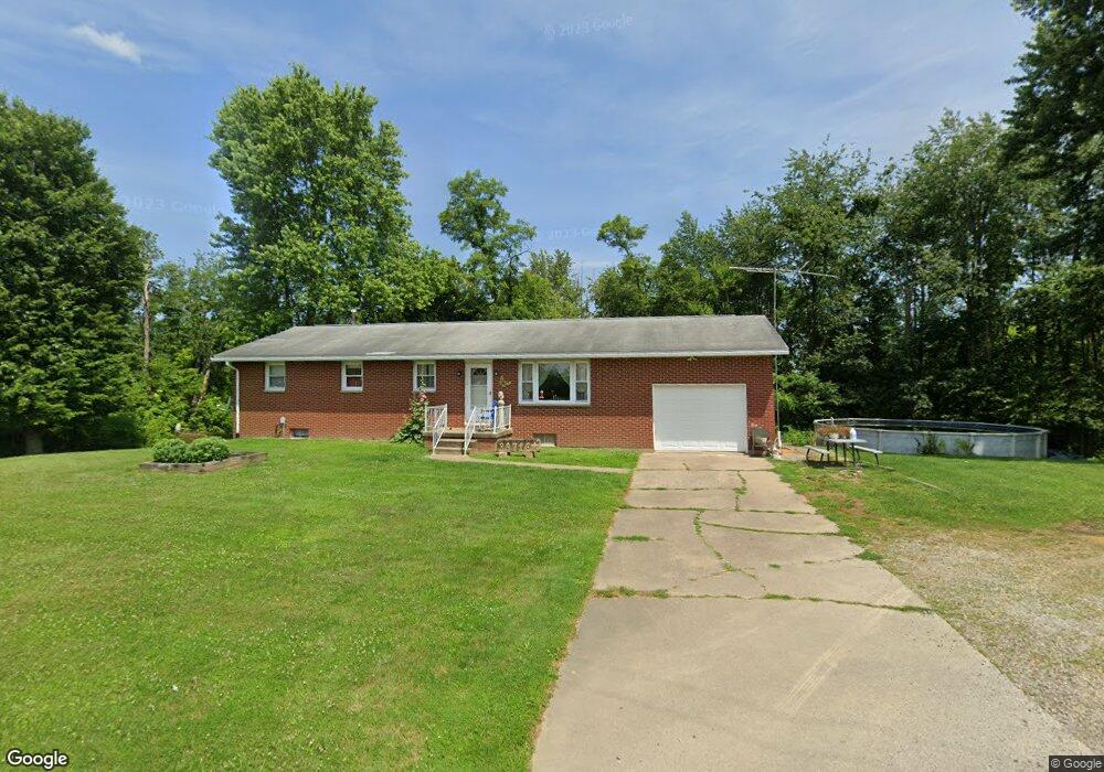
39716 State Route 255 Woodsfield, OH 43793
Estimated Value: $148,493 - $221,000
Studio
2
Baths
1,248
Sq Ft
$151/Sq Ft
Est. Value
About This Home
This home is located at 39716 State Route 255, Woodsfield, OH 43793 and is currently estimated at $188,123, approximately $150 per square foot. 39716 State Route 255 is a home located in Monroe County with nearby schools including Woodsfield Elementary School, Monroe Central High School, and Covenant Christian Academy.
Ownership History
Date
Name
Owned For
Owner Type
Purchase Details
Closed on
Apr 9, 2024
Sold by
Charge Chapel Hill and Charge Greenbrier
Bought by
Moffett Community Church
Current Estimated Value
Purchase Details
Closed on
May 19, 1999
Bought by
Trustees Of The Chapel Hill Charge In Tr
Create a Home Valuation Report for This Property
The Home Valuation Report is an in-depth analysis detailing your home's value as well as a comparison with similar homes in the area
Purchase History
| Date | Buyer | Sale Price | Title Company |
|---|---|---|---|
| Moffett Community Church | -- | None Listed On Document | |
| Trustees Of The Chapel Hill Charge In Tr | -- | -- |
Source: Public Records
Tax History
| Year | Tax Paid | Tax Assessment Tax Assessment Total Assessment is a certain percentage of the fair market value that is determined by local assessors to be the total taxable value of land and additions on the property. | Land | Improvement |
|---|---|---|---|---|
| 2025 | $1,451 | $46,450 | $5,100 | $41,350 |
| 2024 | $1,175 | $36,650 | $4,020 | $32,630 |
| 2023 | $1,175 | $36,650 | $4,020 | $32,630 |
| 2022 | $1,175 | $36,650 | $4,020 | $32,630 |
| 2021 | $1,155 | $35,510 | $3,150 | $32,360 |
| 2020 | $1,156 | $35,510 | $3,150 | $32,360 |
| 2019 | $1,133 | $35,510 | $3,150 | $32,360 |
| 2018 | $1,108 | $33,470 | $2,630 | $30,840 |
| 2017 | $1,116 | $33,470 | $2,630 | $30,840 |
| 2016 | $1,132 | $33,470 | $2,630 | $30,840 |
| 2015 | $970 | $27,400 | $2,160 | $25,240 |
| 2014 | $970 | $27,400 | $2,160 | $25,240 |
| 2013 | $1,023 | $26,810 | $2,100 | $24,710 |
Source: Public Records
Map
Nearby Homes
- 0 Tract 4 Twp Rd 815
- 0 Tract 4 Twp Rd 815
- 41540 Bernard Cline Rd
- 306 Monroe St
- 508 E Marietta St
- 333 S Main St
- 44952 Moose Ridge Rd
- 108 S Paul St
- 207 S Sycamore St
- 175 Andover Rd
- 123 Andover Rd
- 0 Township Rd 460 Unit 23727141
- 119 & 121 N Paul St
- 121 Tr 1 N Paul St
- 110 Andover Rd
- Township Road 460
- 0 Mann Unit Tract 5
- 108 Oaklawn Ave
- 108 Oaklawn Ave Unit B
- 220 Oaklawn Ave
- 39713 State Route 255
- 39709 State Route 255
- 43154 Plainview Rd
- 39584 State Route 255
- 39526 State Route 255
- 43079 Plainview Rd
- 40010 State Route 255
- 39500 State Route 255
- 43273 State Route 800
- 43045 Plainview Rd
- 39504 State Route 255
- 43038 Plainview Rd
- 43038 Plainview Rd
- 43330 State Route 800
- 42905 State Route 800
- 43500 Hunter Hollow Rd
- 40275 State Route 255
- 42873 State Route 800
- 43467 Hunter Hollow Rd
- 42700 Plainview Rd
Your Personal Tour Guide
Ask me questions while you tour the home.