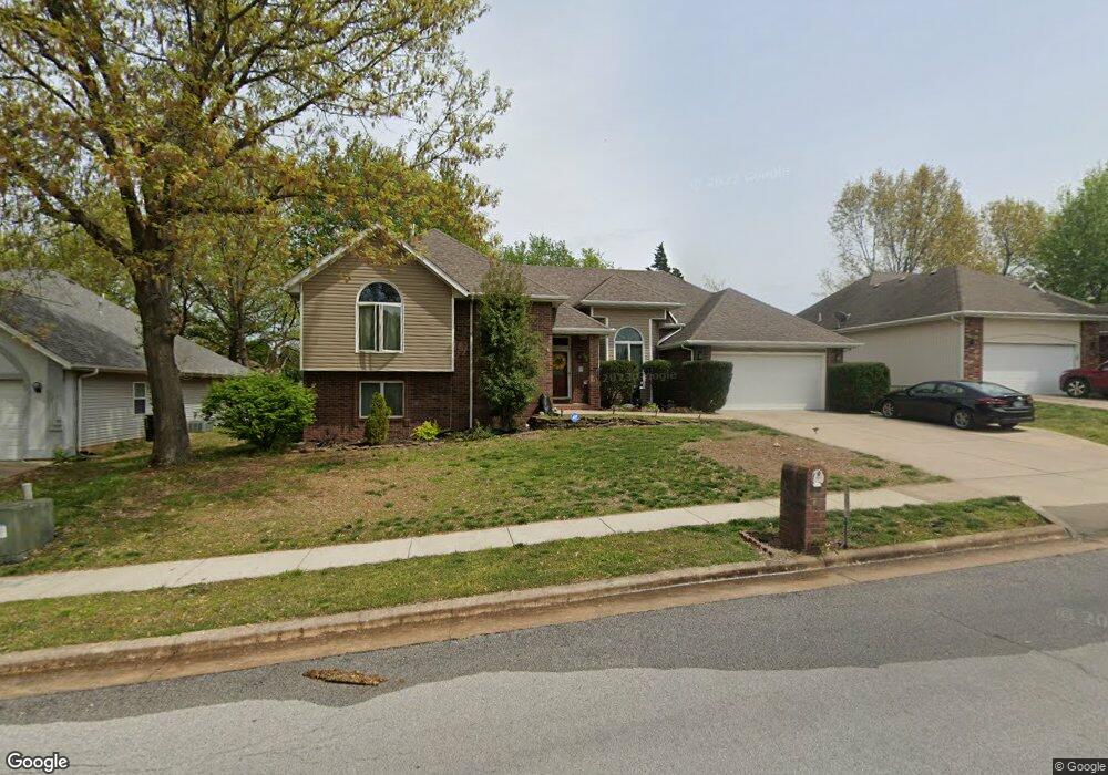
3972 N Broadway Ave Springfield, MO 65803
Estimated Value: $325,000 - $345,173
4
Beds
4
Baths
2,720
Sq Ft
$124/Sq Ft
Est. Value
About This Home
This home is located at 3972 N Broadway Ave, Springfield, MO 65803 and is currently estimated at $336,293, approximately $123 per square foot. 3972 N Broadway Ave is a home located in Greene County with nearby schools including Truman Elementary School, Pleasant View K-8 School, and Hillcrest High School.
Ownership History
Date
Name
Owned For
Owner Type
Purchase Details
Closed on
Dec 4, 2023
Sold by
Thompson Terrie J
Bought by
Terrie J Thompson Trust and Thompson
Current Estimated Value
Purchase Details
Closed on
Jun 30, 2011
Sold by
German Richard A and German Jill D
Bought by
Thompson Dennie Eugene and Thompson Terrie Jean
Home Financials for this Owner
Home Financials are based on the most recent Mortgage that was taken out on this home.
Original Mortgage
$139,900
Interest Rate
4.66%
Mortgage Type
New Conventional
Create a Home Valuation Report for This Property
The Home Valuation Report is an in-depth analysis detailing your home's value as well as a comparison with similar homes in the area
Purchase History
| Date | Buyer | Sale Price | Title Company |
|---|---|---|---|
| Terrie J Thompson Trust | -- | None Listed On Document | |
| Thompson Dennie Eugene | -- | None Available |
Source: Public Records
Mortgage History
| Date | Status | Borrower | Loan Amount |
|---|---|---|---|
| Previous Owner | Thompson Dennie Eugene | $139,900 |
Source: Public Records
Tax History
| Year | Tax Paid | Tax Assessment Tax Assessment Total Assessment is a certain percentage of the fair market value that is determined by local assessors to be the total taxable value of land and additions on the property. | Land | Improvement |
|---|---|---|---|---|
| 2025 | $2,298 | $42,500 | $6,650 | $35,850 |
| 2024 | $2,097 | $36,230 | $2,850 | $33,380 |
| 2023 | $2,087 | $36,230 | $2,850 | $33,380 |
| 2022 | $1,956 | $33,290 | $2,850 | $30,440 |
| 2021 | $1,871 | $33,290 | $2,850 | $30,440 |
| 2020 | $1,923 | $32,470 | $2,850 | $29,620 |
| 2019 | $1,869 | $32,470 | $2,850 | $29,620 |
| 2018 | $1,842 | $31,840 | $4,370 | $27,470 |
| 2017 | $1,825 | $30,040 | $4,370 | $25,670 |
| 2016 | $1,719 | $30,040 | $4,370 | $25,670 |
| 2015 | $1,706 | $30,040 | $4,370 | $25,670 |
| 2014 | $1,716 | $30,040 | $4,370 | $25,670 |
Source: Public Records
Map
Nearby Homes
- 3877 N Daniels Ct
- 3879 N Williams Ct
- 1158 W Bradley St
- 3714 N Mount Zion Ct
- 3740 N Oak Point Ave
- 1122 W Vancouver St
- 3645 N Oak Point Ave
- 3582 N Thistlewood Ct
- 3630 N Thistlewood Ct
- 671 W Bridgewood Ct
- 1420 W Farm Road 102
- 3486 N Farm Road 143
- 3764 N Huntington Ave
- 1835 W Farm Road 102
- 229 W Mazzy Dr
- 4377 N Toby Ave
- 4449 N Toby Ave
- 4353 N Toby Ave
- 1632 N Grant Ave
- 347 Dry River Ct
- 3960 N Broadway Ave
- 3984 N Broadway Ave
- 3996 N Broadway Ave
- 1034 W Woodbine St
- 1035 W Red Oak St
- 990 W Farm Road 96
- 3936 N Broadway Ave
- 1046 W Woodbine St
- 1067 W Red Oak St
- 3924 N Broadway Ave
- 1045 W Woodbine St
- 1058 W Woodbine St
- 3931 N Broadway Ave
- 1079 W Red Oak St
- 1069 W Woodbine St
- 3919 N Broadway Ave
- 1070 W Woodbine St
- 3912 N Franklin Ave
- 1091 W Red Oak St
- 3900 N Broadway Ave
Your Personal Tour Guide
Ask me questions while you tour the home.