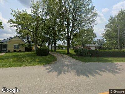
3973 State Route 47 Ansonia, OH 45303
Estimated Value: $333,000 - $499,226
4
Beds
2
Baths
2,393
Sq Ft
$173/Sq Ft
Est. Value
About This Home
This home is located at 3973 State Route 47, Ansonia, OH 45303 and is currently estimated at $414,742, approximately $173 per square foot. 3973 State Route 47 is a home located in Darke County with nearby schools including Ansonia Elementary School, Ansonia Middle School, and Ansonia High School.
Ownership History
Date
Name
Owned For
Owner Type
Purchase Details
Closed on
Sep 26, 2019
Sold by
Dapore Brian and Dapore Kelly
Bought by
Dapore Brian P and Dapore Kelly M
Current Estimated Value
Purchase Details
Closed on
Mar 21, 2003
Sold by
Stoltz Caron and Lumpkin Ted
Bought by
Dapore Brian P and Dapore Kelly M
Purchase Details
Closed on
Oct 21, 1991
Bought by
Dapore Brian P and Dapore Kelly M
Create a Home Valuation Report for This Property
The Home Valuation Report is an in-depth analysis detailing your home's value as well as a comparison with similar homes in the area
Home Values in the Area
Average Home Value in this Area
Purchase History
| Date | Buyer | Sale Price | Title Company |
|---|---|---|---|
| Dapore Brian P | -- | None Available | |
| Dapore Brian P | $185,000 | -- | |
| Dapore Brian P | -- | -- |
Source: Public Records
Tax History Compared to Growth
Tax History
| Year | Tax Paid | Tax Assessment Tax Assessment Total Assessment is a certain percentage of the fair market value that is determined by local assessors to be the total taxable value of land and additions on the property. | Land | Improvement |
|---|---|---|---|---|
| 2024 | $4,906 | $159,550 | $27,520 | $132,030 |
| 2023 | $4,912 | $159,550 | $27,520 | $132,030 |
| 2022 | $4,161 | $116,960 | $23,980 | $92,980 |
| 2021 | $4,133 | $116,960 | $23,980 | $92,980 |
| 2020 | $4,146 | $116,960 | $23,980 | $92,980 |
| 2019 | $3,477 | $102,780 | $23,980 | $78,800 |
| 2018 | $3,006 | $88,820 | $23,980 | $64,840 |
| 2017 | $2,636 | $88,820 | $23,980 | $64,840 |
| 2016 | $2,640 | $84,270 | $18,480 | $65,790 |
| 2015 | $2,640 | $84,270 | $18,480 | $65,790 |
| 2014 | $2,638 | $84,270 | $18,480 | $65,790 |
| 2013 | $2,243 | $66,980 | $17,920 | $49,060 |
Source: Public Records
Map
Nearby Homes
- 8892 N State Route 49
- 5332 Tamarack Trail
- 5400 Tamarack Trail
- 7833 Greenville Celina Rd
- 7584 Ravenwood Dr
- 2493 Ohio 571
- 3010 Hamilton Rd
- 7318 McMecham Rd
- 3163 State Route 571
- 790 Berkshire Dr
- 900 Manchester Dr
- 1688 State Route 571
- 7302 State Route 121
- 7302 Ohio 121
- 1393 Highland Dr
- 1380 Hillside Dr
- 108 Westbury Dr
- 1108 State Route 571
- 101 Westbury Dr
- 112 Aspen Dr
