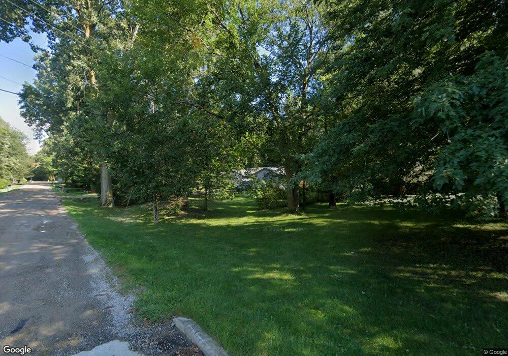
39765 Koppernick Rd Canton, MI 48187
Estimated Value: $416,289 - $501,000
4
Beds
3
Baths
2,677
Sq Ft
$175/Sq Ft
Est. Value
About This Home
This home is located at 39765 Koppernick Rd, Canton, MI 48187 and is currently estimated at $468,822, approximately $175 per square foot. 39765 Koppernick Rd is a home located in Wayne County with nearby schools including Canton High School, Discovery Middle School, and Salem High School.
Ownership History
Date
Name
Owned For
Owner Type
Purchase Details
Closed on
Feb 20, 2019
Sold by
Idmeglio Douglas and Idmeglio Elizabeth A
Bought by
Gray James and Gray Michelle
Current Estimated Value
Home Financials for this Owner
Home Financials are based on the most recent Mortgage that was taken out on this home.
Original Mortgage
$284,905
Outstanding Balance
$249,462
Interest Rate
4.4%
Mortgage Type
Purchase Money Mortgage
Estimated Equity
$219,360
Create a Home Valuation Report for This Property
The Home Valuation Report is an in-depth analysis detailing your home's value as well as a comparison with similar homes in the area
Home Values in the Area
Average Home Value in this Area
Purchase History
| Date | Buyer | Sale Price | Title Company |
|---|---|---|---|
| Gray James | $299,900 | Michigan Title Ins Agcy Inc |
Source: Public Records
Mortgage History
| Date | Status | Borrower | Loan Amount |
|---|---|---|---|
| Open | Gray James | $284,905 |
Source: Public Records
Tax History
| Year | Tax Paid | Tax Assessment Tax Assessment Total Assessment is a certain percentage of the fair market value that is determined by local assessors to be the total taxable value of land and additions on the property. | Land | Improvement |
|---|---|---|---|---|
| 2025 | $2,809 | $174,100 | $0 | $0 |
| 2024 | $2,729 | $169,900 | $0 | $0 |
| 2023 | $2,603 | $161,200 | $0 | $0 |
| 2022 | $5,664 | $144,700 | $0 | $0 |
| 2021 | $5,493 | $146,600 | $0 | $0 |
| 2020 | $5,430 | $131,100 | $0 | $0 |
| 2019 | $4,040 | $122,230 | $0 | $0 |
| 2018 | $1,661 | $110,590 | $0 | $0 |
| 2017 | $4,127 | $111,100 | $0 | $0 |
| 2016 | $3,675 | $108,300 | $0 | $0 |
| 2015 | $9,126 | $97,190 | $0 | $0 |
| 2013 | $8,841 | $95,700 | $0 | $0 |
| 2010 | -- | $95,830 | $77,040 | $18,790 |
Source: Public Records
Map
Nearby Homes
- 219 W Fern
- 00 Commerce Blvd
- 000 Commerce Blvd
- 39500 Warren Rd Unit 242
- 39500 Warren Rd Unit 144
- 39500 Warren Rd Unit 154
- 39500 Warren Rd Unit 115
- 39500 Warren Rd Unit 174
- 39500 Warren Rd Unit 208
- 38508 Alma Ln
- 39618 Bart St
- 40344 Newport Dr Unit 45
- 41430 Warren Rd
- 41415 Copper Creek Dr Unit 17
- 8821 Knolson Ave
- 40504 Newport Dr
- 40584 Newport Ct
- 37674 Colonial Dr S
- 42209 Saratoga Cir Unit 16
- 0 Ford Rd Unit 20240020273
- 39725 Koppernick Rd
- 39905 Koppernick Rd
- 39770 Koppernick Rd
- 39919 Koppernick Rd
- 39687 Koppernick Rd
- 7612 Holly Dr
- 39740 Koppernick Rd
- 7626 Holly Dr
- 39720 Koppernick Rd
- 7640 Holly Dr
- 39920 Koppernick Rd
- 39665 Koppernick Rd
- 39733 John Dr
- 39715 John Dr
- 39949 Koppernick Rd
- 39683 John Dr
- 39700 Koppernick Rd
- 7656 Holly Dr
- 39671 John Dr
- 39934 Koppernick Rd
