Estimated Value: $503,000 - $708,545
3
Beds
3
Baths
2,136
Sq Ft
$285/Sq Ft
Est. Value
About This Home
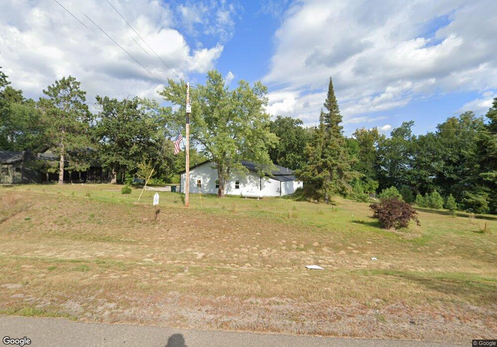
This home is located at 39844 State Highway 6, Emily, MN 56447 and is currently estimated at $608,136, approximately $284 per square foot. 39844 State Highway 6 is a home with nearby schools including Cuyuna Range Elementary School, Crosby-Ironton Secondary School, and Cornerstone Christian School.
Ownership History
Date
Name
Owned For
Owner Type
Purchase Details
Closed on
Jul 28, 2016
Sold by
Martin Franklin Franklin
Bought by
Mileski Blair and Mileski April
Current Estimated Value
Home Financials for this Owner
Home Financials are based on the most recent Mortgage that was taken out on this home.
Original Mortgage
$136,600
Outstanding Balance
$109,201
Interest Rate
3.54%
Estimated Equity
$498,935
Create a Home Valuation Report for This Property
The Home Valuation Report is an in-depth analysis detailing your home's value as well as a comparison with similar homes in the area
Home Values in the Area
Average Home Value in this Area
Purchase History
| Date | Buyer | Sale Price | Title Company |
|---|---|---|---|
| Mileski Blair | $136,600 | -- |
Source: Public Records
Mortgage History
| Date | Status | Borrower | Loan Amount |
|---|---|---|---|
| Open | Mileski Blair | $136,600 |
Source: Public Records
Tax History Compared to Growth
Tax History
| Year | Tax Paid | Tax Assessment Tax Assessment Total Assessment is a certain percentage of the fair market value that is determined by local assessors to be the total taxable value of land and additions on the property. | Land | Improvement |
|---|---|---|---|---|
| 2025 | $4,260 | $689,000 | $260,800 | $428,200 |
| 2024 | $4,260 | $666,700 | $263,800 | $402,900 |
| 2023 | $2,796 | $536,200 | $261,400 | $274,800 |
| 2022 | $2,232 | $428,400 | $147,500 | $280,900 |
| 2021 | $2,772 | $281,200 | $163,400 | $117,800 |
| 2020 | $3,612 | $330,600 | $222,700 | $107,900 |
| 2019 | $3,044 | $373,500 | $267,500 | $106,000 |
| 2018 | $3,212 | $300,800 | $207,700 | $93,100 |
| 2017 | $2,964 | $319,600 | $227,700 | $91,900 |
| 2016 | $2,924 | $324,400 | $232,500 | $91,900 |
| 2015 | $2,826 | $297,900 | $196,000 | $101,900 |
| 2014 | $1,363 | $299,200 | $196,100 | $103,100 |
Source: Public Records
Map
Nearby Homes
- Tract B County Road 1
- Tract A County Road 1
- TBD Deshayes Dr
- 40456 Little Pine River Rd
- 22311 Shadow Point
- TBD Mulligan Dr
- 39812 Par Dr W
- 39918 Par Dr W
- TBD Lot 1 & Lot 2 Pa Par Dr W
- 22416 S Shore Dr
- 41481 State Highway 6
- 22910 S Shore Dr
- Lot 7 Block 1 Yellow Birch Ln
- 18505 County Road 1
- XXX State Highway 6
- 40699 Mary Lake Rd
- 38509 Pickerel Trail
- TBD State Highway 6
- TBD Darsnek Rd
- 19865 Blue Lake Rd
- 21193 3rd St
- 21099 Short Dr
- 39752 State Highway 6
- 39729 State Highway 6
- 39857 State Highway 6
- 21090 Short Dr
- 39870 Lake St
- 39889 Lake St
- 39877 State Highway 6
- 39910 State Highway 6
- 39910 Minnesota 6
- 39895 Minnesota 6
- 39895 State Highway 6
- 39911 Lake St
- 39892 Lake St
- 39884 White Pine St
- 39909 Minnesota 6
- 39919 Minnesota 6
- 21054 Short Dr
- 21119 2nd St