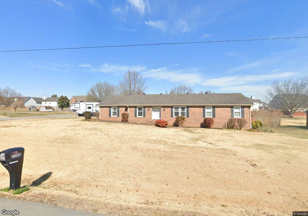
3986 Confederate Rd Murfreesboro, TN 37128
Estimated Value: $460,576 - $503,000
--
Bed
2
Baths
2,769
Sq Ft
$175/Sq Ft
Est. Value
About This Home
This home is located at 3986 Confederate Rd, Murfreesboro, TN 37128 and is currently estimated at $484,144, approximately $174 per square foot. 3986 Confederate Rd is a home located in Rutherford County with nearby schools including Rockvale Elementary School, Blackman Middle School, and Blackman High School.
Ownership History
Date
Name
Owned For
Owner Type
Purchase Details
Closed on
Apr 1, 1997
Sold by
Dockery Sylvia H
Bought by
Cary Charles R and Cary Aissa
Current Estimated Value
Home Financials for this Owner
Home Financials are based on the most recent Mortgage that was taken out on this home.
Original Mortgage
$93,600
Outstanding Balance
$11,890
Interest Rate
7.69%
Estimated Equity
$472,254
Purchase Details
Closed on
May 31, 1996
Sold by
Russell Perkins
Bought by
Dockery Sylvia H
Create a Home Valuation Report for This Property
The Home Valuation Report is an in-depth analysis detailing your home's value as well as a comparison with similar homes in the area
Home Values in the Area
Average Home Value in this Area
Purchase History
| Date | Buyer | Sale Price | Title Company |
|---|---|---|---|
| Cary Charles R | $117,000 | -- | |
| Dockery Sylvia H | $104,772 | -- |
Source: Public Records
Mortgage History
| Date | Status | Borrower | Loan Amount |
|---|---|---|---|
| Open | Dockery Sylvia H | $93,600 |
Source: Public Records
Tax History Compared to Growth
Tax History
| Year | Tax Paid | Tax Assessment Tax Assessment Total Assessment is a certain percentage of the fair market value that is determined by local assessors to be the total taxable value of land and additions on the property. | Land | Improvement |
|---|---|---|---|---|
| 2025 | $1,919 | $102,300 | $13,750 | $88,550 |
| 2024 | $1,919 | $102,300 | $13,750 | $88,550 |
| 2023 | $1,950 | $103,950 | $13,750 | $90,200 |
| 2022 | $1,680 | $103,950 | $13,750 | $90,200 |
| 2021 | $1,585 | $71,425 | $10,000 | $61,425 |
| 2020 | $1,585 | $71,425 | $10,000 | $61,425 |
| 2019 | $1,585 | $71,425 | $10,000 | $61,425 |
| 2018 | $1,267 | $60,350 | $0 | $0 |
| 2017 | $1,217 | $45,400 | $0 | $0 |
| 2016 | $1,217 | $45,400 | $0 | $0 |
| 2015 | $1,217 | $45,400 | $0 | $0 |
| 2014 | $1,129 | $45,400 | $0 | $0 |
| 2013 | -- | $37,075 | $0 | $0 |
Source: Public Records
Map
Nearby Homes
- 4519 Sardius Dr
- 0 Scottish Dr
- 4510 Ropha Ct
- 0 Old Rd S
- 0 Roxburghe Ct
- 4719 Beryl Dr
- 1 Old Rd S
- 4318 Roxburghe Ct
- 4801 Beryl Dr
- 4732 Kingdom Dr
- 783 N Farm Ct
- 3958 Country Park Ln
- 1789 Antebellum Dr
- 909 Sapphire Dr
- 1622 Charismatic Place
- 3903 Country Park Ln
- 1708 Charismatic Place
- 3716 Pimlico Ln
- 1720 Charismatic Place
- 3621 Pimlico Ln
- 3966 Confederate Rd
- 4527 Scottish Dr
- 4523 Scottish Dr
- 4008 Confederate Rd
- 4519 Scottish Dr
- 603 Rampart Ln
- 4605 Scottish Dr
- 4515 Scottish Dr
- 3946 Confederate Rd
- 3955 Confederate Rd
- 4609 Scottish Dr
- 4511 Scottish Dr
- 608 Rampart Ln
- 4038 Confederate Rd
- 4526 Scottish Dr
- 4522 Scottish Dr
- 4530 Scottish Dr
- 623 Rampart Ln
- 4518 Scottish Dr
- 4507 Scottish Dr