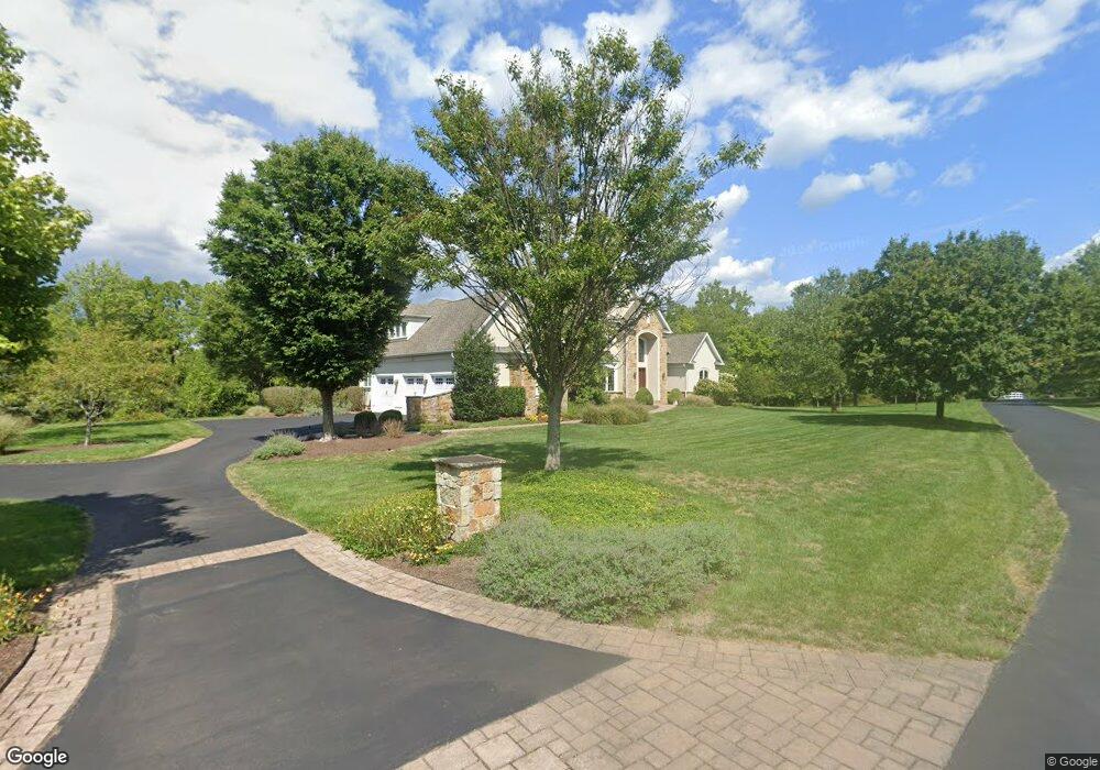
3986 Smith Rd Furlong, PA 18925
Estimated Value: $1,316,000 - $1,933,105
4
Beds
4
Baths
4,500
Sq Ft
$337/Sq Ft
Est. Value
About This Home
This home is located at 3986 Smith Rd, Furlong, PA 18925 and is currently estimated at $1,517,276, approximately $337 per square foot. 3986 Smith Rd is a home located in Bucks County with nearby schools including Bridge Valley Elementary School, Holicong Middle School, and Central Bucks High School - East.
Ownership History
Date
Name
Owned For
Owner Type
Purchase Details
Closed on
May 28, 2009
Sold by
Wilco Properties Llc
Bought by
Mccabe Bonnie Jean and Mccabe Barry L
Current Estimated Value
Home Financials for this Owner
Home Financials are based on the most recent Mortgage that was taken out on this home.
Original Mortgage
$893,000
Outstanding Balance
$568,457
Interest Rate
4.91%
Mortgage Type
Construction
Estimated Equity
$948,819
Create a Home Valuation Report for This Property
The Home Valuation Report is an in-depth analysis detailing your home's value as well as a comparison with similar homes in the area
Home Values in the Area
Average Home Value in this Area
Purchase History
| Date | Buyer | Sale Price | Title Company |
|---|---|---|---|
| Mccabe Bonnie Jean | $400,000 | None Available |
Source: Public Records
Mortgage History
| Date | Status | Borrower | Loan Amount |
|---|---|---|---|
| Open | Mccabe Bonnie Jean | $893,000 |
Source: Public Records
Tax History Compared to Growth
Tax History
| Year | Tax Paid | Tax Assessment Tax Assessment Total Assessment is a certain percentage of the fair market value that is determined by local assessors to be the total taxable value of land and additions on the property. | Land | Improvement |
|---|---|---|---|---|
| 2025 | $16,515 | $101,440 | $23,160 | $78,280 |
| 2024 | $16,515 | $101,440 | $23,160 | $78,280 |
| 2023 | $15,956 | $101,440 | $23,160 | $78,280 |
| 2022 | $15,765 | $101,440 | $23,160 | $78,280 |
| 2021 | $15,576 | $101,440 | $23,160 | $78,280 |
| 2020 | $15,576 | $101,440 | $23,160 | $78,280 |
| 2019 | $15,475 | $101,440 | $23,160 | $78,280 |
| 2018 | $15,475 | $101,440 | $23,160 | $78,280 |
| 2017 | $15,348 | $101,440 | $23,160 | $78,280 |
| 2016 | $15,500 | $101,440 | $23,160 | $78,280 |
| 2015 | -- | $101,440 | $23,160 | $78,280 |
| 2014 | -- | $101,440 | $23,160 | $78,280 |
Source: Public Records
Map
Nearby Homes
- 1221 Creek Rd
- 941 Penns Park
- 158 Grouse Cir
- 214 Dove Ct
- 191 Cardinal Ct S
- 183 Spring Meadow Cir
- 147 Raven Ct
- 148 Raven Ct
- 925 Park Ave
- 377 Spring Meadow Cir
- 4697 Smith Rd
- 495 Goldenrod Crossing W
- 529 Honeysuckle Ct
- 92 Acorn Ct E
- 561 Spring Meadow Cir
- 1341 Durham Rd
- 4549 Lower Mountain Rd
- 4448 Lower Mountain Rd
- 4981 New Rd
- 0 Old York Rd Unit PABU2103356
- 3982 Smith Rd
- 914 Forest Grove Rd
- 3984 Smith Rd
- 3936 Smith Rd
- 3947 Smith Rd
- 3914 Smith Rd
- 853 Green Meadow Dr
- 00 Smith Rd
- 859 Green Meadow Dr
- 3910 Smith Rd
- 837 Green Meadow Dr
- 867 Green Meadow Dr
- 831 Green Meadow Dr
- 877 Green Meadow Dr
- 3868 Smith Rd
- 842 Green Meadow Dr
- 842 Smith Rd
- 862 Green Meadow Dr
- 0 Green Meadow Dr
- 4036 Smith Rd