Estimated Value: $108,000 - $172,000
--
Bed
2
Baths
840
Sq Ft
$180/Sq Ft
Est. Value
About This Home
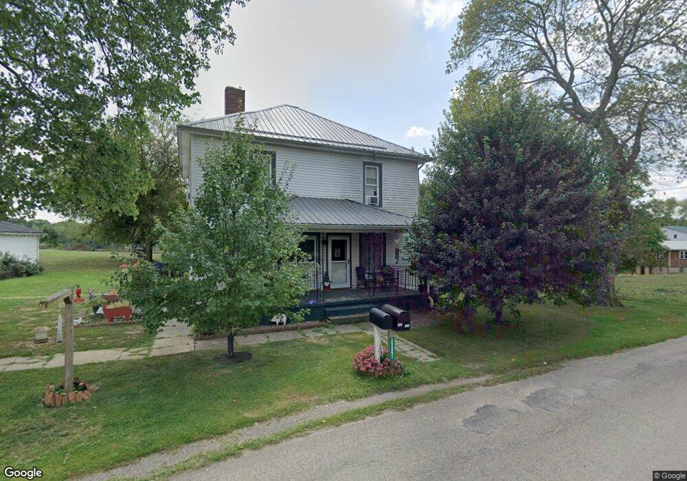
This home is located at 39861 Hanover Ridge Rd Unit 17, Scio, OH 43988 and is currently estimated at $151,068, approximately $179 per square foot. 39861 Hanover Ridge Rd Unit 17 is a home located in Harrison County with nearby schools including Harrison Central Elementary School and Harrison Central Junior/Senior High School.
Ownership History
Date
Name
Owned For
Owner Type
Purchase Details
Closed on
Aug 16, 2013
Sold by
Hendricks Kenneth L
Bought by
Myer Gary A and Myer Sarah L
Current Estimated Value
Purchase Details
Closed on
Feb 28, 2013
Sold by
Hendricks Kenneth L
Bought by
Hendricks Kenneth L and Rogers Carol S
Purchase Details
Closed on
Dec 18, 2007
Sold by
Hendricks Kenneth V
Bought by
Hendricks Kennneth L
Purchase Details
Closed on
Jul 23, 1998
Create a Home Valuation Report for This Property
The Home Valuation Report is an in-depth analysis detailing your home's value as well as a comparison with similar homes in the area
Home Values in the Area
Average Home Value in this Area
Purchase History
| Date | Buyer | Sale Price | Title Company |
|---|---|---|---|
| Myer Gary A | $80,000 | None Available | |
| Hendricks Kenneth L | -- | None Available | |
| Hendricks Kennneth L | -- | None Available | |
| -- | -- | -- |
Source: Public Records
Tax History Compared to Growth
Tax History
| Year | Tax Paid | Tax Assessment Tax Assessment Total Assessment is a certain percentage of the fair market value that is determined by local assessors to be the total taxable value of land and additions on the property. | Land | Improvement |
|---|---|---|---|---|
| 2024 | $1,538 | $40,030 | $15,430 | $24,600 |
| 2023 | $1,538 | $40,030 | $15,430 | $24,600 |
| 2022 | $1,241 | $31,650 | $14,270 | $17,380 |
| 2021 | $1,227 | $31,650 | $14,270 | $17,380 |
| 2020 | $1,221 | $31,650 | $14,270 | $17,380 |
| 2019 | $1,194 | $28,300 | $12,740 | $15,560 |
| 2018 | $1,193 | $28,300 | $12,740 | $15,560 |
| 2017 | $1,207 | $28,300 | $12,740 | $15,560 |
| 2016 | $1,048 | $23,110 | $9,070 | $14,040 |
| 2015 | $1,042 | $23,110 | $9,070 | $14,040 |
| 2014 | $483 | $22,060 | $8,410 | $13,650 |
| 2013 | $483 | $22,060 | $8,410 | $13,650 |
Source: Public Records
Map
Nearby Homes
- 87038 Keyser Rd
- 0 Country Rd
- 38500 Bower Rd
- 155 E College St
- 37420 Ohio 151
- 109 W College St
- 42535 Jewett Scio Rd
- 47 Cr Laverty 47 Dr
- 85200 Merryman Rd
- 90480 Kilgore Ridge Rd
- 0 Jewett Scio Rd
- 103 Lake St
- 315 Euclid Ave
- 91240 Kilgore Ridge Rd Unit 47
- 91800 Irish Creek Rd
- 90850 Jewett Germano Rd
- 89501 Arbaugh Rd
- 0 Brewer Rd
- 87085 Crall Rd
- 91510 Amos Rd
- 39878 Hanover Ridge Rd
- 39902 Hanover Ridge Rd Unit 17
- 40001 Hanover Ridge Rd
- 39817 Hanover Ridge Rd
- 87800 Havonick Rd
- 39822 Hanover Ridge Rd Unit 17
- 40084 Hanover Ridge Rd
- 40101 Hanover Ridge Rd
- 39786 Hanover Ridge Rd Unit 17
- 39776 Hanover Ridge Rd
- 39713 Hanover Ridge Rd
- 40125 Hanover Ridge Rd
- 39640 Hanover Ridge Rd Unit 17
- 39655 Hanover Ridge Rd
- 40200 Hanover Ridge Rd
- 87500 Maple Rd
- 87664 Dodson Rd Unit 17
- 39625 Gundy Ridge Rd
- 87550 Maple Rd
- 88230 Maple Rd