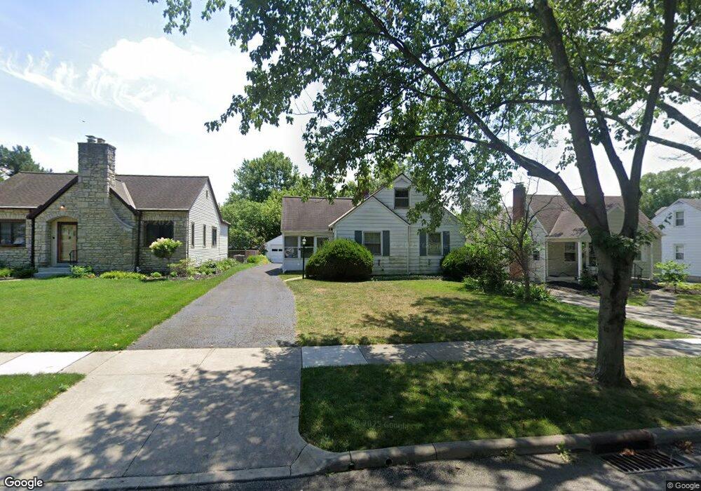
399 Richards Rd Columbus, OH 43214
Clintonville NeighborhoodEstimated Value: $365,000 - $424,000
3
Beds
2
Baths
1,300
Sq Ft
$309/Sq Ft
Est. Value
About This Home
This home is located at 399 Richards Rd, Columbus, OH 43214 and is currently estimated at $401,722, approximately $309 per square foot. 399 Richards Rd is a home located in Franklin County with nearby schools including Indian Springs Elementary School, Dominion Middle School, and Whetstone High School.
Ownership History
Date
Name
Owned For
Owner Type
Purchase Details
Closed on
Feb 17, 2025
Sold by
Mary Jane Fuller Trust and Fuller-Smith Linda S
Bought by
Linda S Fuller-Smith Trust
Current Estimated Value
Purchase Details
Closed on
Jul 21, 2017
Sold by
Fuller 1Zmary Jane
Bought by
Fuller Mary Jane and Mary Jane Fuller Trusts
Purchase Details
Closed on
Aug 12, 1996
Sold by
Hartsoe Geraldine W
Bought by
Mary Jane Fuller
Purchase Details
Closed on
May 2, 1994
Purchase Details
Closed on
Mar 24, 1988
Create a Home Valuation Report for This Property
The Home Valuation Report is an in-depth analysis detailing your home's value as well as a comparison with similar homes in the area
Home Values in the Area
Average Home Value in this Area
Purchase History
| Date | Buyer | Sale Price | Title Company |
|---|---|---|---|
| Linda S Fuller-Smith Trust | -- | None Listed On Document | |
| Fuller Mary Jane | -- | None Available | |
| Mary Jane Fuller | $129,900 | -- | |
| -- | $117,000 | -- | |
| -- | $79,500 | -- |
Source: Public Records
Tax History
| Year | Tax Paid | Tax Assessment Tax Assessment Total Assessment is a certain percentage of the fair market value that is determined by local assessors to be the total taxable value of land and additions on the property. | Land | Improvement |
|---|---|---|---|---|
| 2025 | $4,741 | $115,430 | $52,990 | $62,440 |
| 2024 | $4,741 | $115,430 | $52,990 | $62,440 |
| 2023 | $4,708 | $115,430 | $52,990 | $62,440 |
| 2022 | $5,268 | $110,320 | $34,580 | $75,740 |
| 2021 | $5,277 | $110,320 | $34,580 | $75,740 |
| 2020 | $5,284 | $110,320 | $34,580 | $75,740 |
| 2019 | $4,535 | $83,510 | $26,600 | $56,910 |
| 2018 | $4,151 | $83,510 | $26,600 | $56,910 |
| 2017 | $4,346 | $83,510 | $26,600 | $56,910 |
| 2016 | $4,159 | $71,540 | $27,440 | $44,100 |
| 2015 | $3,776 | $71,540 | $27,440 | $44,100 |
| 2014 | $3,785 | $71,540 | $27,440 | $44,100 |
| 2013 | $1,816 | $68,145 | $26,145 | $42,000 |
Source: Public Records
Map
Nearby Homes
- 374 Acton Rd
- 440 Chatham Rd
- 531 Richards Rd
- 467 Brevoort Rd
- 544 Piedmont Rd
- 188 Chatham Rd
- 107 E Dunedin Rd
- 37 Glencoe Rd
- 30 E Torrence Rd
- 82 Blenheim Rd
- 83 Clinton Heights Ave
- 390 Lenappe Dr
- 3546 Beulah Rd
- 126 Erie Rd
- 589 Clinton Heights Ave
- 296 Walhalla Rd
- 76 E Lakeview Ave
- 84-86 W Como Ave
- 196 W North Broadway St
- 796 E Kenworth Rd
- 405 Richards Rd
- 393 Richards Rd
- 387 Richards Rd
- 392 Fallis Rd
- 381 Richards Rd
- 406 Fallis Rd
- 404 Richards Rd
- 396 Richards Rd
- 410 Richards Rd
- 372 Fallis Rd
- 410 Fallis Rd
- 427 Richards Rd
- 375 Richards Rd
- 390 Richards Rd
- 416 Richards Rd
- 384 Richards Rd
- 422 Richards Rd
- 418 Fallis Rd
- 366 Fallis Rd
- 433 Richards Rd
Your Personal Tour Guide
Ask me questions while you tour the home.