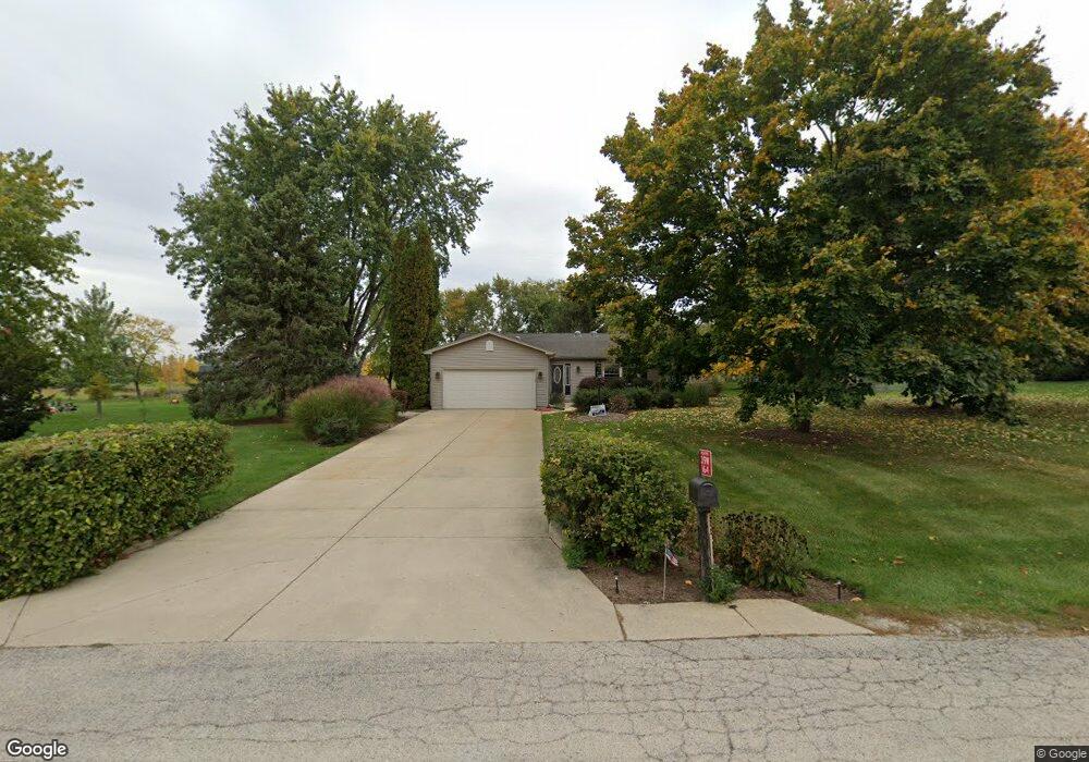
39W164 Cliff Dr Elgin, IL 60124
Far West Elgin NeighborhoodEstimated Value: $357,000 - $405,779
3
Beds
2
Baths
1,710
Sq Ft
$225/Sq Ft
Est. Value
About This Home
This home is located at 39W164 Cliff Dr, Elgin, IL 60124 and is currently estimated at $384,695, approximately $224 per square foot. 39W164 Cliff Dr is a home located in Kane County with nearby schools including Howard B. Thomas Grade School, Prairie Knolls Middle School, and Central Middle School.
Ownership History
Date
Name
Owned For
Owner Type
Purchase Details
Closed on
Sep 19, 2022
Sold by
Smith Jerry A and Smith Paula M
Bought by
Smith Living Trust
Current Estimated Value
Purchase Details
Closed on
Jun 15, 2000
Sold by
Lackowski Randall and Lackowski Joanne
Bought by
Smith Jerry A and Smith Paula M
Home Financials for this Owner
Home Financials are based on the most recent Mortgage that was taken out on this home.
Original Mortgage
$155,000
Interest Rate
8.31%
Create a Home Valuation Report for This Property
The Home Valuation Report is an in-depth analysis detailing your home's value as well as a comparison with similar homes in the area
Home Values in the Area
Average Home Value in this Area
Purchase History
| Date | Buyer | Sale Price | Title Company |
|---|---|---|---|
| Smith Living Trust | -- | -- | |
| Smith Jerry A | $205,000 | -- |
Source: Public Records
Mortgage History
| Date | Status | Borrower | Loan Amount |
|---|---|---|---|
| Previous Owner | Smith Jerry A | $155,000 |
Source: Public Records
Tax History
| Year | Tax Paid | Tax Assessment Tax Assessment Total Assessment is a certain percentage of the fair market value that is determined by local assessors to be the total taxable value of land and additions on the property. | Land | Improvement |
|---|---|---|---|---|
| 2024 | $6,008 | $94,185 | $27,638 | $66,547 |
| 2023 | $5,686 | $85,196 | $25,000 | $60,196 |
| 2022 | $6,213 | $79,264 | $23,138 | $56,126 |
| 2021 | $5,929 | $73,994 | $22,353 | $51,641 |
| 2020 | $5,903 | $72,664 | $21,951 | $50,713 |
| 2019 | $5,897 | $71,724 | $21,667 | $50,057 |
| 2018 | $6,003 | $73,264 | $20,664 | $52,600 |
| 2017 | $5,842 | $70,717 | $20,140 | $50,577 |
| 2016 | $5,551 | $62,541 | $19,662 | $42,879 |
| 2015 | -- | $60,724 | $19,662 | $41,062 |
| 2014 | -- | $65,142 | $19,662 | $45,480 |
| 2013 | -- | $67,441 | $19,998 | $47,443 |
Source: Public Records
Map
Nearby Homes
- 310 Astor Ct
- 282 Snowdrop Ln
- 270 Snowdrop Ln
- 272 Snowdrop Ln
- 280 Snowdrop Ln
- 274 Snowdrop Ln
- 315 Snowdrop Ln
- 264 Snowdrop Ln
- 313 Snowdrop Ln
- 268 Snowdrop Ln
- 289 Snow Drop Ln
- 283 Snowdrop Ln
- 289 Snowdrop Ln
- 285 Snowdrop Ln
- COVENTRY Plan at West Point Gardens
- EMERSON Plan at West Point Gardens
- HENLEY Plan at West Point Gardens
- FAIRFIELD Plan at West Point Gardens
- 283 Snow Drop Ln
- 282 Snow Drop Ln
- 39W190 Cliff Dr
- 39W142 Cliff Dr
- 3809 Marigold Dr
- 3811 Marigold Dr
- 3807 Marigold Dr
- 39W171 Cliff Dr
- 3813 Marigold Dr
- 3805 Marigold Dr
- 39W155 Cliff Dr
- 39W206 Cliff Dr
- 39W195 Cliff Dr
- 39W102 Cliff Dr
- 187 Winding Hill Dr
- 3609 Doral Dr
- 2511 Watermark Terrace
- 3601 Doral Dr
- 2535 Watermark Terrace Unit 207
- 2520 Watermark Terrace Unit 309
- 2500 Watermark Terrace Unit 315
- 2515 Watermark Terrace Unit 120
Your Personal Tour Guide
Ask me questions while you tour the home.