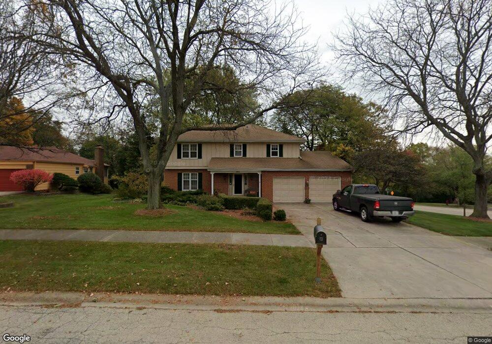
3N751 Hawthorn Dr Saint Charles, IL 60174
Wildrose NeighborhoodEstimated Value: $511,633 - $599,000
4
Beds
3
Baths
2,273
Sq Ft
$242/Sq Ft
Est. Value
About This Home
This home is located at 3N751 Hawthorn Dr, Saint Charles, IL 60174 and is currently estimated at $551,158, approximately $242 per square foot. 3N751 Hawthorn Dr is a home located in Kane County with nearby schools including Wild Rose Elementary School, Wredling Middle School, and St Charles North High School.
Ownership History
Date
Name
Owned For
Owner Type
Purchase Details
Closed on
Feb 18, 2019
Sold by
Schmidt Robert K and Schmidt Anne F
Bought by
Schmidt Robert Karl and Schmidt Anne Frances
Current Estimated Value
Purchase Details
Closed on
Oct 30, 1998
Sold by
Rieger Rodney W and Rieger Patricia C
Bought by
Schmidt Robert K and Schmidt Anne F
Home Financials for this Owner
Home Financials are based on the most recent Mortgage that was taken out on this home.
Original Mortgage
$160,000
Outstanding Balance
$34,924
Interest Rate
6.59%
Estimated Equity
$516,234
Create a Home Valuation Report for This Property
The Home Valuation Report is an in-depth analysis detailing your home's value as well as a comparison with similar homes in the area
Home Values in the Area
Average Home Value in this Area
Purchase History
| Date | Buyer | Sale Price | Title Company |
|---|---|---|---|
| Schmidt Robert Karl | -- | Attorney | |
| Schmidt Robert K | $260,000 | Chicago Title Insurance Co |
Source: Public Records
Mortgage History
| Date | Status | Borrower | Loan Amount |
|---|---|---|---|
| Open | Schmidt Robert K | $160,000 |
Source: Public Records
Tax History Compared to Growth
Tax History
| Year | Tax Paid | Tax Assessment Tax Assessment Total Assessment is a certain percentage of the fair market value that is determined by local assessors to be the total taxable value of land and additions on the property. | Land | Improvement |
|---|---|---|---|---|
| 2024 | $9,733 | $145,482 | $33,516 | $111,966 |
| 2023 | $9,262 | $130,208 | $29,997 | $100,211 |
| 2022 | $9,067 | $124,536 | $31,543 | $92,993 |
| 2021 | $8,546 | $118,708 | $30,067 | $88,641 |
| 2020 | $8,736 | $119,749 | $29,506 | $90,243 |
| 2019 | $8,578 | $117,378 | $28,922 | $88,456 |
| 2018 | $8,851 | $120,669 | $29,285 | $91,384 |
| 2017 | $8,622 | $116,544 | $28,284 | $88,260 |
| 2016 | $9,073 | $112,451 | $27,291 | $85,160 |
| 2015 | -- | $104,990 | $26,997 | $77,993 |
| 2014 | -- | $93,406 | $26,997 | $66,409 |
| 2013 | -- | $91,519 | $27,267 | $64,252 |
Source: Public Records
Map
Nearby Homes
- 810 Thornwood Dr
- 4N220 Thornly Rd
- 43W321 Creekside Ct
- 205 Auburn Ct Unit 205
- 36W068 Indian Mound Rd
- 125 Fairview Dr Unit 7
- 232 Benham Ct Unit 12FL
- 26 S 13th St
- 1010 Walnut St
- 106 Sumac Ct
- 221 N 6th St
- 242 Remington Dr
- 4N680 Ware Woods Dr
- 328 S 14th St Unit 3
- 3042 Saint Michel Ln
- 4N675 Old Farm Rd
- 3108 Saint Michel Ln
- 239 Grand Ridge Rd
- 314 W Main St
- 508 S 13th St
- 1 Hawthorn Dr
- 3N771 Hawthorn Dr
- 3N787 Hawthorn Dr
- 1905 Red Haw Ln
- 3N758 Thornapple Rd
- 1909 Red Haw Ln
- 3N758 Hawthorn Dr
- 2001 Red Haw Ln
- 3N778 Hawthorn Dr
- 3N784 Thornapple Rd
- 3N809 Hawthorn Dr
- 2005 Red Haw Ln
- 3N798 Hawthorn Dr
- 3N808 Thornapple Rd
- 915 Thornwood Ct
- 3N819 Hawthorn Dr
- 922 Wildwood Ct
- 917 Thornwood Ct
- 919 Thornwood Ct
- 918 Wildwood Ct