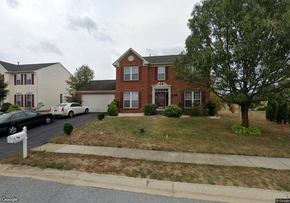
4 Amanda Cir Bear, DE 19701
Kirkwood NeighborhoodEstimated Value: $477,699 - $552,000
3
Beds
3
Baths
2,196
Sq Ft
$238/Sq Ft
Est. Value
About This Home
This home is located at 4 Amanda Cir, Bear, DE 19701 and is currently estimated at $523,675, approximately $238 per square foot. 4 Amanda Cir is a home located in New Castle County with nearby schools including Kathleen H. Wilbur Elementary School, Gunning Bedford Middle School, and Aquinas Academy.
Ownership History
Date
Name
Owned For
Owner Type
Purchase Details
Closed on
Mar 31, 2006
Sold by
Demby Neena R
Bought by
Rollins Robert B and Harris Jacqueline C
Current Estimated Value
Home Financials for this Owner
Home Financials are based on the most recent Mortgage that was taken out on this home.
Original Mortgage
$288,000
Outstanding Balance
$165,121
Interest Rate
6.32%
Mortgage Type
Fannie Mae Freddie Mac
Estimated Equity
$358,554
Purchase Details
Closed on
Jul 28, 2003
Sold by
Nvr Inc
Bought by
Demby Neena R
Home Financials for this Owner
Home Financials are based on the most recent Mortgage that was taken out on this home.
Original Mortgage
$267,850
Interest Rate
5.28%
Mortgage Type
Purchase Money Mortgage
Purchase Details
Closed on
May 8, 2003
Sold by
Sunset Meadows Inc
Bought by
Nvr Inc
Create a Home Valuation Report for This Property
The Home Valuation Report is an in-depth analysis detailing your home's value as well as a comparison with similar homes in the area
Home Values in the Area
Average Home Value in this Area
Purchase History
| Date | Buyer | Sale Price | Title Company |
|---|---|---|---|
| Rollins Robert B | $360,000 | None Available | |
| Demby Neena R | $297,615 | -- | |
| Nvr Inc | $70,000 | -- |
Source: Public Records
Mortgage History
| Date | Status | Borrower | Loan Amount |
|---|---|---|---|
| Open | Rollins Robert B | $288,000 | |
| Previous Owner | Demby Neena R | $267,850 |
Source: Public Records
Tax History
| Year | Tax Paid | Tax Assessment Tax Assessment Total Assessment is a certain percentage of the fair market value that is determined by local assessors to be the total taxable value of land and additions on the property. | Land | Improvement |
|---|---|---|---|---|
| 2024 | $3,603 | $103,800 | $15,300 | $88,500 |
| 2023 | $3,281 | $103,800 | $15,300 | $88,500 |
| 2022 | $3,413 | $103,800 | $15,300 | $88,500 |
| 2021 | $3,410 | $103,800 | $15,300 | $88,500 |
| 2020 | $3,422 | $103,800 | $15,300 | $88,500 |
| 2019 | $3,789 | $103,800 | $15,300 | $88,500 |
| 2018 | $3,366 | $103,800 | $15,300 | $88,500 |
| 2017 | $3,151 | $103,800 | $15,300 | $88,500 |
| 2016 | $2,810 | $103,800 | $15,300 | $88,500 |
| 2015 | $2,814 | $103,800 | $15,300 | $88,500 |
| 2014 | $2,818 | $103,800 | $15,300 | $88,500 |
Source: Public Records
Map
Nearby Homes
- 211 Audubon Dr
- 1962 Old Kirkwood Rd
- 1447 Olmsted Dr
- 1049 Matthew Way
- 3934 Kirkwood Saint Georges
- 808 Trophy Way
- 918 Decoy Way Unit 171
- 715 Javelin Way Unit 71
- 1119 Casey Dr
- 808 Quinn Ct
- 616 Clifton Dr
- 622 Clifton Dr
- 1224 Caitlin Way
- 205 E Harvest Dr
- 425 E Red Lion Dr
- 3213 Wrangle Hill Rd
- 3211 Wrangle Hill Rd
- 3209 Wrangle Hill Rd
- 325 Howell School Rd
- 26 Cobblestone Dr
Your Personal Tour Guide
Ask me questions while you tour the home.