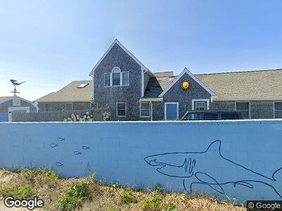
4 Beach Pine Rd Dennis Port, MA 02639
Dennis Port NeighborhoodEstimated Value: $1,962,000 - $2,668,000
5
Beds
4
Baths
3,323
Sq Ft
$662/Sq Ft
Est. Value
About This Home
This home is located at 4 Beach Pine Rd, Dennis Port, MA 02639 and is currently estimated at $2,198,501, approximately $661 per square foot. 4 Beach Pine Rd is a home located in Barnstable County with nearby schools including Dennis-Yarmouth Regional High School and St. Pius X. School.
Ownership History
Date
Name
Owned For
Owner Type
Purchase Details
Closed on
Dec 15, 2008
Sold by
Harback Peter and Harback Roberta
Bought by
Beach Pines Road Rt
Current Estimated Value
Purchase Details
Closed on
May 12, 2006
Sold by
Shebar Ila Karen
Bought by
Harback Peter and Harback Roberta
Home Financials for this Owner
Home Financials are based on the most recent Mortgage that was taken out on this home.
Original Mortgage
$550,000
Interest Rate
6.4%
Mortgage Type
Purchase Money Mortgage
Purchase Details
Closed on
Mar 5, 1997
Sold by
Meehan Kevin P
Bought by
Shebar Eric T and Shebar Ila Karen
Home Financials for this Owner
Home Financials are based on the most recent Mortgage that was taken out on this home.
Original Mortgage
$350,000
Interest Rate
7.77%
Mortgage Type
Purchase Money Mortgage
Purchase Details
Closed on
Nov 30, 1994
Sold by
Ellen Rt
Bought by
Meehan Kevin P
Create a Home Valuation Report for This Property
The Home Valuation Report is an in-depth analysis detailing your home's value as well as a comparison with similar homes in the area
Home Values in the Area
Average Home Value in this Area
Purchase History
| Date | Buyer | Sale Price | Title Company |
|---|---|---|---|
| Beach Pines Road Rt | -- | -- | |
| Harback Peter | $1,550,000 | -- | |
| Shebar Eric T | $692,000 | -- | |
| Meehan Kevin P | $350,000 | -- |
Source: Public Records
Mortgage History
| Date | Status | Borrower | Loan Amount |
|---|---|---|---|
| Previous Owner | Harback Peter | $550,000 | |
| Previous Owner | Shebar Ila K | $250,100 | |
| Previous Owner | Shebar Eric T | $350,000 |
Source: Public Records
Tax History Compared to Growth
Tax History
| Year | Tax Paid | Tax Assessment Tax Assessment Total Assessment is a certain percentage of the fair market value that is determined by local assessors to be the total taxable value of land and additions on the property. | Land | Improvement |
|---|---|---|---|---|
| 2025 | $7,380 | $1,704,300 | $705,800 | $998,500 |
| 2024 | $7,587 | $1,728,200 | $678,700 | $1,049,500 |
| 2023 | $7,338 | $1,571,300 | $617,000 | $954,300 |
| 2022 | $7,171 | $1,280,600 | $555,800 | $724,800 |
| 2021 | $6,395 | $1,166,200 | $544,900 | $621,300 |
| 2020 | $5,911 | $1,159,100 | $520,700 | $638,400 |
| 2019 | $6,992 | $1,133,200 | $510,500 | $622,700 |
| 2018 | $6,479 | $1,021,900 | $486,000 | $535,900 |
| 2017 | $6,285 | $1,021,900 | $486,000 | $535,900 |
| 2016 | $6,606 | $1,011,700 | $570,700 | $441,000 |
| 2015 | $6,475 | $1,011,700 | $570,700 | $441,000 |
| 2014 | $6,749 | $1,062,800 | $570,700 | $492,100 |
Source: Public Records
Map
Nearby Homes
- 402 Old Wharf Rd
- 402 Old Wharf Rd
- 13 Hamilton Rd
- 30 Union Wharf Rd Unit 5
- 9 Chase Ave Unit 1
- 50A Depot St
- 138 Sea St Unit 6
- 23 Arbor Way Unit 27
- 23 Arbor Way Unit 23
- 67 Inman Rd Unit X
- 433 Lower County Rd Unit 25
- 262 Old Wharf Rd Unit 20
- 14 Lower County Rd
- 191 Sea St Unit 3, AKA 2C
- 248 Old Wharf Rd Unit B-1
- 1 E Belmont Unit TH19
- 1 E Belmont Unit 445
- 241 Old Wharf Rd Unit 90
- 241 Old Wharf Rd Unit 88
- 241 Old Wharf Rd Unit 98
- 4 Beach Pine Rd
- 2 Beach Pine Rd
- 3 Beach Pine Rd
- 9 Beach Pine Rd
- 10 Beach Pine Rd
- 395 Old Wharf Rd
- 10 Town Pkwy
- 16 Highbank Cir
- 15 Beach Pine Rd
- 12 Raycroft
- 12 Raycroft Pkwy
- 16 Beach Pine Rd
- 8 Highbank Cir
- 15 Highbank Cir
- 11 Highbank Cir
- 19 Beach Pine Rd
- 20 Highbank Cir
- 9 Highbank Cir
- 2 Highbank Cir
- 20 Beach Pine Rd