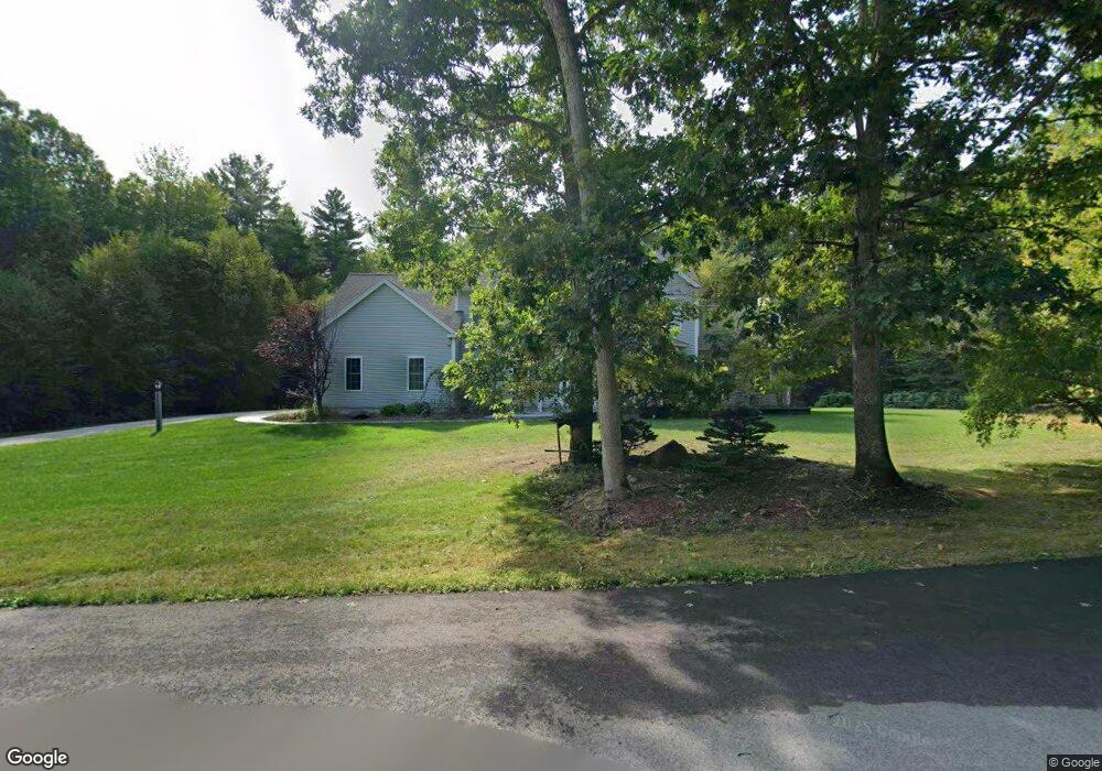
4 Bennett Rd Brookline, NH 03033
Estimated Value: $958,112 - $1,026,000
4
Beds
3
Baths
4,103
Sq Ft
$239/Sq Ft
Est. Value
About This Home
This home is located at 4 Bennett Rd, Brookline, NH 03033 and is currently estimated at $981,028, approximately $239 per square foot. 4 Bennett Rd is a home located in Hillsborough County with nearby schools including Richard Maghakian Memorial School, Captain Samuel Douglass Academy, and Hollis-Brookline Middle School.
Ownership History
Date
Name
Owned For
Owner Type
Purchase Details
Closed on
Jun 23, 2022
Sold by
Arroyo-Rodriguez Daniel and Arroyo Ella F
Bought by
Arroyo Ft and Rodriguez
Current Estimated Value
Purchase Details
Closed on
Aug 19, 2020
Sold by
Silvestri David and Silvestri Lindsay S
Bought by
Arroyo-Rodriguez Daniel and Arroyo Ella F
Home Financials for this Owner
Home Financials are based on the most recent Mortgage that was taken out on this home.
Original Mortgage
$400,620
Interest Rate
3%
Mortgage Type
New Conventional
Purchase Details
Closed on
Sep 3, 2008
Sold by
Adamyk Homes Inc
Bought by
Silvestri David and Silvestri Lindsay S
Home Financials for this Owner
Home Financials are based on the most recent Mortgage that was taken out on this home.
Original Mortgage
$345,000
Interest Rate
6.69%
Mortgage Type
Purchase Money Mortgage
Create a Home Valuation Report for This Property
The Home Valuation Report is an in-depth analysis detailing your home's value as well as a comparison with similar homes in the area
Home Values in the Area
Average Home Value in this Area
Purchase History
We collect this data history from publicly available records. To have your information removed, we recommend requesting removal directly through your county’s website.
| Date | Buyer | Sale Price | Title Company |
|---|---|---|---|
| Arroyo Ft | -- | None Available | |
| Arroyo-Rodriguez Daniel | $607,000 | None Available | |
| Arroyo-Rodriguez Daniel | $607,000 | None Available | |
| Silvestri David | $510,500 | -- |
Source: Public Records
Mortgage History
We collect this data history from publicly available records. To have your information removed, we recommend requesting removal directly through your county’s website.
| Date | Status | Borrower | Loan Amount |
|---|---|---|---|
| Previous Owner | Arroyo-Rodriguez Daniel | $400,620 | |
| Previous Owner | Silvestri David | $346,000 | |
| Previous Owner | Silvestri David | $348,797 | |
| Previous Owner | Silvestri David | $355,000 | |
| Previous Owner | Silvestri David | $345,000 |
Source: Public Records
Tax History
| Year | Tax Paid | Tax Assessment Tax Assessment Total Assessment is a certain percentage of the fair market value that is determined by local assessors to be the total taxable value of land and additions on the property. | Land | Improvement |
|---|---|---|---|---|
| 2025 | $20,828 | $845,300 | $216,600 | $628,700 |
| 2024 | $19,112 | $845,300 | $216,600 | $628,700 |
| 2023 | $17,565 | $845,300 | $216,600 | $628,700 |
| 2022 | $14,682 | $494,000 | $138,500 | $355,500 |
| 2021 | $14,119 | $494,000 | $138,500 | $355,500 |
| 2020 | $13,733 | $494,000 | $138,500 | $355,500 |
| 2019 | $14,756 | $494,000 | $138,500 | $355,500 |
| 2018 | $13,867 | $494,000 | $138,500 | $355,500 |
| 2017 | $13,387 | $406,400 | $113,500 | $292,900 |
| 2016 | $13,232 | $406,400 | $113,500 | $292,900 |
| 2015 | $12,619 | $406,400 | $113,500 | $292,900 |
| 2014 | $13,350 | $406,400 | $113,500 | $292,900 |
| 2013 | $12,788 | $404,300 | $113,500 | $290,800 |
Source: Public Records
Map
Nearby Homes
- 25 Pepperell Rd
- 9 Bohanon Bridge Rd
- 15 Pepperell Rd
- 26 Pepperell Rd
- 9 Quigley Way
- 9 Louis Dr
- 84 Irene Dr
- 112 Route 13 Unit A
- 118 Lawrence St
- 6 Milford St
- 23 Austin Ln
- 107 Fresh Pond Ln
- 7 Blueberry Ln
- 143 Worcester Rd
- 170 Ridge Rd
- 142 Worcester Rd
- 2 Wildwood Dr
- 45 Wildwood Dr
- 34 Cleveland Hill Rd
- 9 Maxwell Dr
Your Personal Tour Guide
Ask me questions while you tour the home.