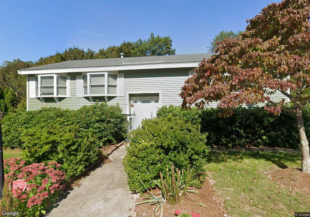
4 Burns Way Gloucester, MA 01930
Estimated Value: $791,000 - $1,029,000
3
Beds
2
Baths
1,548
Sq Ft
$575/Sq Ft
Est. Value
About This Home
This home is located at 4 Burns Way, Gloucester, MA 01930 and is currently estimated at $890,574, approximately $575 per square foot. 4 Burns Way is a home located in Essex County with nearby schools including Plum Cove School, Ralph B O'maley Middle School, and Gloucester High School.
Ownership History
Date
Name
Owned For
Owner Type
Purchase Details
Closed on
Apr 28, 1989
Sold by
Burns Barry P
Bought by
Robbins Thomas W
Current Estimated Value
Home Financials for this Owner
Home Financials are based on the most recent Mortgage that was taken out on this home.
Original Mortgage
$70,000
Interest Rate
10.9%
Mortgage Type
Purchase Money Mortgage
Create a Home Valuation Report for This Property
The Home Valuation Report is an in-depth analysis detailing your home's value as well as a comparison with similar homes in the area
Purchase History
| Date | Buyer | Sale Price | Title Company |
|---|---|---|---|
| Robbins Thomas W | $212,000 | -- |
Source: Public Records
Mortgage History
| Date | Status | Borrower | Loan Amount |
|---|---|---|---|
| Open | Robbins Thomas W | $80,000 | |
| Closed | Robbins Thomas W | $30,000 | |
| Closed | Robbins Thomas W | $68,000 | |
| Closed | Robbins Thomas W | $70,000 |
Source: Public Records
Tax History
| Year | Tax Paid | Tax Assessment Tax Assessment Total Assessment is a certain percentage of the fair market value that is determined by local assessors to be the total taxable value of land and additions on the property. | Land | Improvement |
|---|---|---|---|---|
| 2025 | $7,065 | $726,900 | $184,700 | $542,200 |
| 2024 | $7,315 | $751,800 | $175,900 | $575,900 |
| 2023 | $6,881 | $649,800 | $157,100 | $492,700 |
| 2022 | $6,406 | $546,100 | $136,600 | $409,500 |
| 2021 | $6,250 | $502,400 | $124,200 | $378,200 |
| 2020 | $5,962 | $483,500 | $124,200 | $359,300 |
| 2019 | $6,075 | $478,700 | $124,200 | $354,500 |
| 2018 | $5,745 | $444,300 | $124,200 | $320,100 |
| 2017 | $5,400 | $409,400 | $118,300 | $291,100 |
| 2016 | $5,349 | $393,000 | $123,400 | $269,600 |
| 2015 | $5,119 | $375,000 | $123,400 | $251,600 |
Source: Public Records
Map
Nearby Homes
- 672 Washington St
- 136 Leonard St
- 2 Breezy Point Rd
- 4 Ciaramitaro Ct
- 226 Atlantic St
- 178 Atlantic St
- 167 Atlantic St
- 3 Deacon Farm Ln
- 13 Honeysuckle Rd
- 31 Echo Ave
- 9 Hickory St
- 1030 Washington St
- 43 High St Unit B
- 10 Emerald St
- 13 Mystic Ave
- 8 Mystic Ave
- 3 Rockland St
- 98 Maplewood Ave
- 6 Monroe Ct
- 33 Quarry Ridge Ln Unit 33
- 14 Butternut Ln
- 12 Butternut Ln
- 6 Burns Way
- 5 Bittersweet Rd
- 3 Bittersweet Rd
- 16 Butternut Ln
- 7 Butternut Ln
- 7 Bittersweet Rd
- 8 Bittersweet Rd
- 8 Butternut Ln
- 1 Bittersweet Rd
- 9 Butternut Ln
- 731 Washington St
- 4 Bittersweet Rd
- 4 Butternut Ln
- 18 Youngs Rd
- 717 Washington St
- 729 Washington St
- 709 Washington St
- 723 Washington St
Your Personal Tour Guide
Ask me questions while you tour the home.