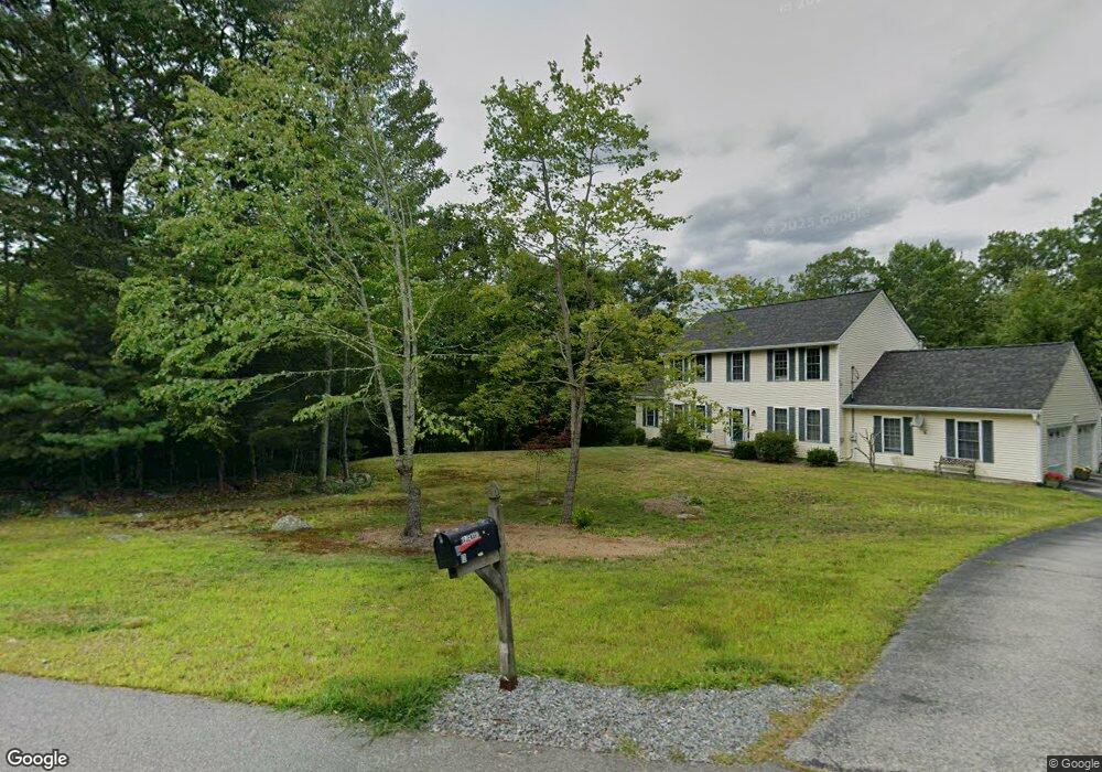
4 Calvin Way Brookline, NH 03033
Estimated Value: $745,423 - $817,000
5
Beds
4
Baths
3,264
Sq Ft
$244/Sq Ft
Est. Value
About This Home
This home is located at 4 Calvin Way, Brookline, NH 03033 and is currently estimated at $794,856, approximately $243 per square foot. 4 Calvin Way is a home with nearby schools including Richard Maghakian Memorial School, Captain Samuel Douglass Academy, and Hollis-Brookline Middle School.
Ownership History
Date
Name
Owned For
Owner Type
Purchase Details
Closed on
Mar 27, 2024
Sold by
Brickner Heather E and Brickner Shawn A
Bought by
Shawn & H Brickner Ret and Brickner
Current Estimated Value
Purchase Details
Closed on
Nov 2, 2001
Sold by
Glendale Homes Inc
Bought by
Brickner Heather E and Brickner Shawn A
Home Financials for this Owner
Home Financials are based on the most recent Mortgage that was taken out on this home.
Original Mortgage
$225,980
Interest Rate
6.82%
Mortgage Type
Purchase Money Mortgage
Create a Home Valuation Report for This Property
The Home Valuation Report is an in-depth analysis detailing your home's value as well as a comparison with similar homes in the area
Home Values in the Area
Average Home Value in this Area
Purchase History
| Date | Buyer | Sale Price | Title Company |
|---|---|---|---|
| Shawn & H Brickner Ret | -- | None Available | |
| Shawn & H Brickner Ret | -- | None Available | |
| Brickner Heather E | $282,500 | -- | |
| Brickner Heather E | $282,500 | -- |
Source: Public Records
Mortgage History
| Date | Status | Borrower | Loan Amount |
|---|---|---|---|
| Previous Owner | Brickner Heather E | $206,025 | |
| Previous Owner | Brickner Heather E | $225,980 |
Source: Public Records
Tax History Compared to Growth
Tax History
| Year | Tax Paid | Tax Assessment Tax Assessment Total Assessment is a certain percentage of the fair market value that is determined by local assessors to be the total taxable value of land and additions on the property. | Land | Improvement |
|---|---|---|---|---|
| 2024 | $13,923 | $615,800 | $218,100 | $397,700 |
| 2023 | $12,796 | $615,800 | $218,100 | $397,700 |
| 2022 | $11,303 | $380,300 | $131,200 | $249,100 |
| 2021 | $10,869 | $380,300 | $131,200 | $249,100 |
| 2020 | $10,572 | $380,300 | $131,200 | $249,100 |
| 2019 | $11,360 | $380,300 | $131,200 | $249,100 |
| 2018 | $11,242 | $380,300 | $131,200 | $249,100 |
| 2017 | $10,122 | $307,300 | $103,900 | $203,400 |
| 2016 | $9,993 | $306,900 | $103,900 | $203,000 |
| 2015 | $9,529 | $306,900 | $103,900 | $203,000 |
| 2014 | $10,082 | $306,900 | $103,900 | $203,000 |
| 2013 | $9,707 | $306,900 | $103,900 | $203,000 |
Source: Public Records
Map
Nearby Homes
- 59 Cleveland Hill Rd
- 9 Marjorie Dr
- 6 Laurelcrest Dr
- 2 Corey Hill Rd
- 12 Old Milford Rd
- 42 Pepperell Rd
- 22 Hobart Hill Rd
- 47 Pepperell Rd
- 18 Sawtelle Rd
- 55 Oak Hill Rd
- 25 Rocky Pond Rd
- 15 N End Rd
- 6 Flint Meadow Dr
- 5 Carons Way
- 6 High Oaks Path
- 0 Brookline St
- 26 Ben Farnsworth Rd
- 1235 Townsend Rd
- 28 N Mason Rd
- 52 W Hollis Rd