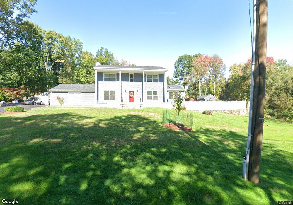
4 Cedar Crest Dr Danbury, CT 06811
Estimated Value: $612,698 - $751,000
4
Beds
3
Baths
2,556
Sq Ft
$260/Sq Ft
Est. Value
About This Home
This home is located at 4 Cedar Crest Dr, Danbury, CT 06811 and is currently estimated at $664,425, approximately $259 per square foot. 4 Cedar Crest Dr is a home located in Fairfield County with nearby schools including Mill Ridge Primary School, Rogers Park Middle School, and Danbury High School.
Ownership History
Date
Name
Owned For
Owner Type
Purchase Details
Closed on
Apr 1, 1999
Sold by
Wach Charles and Wach Angela
Bought by
Montero Isabelle C
Current Estimated Value
Purchase Details
Closed on
May 31, 1994
Sold by
Brink Steven and Brink Kathy
Bought by
Wach Charles and Wach Angela
Purchase Details
Closed on
May 31, 1991
Sold by
Page Catherine
Bought by
Brink Steven and Brink Kathy
Create a Home Valuation Report for This Property
The Home Valuation Report is an in-depth analysis detailing your home's value as well as a comparison with similar homes in the area
Home Values in the Area
Average Home Value in this Area
Purchase History
| Date | Buyer | Sale Price | Title Company |
|---|---|---|---|
| Montero Isabelle C | $279,500 | -- | |
| Wach Charles | $246,000 | -- | |
| Brink Steven | $240,000 | -- |
Source: Public Records
Mortgage History
| Date | Status | Borrower | Loan Amount |
|---|---|---|---|
| Open | Brink Steven | $330,000 | |
| Closed | Brink Steven | $202,000 | |
| Closed | Brink Steven | $230,000 |
Source: Public Records
Tax History
| Year | Tax Paid | Tax Assessment Tax Assessment Total Assessment is a certain percentage of the fair market value that is determined by local assessors to be the total taxable value of land and additions on the property. | Land | Improvement |
|---|---|---|---|---|
| 2025 | $9,313 | $372,680 | $96,740 | $275,940 |
| 2024 | $9,108 | $372,680 | $96,740 | $275,940 |
| 2023 | $8,695 | $372,680 | $96,740 | $275,940 |
| 2022 | $7,890 | $279,600 | $94,400 | $185,200 |
| 2021 | $0 | $279,600 | $94,400 | $185,200 |
| 2020 | $0 | $279,600 | $94,400 | $185,200 |
| 2019 | $7,717 | $279,600 | $94,400 | $185,200 |
| 2018 | $7,717 | $279,600 | $94,400 | $185,200 |
| 2017 | $7,495 | $258,900 | $90,000 | $168,900 |
| 2016 | $7,425 | $258,900 | $90,000 | $168,900 |
| 2015 | $7,317 | $258,900 | $90,000 | $168,900 |
| 2014 | $7,146 | $258,900 | $90,000 | $168,900 |
Source: Public Records
Map
Nearby Homes
- 11 Westwood Dr
- 53 Greenlawn Dr
- 55 Mill Plain Rd Unit 17-6
- 2 Greenlawn Dr
- 1003 Larson Dr
- 403 Larson Dr
- 85 Winding Ridge Way Unit 85
- 115 Center Meadow Ln Unit 115
- 10 Putnam Ln Unit 10
- 503 Center Meadow Ln Unit 503
- 184 Warrington Round Unit 184
- 24 Hearthstone Way
- Mohonk Plan at Rivington - The Meadows
- Aberton Plan at Rivington - Regency
- Alstead Plan at Rivington - Regency
- Mohonk Elite Plan at Rivington - The Meadows
- Winwood Plan at Rivington - Regency
- Hawthorne Plan at Rivington - The Meadows
- Albrecht Plan at Rivington - The Meadows
- Jaywick Plan at Rivington - Regency
- 33 Aunt Hack Rd
- 2 Cedar Crest Dr
- 6 Cedar Crest Dr
- 35 Aunt Hack Rd Unit 37
- 1 Cedar Crest Dr
- 25 Lindencrest Dr
- 37 Aunt Hack Rd
- 5 Cedar Crest Dr
- 27 Lindencrest Dr
- 32 Aunt Hack Rd
- 27 Aunt Hack Rd
- 34 Aunt Hack Rd
- 23 Lindencrest Dr
- 2 Birchcrest Dr
- 28-30 Aunt Hack Rd
- 39 Aunt Hack Rd
- 29 Lindencrest Dr
- 1 Birchcrest Dr
- 36 Aunt Hack Rd
- 28 Aunt Hack Rd Unit 30