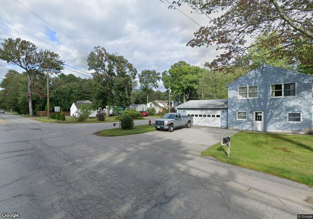
4 Cote Dr Dover, NH 03820
Dover Point NeighborhoodEstimated Value: $597,481 - $767,000
2
Beds
2
Baths
1,584
Sq Ft
$420/Sq Ft
Est. Value
About This Home
This home is located at 4 Cote Dr, Dover, NH 03820 and is currently estimated at $665,870, approximately $420 per square foot. 4 Cote Dr is a home located in Strafford County with nearby schools including Garrison School, Dover Middle School, and Dover Senior High School.
Ownership History
Date
Name
Owned For
Owner Type
Purchase Details
Closed on
Feb 18, 2014
Sold by
Beaudry Ralph C
Bought by
Clarke-Beaudry Ralph and Beaudry Sandra L
Current Estimated Value
Home Financials for this Owner
Home Financials are based on the most recent Mortgage that was taken out on this home.
Original Mortgage
$204,000
Outstanding Balance
$153,409
Interest Rate
4.52%
Mortgage Type
Purchase Money Mortgage
Estimated Equity
$512,461
Purchase Details
Closed on
Jan 30, 2004
Sold by
Bradley William J
Bought by
Beaudry Ralph C
Home Financials for this Owner
Home Financials are based on the most recent Mortgage that was taken out on this home.
Original Mortgage
$258,900
Interest Rate
5.82%
Mortgage Type
Purchase Money Mortgage
Purchase Details
Closed on
Dec 17, 1999
Sold by
Goldstein Robert M and Goldstein Deborah A
Bought by
Bradley William J
Home Financials for this Owner
Home Financials are based on the most recent Mortgage that was taken out on this home.
Original Mortgage
$117,600
Interest Rate
7.81%
Purchase Details
Closed on
Jul 1, 1998
Sold by
Dahl Kenneth C and Dahl Ann
Bought by
Goldstein Robert M
Home Financials for this Owner
Home Financials are based on the most recent Mortgage that was taken out on this home.
Original Mortgage
$112,955
Interest Rate
7.04%
Create a Home Valuation Report for This Property
The Home Valuation Report is an in-depth analysis detailing your home's value as well as a comparison with similar homes in the area
Home Values in the Area
Average Home Value in this Area
Purchase History
| Date | Buyer | Sale Price | Title Company |
|---|---|---|---|
| Clarke-Beaudry Ralph | -- | -- | |
| Beaudry Ralph C | $268,500 | -- | |
| Bradley William J | $147,000 | -- | |
| Goldstein Robert M | $116,900 | -- |
Source: Public Records
Mortgage History
| Date | Status | Borrower | Loan Amount |
|---|---|---|---|
| Open | Clarke-Beaudry Ralph | $204,000 | |
| Previous Owner | Goldstein Robert M | $258,900 | |
| Previous Owner | Goldstein Robert M | $117,600 | |
| Previous Owner | Goldstein Robert M | $112,955 |
Source: Public Records
Tax History
| Year | Tax Paid | Tax Assessment Tax Assessment Total Assessment is a certain percentage of the fair market value that is determined by local assessors to be the total taxable value of land and additions on the property. | Land | Improvement |
|---|---|---|---|---|
| 2024 | $8,891 | $489,300 | $176,700 | $312,600 |
| 2023 | $7,987 | $427,100 | $152,600 | $274,500 |
| 2022 | $7,837 | $395,000 | $144,600 | $250,400 |
| 2021 | $7,508 | $346,000 | $128,500 | $217,500 |
| 2020 | $7,281 | $293,000 | $112,500 | $180,500 |
| 2019 | $6,985 | $277,300 | $100,400 | $176,900 |
| 2018 | $6,691 | $268,500 | $92,400 | $176,100 |
| 2017 | $6,499 | $251,200 | $80,300 | $170,900 |
| 2016 | $6,307 | $239,900 | $84,300 | $155,600 |
| 2015 | $6,062 | $227,800 | $84,300 | $143,500 |
| 2014 | $5,925 | $227,800 | $84,300 | $143,500 |
| 2011 | $5,461 | $217,400 | $81,700 | $135,700 |
Source: Public Records
Map
Nearby Homes
- 0 Cote Dr Unit 55B
- 348 Dover Point Rd
- 354 Dover Point Rd
- 18 Little Bay Dr
- 18 Deborah Ln
- 41 Clearwater Dr
- Slip B18 Little Bay
- 71 Shipwright Way
- 10 Shipwright Way
- 708 River Rd Unit 2
- 708 River Rd Unit 3
- 25 Fosters Dr
- 18 Governor Hill Rd
- 1708 State Rd
- 0 Franks Fort Island Unit 1650383
- 11 Willey Creek Rd
- 10 Pasture Hill Dr
- Lot 2 Cedar Tbd
- 69 Polly Ann Trailer Park
- 3 Greenfield Dr Unit C
Your Personal Tour Guide
Ask me questions while you tour the home.