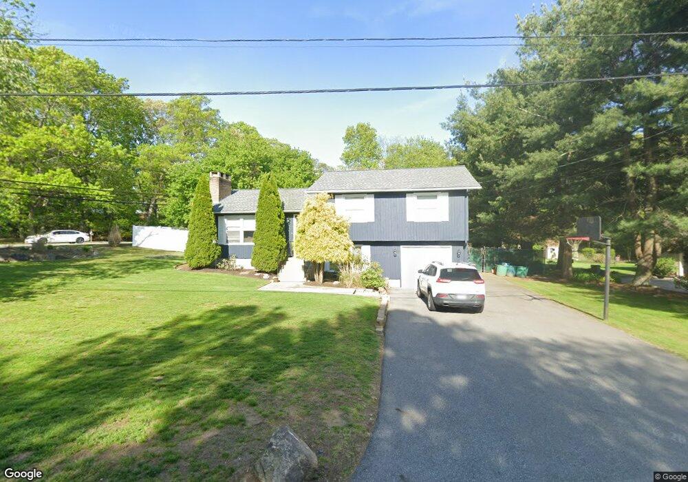
4 Council Rock Rd Cranston, RI 02921
Comstock Gardens NeighborhoodEstimated Value: $484,000 - $580,000
3
Beds
2
Baths
1,532
Sq Ft
$349/Sq Ft
Est. Value
About This Home
This home is located at 4 Council Rock Rd, Cranston, RI 02921 and is currently estimated at $534,318, approximately $348 per square foot. 4 Council Rock Rd is a home located in Providence County with nearby schools including Orchard Farms El. School, Western Hills Middle School, and Cranston High School West.
Ownership History
Date
Name
Owned For
Owner Type
Purchase Details
Closed on
Sep 2, 2005
Sold by
Natale Joseph J
Bought by
Procaccianti Kimberlee
Current Estimated Value
Home Financials for this Owner
Home Financials are based on the most recent Mortgage that was taken out on this home.
Original Mortgage
$272,000
Outstanding Balance
$143,361
Interest Rate
5.81%
Mortgage Type
Purchase Money Mortgage
Estimated Equity
$390,957
Purchase Details
Closed on
May 20, 2005
Sold by
Ucran Jacqueline P
Bought by
Natale Joseph J
Home Financials for this Owner
Home Financials are based on the most recent Mortgage that was taken out on this home.
Original Mortgage
$266,000
Interest Rate
5.95%
Mortgage Type
Purchase Money Mortgage
Create a Home Valuation Report for This Property
The Home Valuation Report is an in-depth analysis detailing your home's value as well as a comparison with similar homes in the area
Home Values in the Area
Average Home Value in this Area
Purchase History
| Date | Buyer | Sale Price | Title Company |
|---|---|---|---|
| Procaccianti Kimberlee | $340,000 | -- | |
| Natale Joseph J | $280,000 | -- |
Source: Public Records
Mortgage History
| Date | Status | Borrower | Loan Amount |
|---|---|---|---|
| Open | Natale Joseph J | $272,000 | |
| Closed | Natale Joseph J | $34,000 | |
| Previous Owner | Natale Joseph J | $266,000 | |
| Previous Owner | Natale Joseph J | $64,000 |
Source: Public Records
Tax History Compared to Growth
Tax History
| Year | Tax Paid | Tax Assessment Tax Assessment Total Assessment is a certain percentage of the fair market value that is determined by local assessors to be the total taxable value of land and additions on the property. | Land | Improvement |
|---|---|---|---|---|
| 2025 | $5,355 | $385,800 | $128,700 | $257,100 |
| 2024 | $5,251 | $385,800 | $128,700 | $257,100 |
| 2023 | $5,175 | $273,800 | $88,700 | $185,100 |
| 2022 | $5,068 | $273,800 | $88,700 | $185,100 |
| 2021 | $4,928 | $273,800 | $88,700 | $185,100 |
| 2020 | $5,035 | $242,400 | $93,000 | $149,400 |
| 2019 | $5,035 | $242,400 | $93,000 | $149,400 |
| 2018 | $4,918 | $242,400 | $93,000 | $149,400 |
| 2017 | $5,065 | $220,800 | $84,500 | $136,300 |
| 2016 | $4,957 | $220,800 | $84,500 | $136,300 |
| 2015 | $4,957 | $220,800 | $84,500 | $136,300 |
| 2014 | $4,621 | $202,300 | $76,100 | $126,200 |
Source: Public Records
Map
Nearby Homes
- 53 Charcalee Dr
- 20 Doreen Ct
- 9 Gray Coach E
- 26 Scituate Farms Dr
- 18 Quail Ridge Rd
- 95 Amy Dr
- 7 Taylor Rd
- 17 Woodview Dr
- 105 Amy Dr
- 27 Tartaglia St
- 121 Ashbrook Dr
- 2073 Plainfield Pike
- 20 Wild Berry Dr
- 435 Scituate Ave
- 27 Nardolillo St
- 11 Red Robin Rd
- 80 Tomahawk Trail
- 102 Moccasin Trail
- 134 Lake Garden Dr
- 51 Stone Dr
- 16 Council Rock Rd
- 7 Council Rock Rd
- 946 Scituate Ave
- 945 Scituate Ave
- 968 Scituate Ave
- 26 Council Rock Rd
- 25 Council Rock Rd
- 965 Scituate Ave
- 909 Scituate Ave
- 16 Charcalee Dr
- 37 Council Rock Rd
- 36 Council Rock Rd
- 926 Scituate Ave
- 1017 Scituate Ave
- 20 Charcalee Dr
- 907 Scituate Ave
- 33 Charcalee Dr
- 19 Charcalee Dr
- 46 Council Rock Rd
- 1025 Scituate Ave