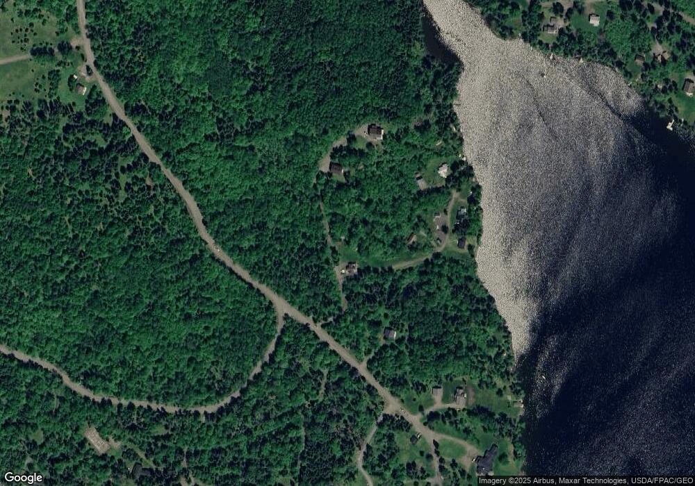
4 Cove Path Rangeley, ME 04970
Estimated Value: $580,000
Studio
--
Bath
2,108
Sq Ft
$275/Sq Ft
Est. Value
About This Home
This home is located at 4 Cove Path, Rangeley, ME 04970 and is currently estimated at $580,000, approximately $275 per square foot. 4 Cove Path is a home with nearby schools including Rangeley Lakes Regional School.
Ownership History
Date
Name
Owned For
Owner Type
Purchase Details
Closed on
Jun 21, 2021
Sold by
Mcphetres Joyce and Hinckley-Gordon Lorene
Bought by
Hinckley-Gordon Michael and Hinckley-Gordon Lorene
Current Estimated Value
Home Financials for this Owner
Home Financials are based on the most recent Mortgage that was taken out on this home.
Original Mortgage
$155,000
Outstanding Balance
$139,720
Interest Rate
2.9%
Mortgage Type
Purchase Money Mortgage
Estimated Equity
$440,280
Purchase Details
Closed on
Mar 13, 2017
Sold by
Mcphetres Joyce and Hinckley-Gordon Lorene
Bought by
Rangeley Ret and Mcphetres
Create a Home Valuation Report for This Property
The Home Valuation Report is an in-depth analysis detailing your home's value as well as a comparison with similar homes in the area
Purchase History
| Date | Buyer | Sale Price | Title Company |
|---|---|---|---|
| Hinckley-Gordon Michael | -- | None Available | |
| Hinckley-Gordon Michael | -- | None Available | |
| Rangeley Ret | -- | -- | |
| Rangeley Ret | -- | -- |
Source: Public Records
Mortgage History
| Date | Status | Borrower | Loan Amount |
|---|---|---|---|
| Open | Hinckley-Gordon Michael | $155,000 | |
| Closed | Hinckley-Gordon Michael | $155,000 |
Source: Public Records
Tax History
| Year | Tax Paid | Tax Assessment Tax Assessment Total Assessment is a certain percentage of the fair market value that is determined by local assessors to be the total taxable value of land and additions on the property. | Land | Improvement |
|---|---|---|---|---|
| 2024 | $3,311 | $270,700 | $130,500 | $140,200 |
| 2023 | $3,311 | $270,700 | $130,500 | $140,200 |
| 2022 | $2,914 | $193,500 | $93,300 | $100,200 |
| 2021 | $2,870 | $193,500 | $93,300 | $100,200 |
| 2020 | $2,678 | $193,500 | $93,300 | $100,200 |
| 2019 | $2,699 | $193,500 | $93,300 | $100,200 |
| 2018 | $2,612 | $193,500 | $93,300 | $100,200 |
| 2017 | $2,452 | $193,500 | $93,300 | $100,200 |
| 2016 | $2,307 | $193,500 | $93,300 | $100,200 |
| 2015 | $2,216 | $193,500 | $93,300 | $100,200 |
| 2014 | $2,235 | $193,500 | $93,300 | $100,200 |
| 2013 | $1,733 | $148,100 | $93,300 | $54,800 |
Source: Public Records
Map
Nearby Homes
- 62 Hernborg Rd
- 30 Spotted Fawn Ln
- 574 Mingo Loop Rd
- 378 Mingo Loop Rd
- Lot 7 Sanctuary Dr
- 658 Mingo Loop Rd
- 642 Mingo Loop Rd
- 65 Judkins Rd
- 60 Targett Rd
- 41 Stone Hedge Ln
- 640 Bald Mountain Rd
- 641 Bald Mountain Rd
- 4 Gilbert Cir
- 163 Bemis Rd
- 166 Bemis Rd
- 747 S South Shore Dr Unit 25
- Lot 24-1 Rte 17
- lot 31,32 Stephens Rd
- 44 Loon Lake Rd
- 62 Loon Lake Rd
- 23 Cove Path
- 278 Bonney Point Rd
- 75 Bonney Point Rd
- 205 Bonney Point Rd
- 282 Bonney Point Rd
- 281 Bonney Point Rd
- 80 Hernborg Rd
- 261 Bonney Point Rd
- 261A Bonney Point Rd
- 90 Hernborg Rd
- Lot 6-54A Hernborg Rd
- 85 Hernborg Rd
- 52 Hernborg Rd
- M6/L59 Hernborg Rd
- 60 Bear Path
- 14 Whitetail Path
- 6-59 Hernborg Rd
- 6-59-1 Hernborg Rd
- 66 Bear Path
- 46 Hernborg Rd
Your Personal Tour Guide
Ask me questions while you tour the home.
