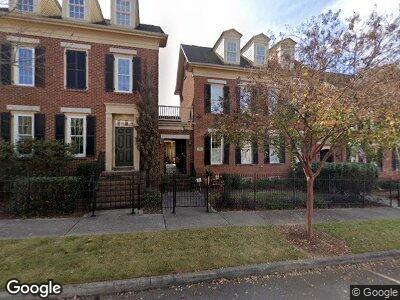
4 Cranston St NW Huntsville, AL 35806
Research Park NeighborhoodEstimated Value: $482,000 - $623,000
4
Beds
4
Baths
2,442
Sq Ft
$223/Sq Ft
Est. Value
About This Home
This home is located at 4 Cranston St NW, Huntsville, AL 35806 and is currently estimated at $544,080, approximately $222 per square foot. 4 Cranston St NW is a home located in Madison County with nearby schools including Providence Elementary School, Williams P-8 School, and Columbia High School.
Ownership History
Date
Name
Owned For
Owner Type
Purchase Details
Closed on
Jan 17, 2023
Sold by
D R Horton Inc
Bought by
Olander Justin Paul and Olander Hannah Louise
Current Estimated Value
Purchase Details
Closed on
Oct 1, 2008
Sold by
Stricklin Custom Homes Inc
Bought by
Crim Randy J and Crim Nancy A
Home Financials for this Owner
Home Financials are based on the most recent Mortgage that was taken out on this home.
Original Mortgage
$340
Interest Rate
6.45%
Mortgage Type
New Conventional
Create a Home Valuation Report for This Property
The Home Valuation Report is an in-depth analysis detailing your home's value as well as a comparison with similar homes in the area
Home Values in the Area
Average Home Value in this Area
Purchase History
| Date | Buyer | Sale Price | Title Company |
|---|---|---|---|
| Olander Justin Paul | $332,535 | -- | |
| Crim Randy J | -- | -- |
Source: Public Records
Mortgage History
| Date | Status | Borrower | Loan Amount |
|---|---|---|---|
| Previous Owner | Crim Randy J | $328,958 | |
| Previous Owner | Crim Randy J | $344,800 | |
| Previous Owner | Crim Randy J | $340 |
Source: Public Records
Tax History Compared to Growth
Tax History
| Year | Tax Paid | Tax Assessment Tax Assessment Total Assessment is a certain percentage of the fair market value that is determined by local assessors to be the total taxable value of land and additions on the property. | Land | Improvement |
|---|---|---|---|---|
| 2024 | -- | $44,700 | $9,500 | $35,200 |
| 2023 | $0 | $44,700 | $9,500 | $35,200 |
| 2022 | $0 | $41,440 | $9,500 | $31,940 |
| 2021 | $2,103 | $39,440 | $7,500 | $31,940 |
| 2020 | $0 | $38,700 | $7,500 | $31,200 |
| 2019 | $2,103 | $38,700 | $7,500 | $31,200 |
| 2018 | $2,103 | $37,080 | $0 | $0 |
| 2017 | $2,103 | $37,080 | $0 | $0 |
| 2016 | $2,103 | $37,080 | $0 | $0 |
| 2015 | $2,103 | $37,080 | $0 | $0 |
| 2014 | $2,050 | $36,180 | $0 | $0 |
Source: Public Records
Map
Nearby Homes
- 4 Battery St NW
- 1 Thayer St NW
- 9 Beck St
- 1 Chalkstone St NW
- 1917 Shellbrook Dr NW
- 2 Ross St NW
- 16 College Hill Cir NW
- 1867 Shellbrook Dr NW
- 17 Biltmore Dr NW
- 55 Hillcrest Ave NW
- 86 Hillcrest Ave NW
- 4 Admiral St NW
- 90 Hillcrest Ave NW
- 21 Bridgham St NW
- 45 Pine St NW
- 89 Hillcrest Ave NW
- 43 Pine St NW
- 33 Pine St NW
- 19 Bridgham St NW
- 14 Weybosset St NW
- 4 Cranston St NW
- 6 Cranston St NW
- 8 Cranston St NW
- 10 Cranston St NW
- 3 Hope St NW
- 1 Hope St NW
- 12 Cranston St NW
- 5 Hope St NW
- 1 Cranston St NW
- 7 Hope St NW
- 3 Cranston St NW
- 14 Cranston St NW
- 5 Cranston St NW
- 9 Hope St NW
- 16 Cranston St NW
- 11 Hope St NW
- 7 Cranston St NW
- 2 Hope St NW
- 4 Hope St NW
- 15 Hope St NW