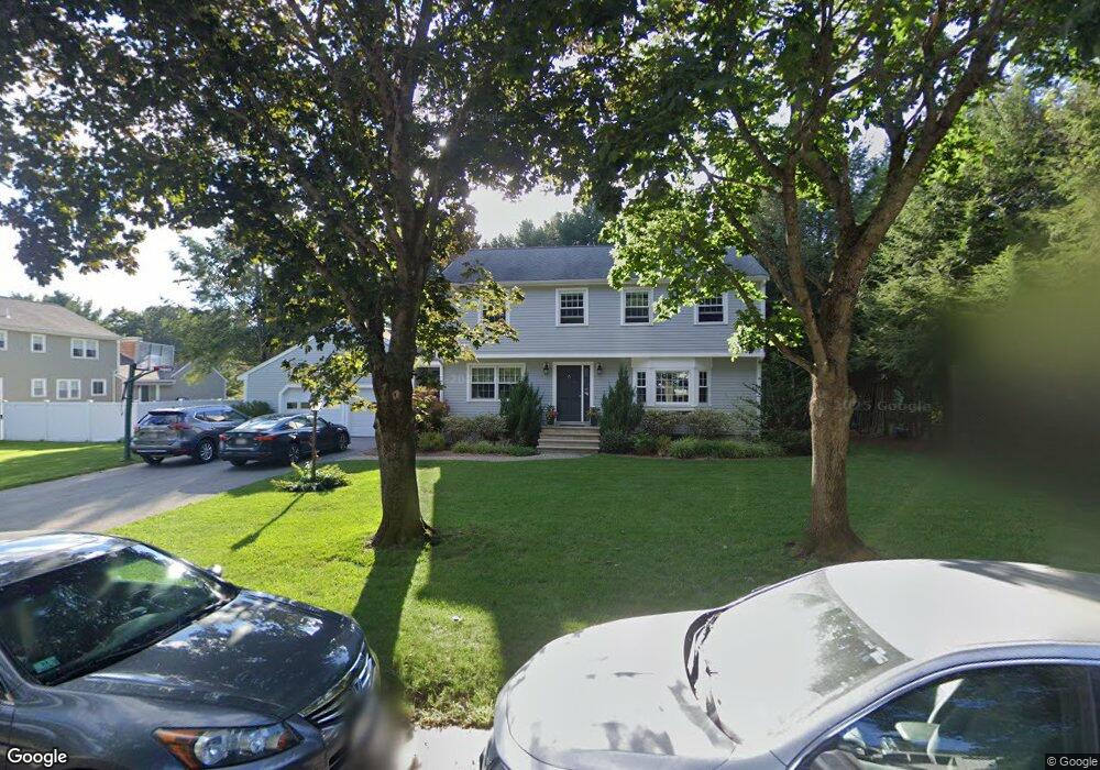
4 Danforth Cir Andover, MA 01810
Southern Andover NeighborhoodEstimated Value: $1,114,744 - $1,362,000
4
Beds
3
Baths
1,872
Sq Ft
$639/Sq Ft
Est. Value
About This Home
This home is located at 4 Danforth Cir, Andover, MA 01810 and is currently estimated at $1,196,936, approximately $639 per square foot. 4 Danforth Cir is a home located in Essex County with nearby schools including South Elementary School, Doherty Middle School, and Andover High School.
Ownership History
Date
Name
Owned For
Owner Type
Purchase Details
Closed on
Dec 20, 2002
Sold by
Rac Vac Rt and Crusius Ralph A
Bought by
Rinaldi Steven J and Rinaldi Erica C
Current Estimated Value
Home Financials for this Owner
Home Financials are based on the most recent Mortgage that was taken out on this home.
Original Mortgage
$400,000
Outstanding Balance
$170,830
Interest Rate
6.16%
Mortgage Type
Purchase Money Mortgage
Estimated Equity
$1,026,106
Create a Home Valuation Report for This Property
The Home Valuation Report is an in-depth analysis detailing your home's value as well as a comparison with similar homes in the area
Home Values in the Area
Average Home Value in this Area
Purchase History
| Date | Buyer | Sale Price | Title Company |
|---|---|---|---|
| Rinaldi Steven J | $505,000 | -- | |
| Rinaldi Steven J | $505,000 | -- |
Source: Public Records
Mortgage History
| Date | Status | Borrower | Loan Amount |
|---|---|---|---|
| Open | Rinaldi Steven J | $67,200 | |
| Open | Rinaldi Steven J | $400,000 | |
| Closed | Rinaldi Steven J | $400,000 |
Source: Public Records
Tax History
| Year | Tax Paid | Tax Assessment Tax Assessment Total Assessment is a certain percentage of the fair market value that is determined by local assessors to be the total taxable value of land and additions on the property. | Land | Improvement |
|---|---|---|---|---|
| 2024 | $11,373 | $883,000 | $495,900 | $387,100 |
| 2023 | $10,905 | $798,300 | $446,600 | $351,700 |
| 2022 | $10,273 | $703,600 | $388,500 | $315,100 |
| 2021 | $9,856 | $644,600 | $353,200 | $291,400 |
| 2020 | $9,482 | $631,700 | $344,700 | $287,000 |
| 2019 | $9,125 | $597,600 | $314,900 | $282,700 |
| 2018 | $8,829 | $564,500 | $302,800 | $261,700 |
| 2017 | $8,472 | $558,100 | $296,900 | $261,200 |
| 2016 | $8,301 | $560,100 | $296,900 | $263,200 |
| 2015 | $7,984 | $533,300 | $285,500 | $247,800 |
Source: Public Records
Map
Nearby Homes
- 6 Danforth Cir
- 12 Abbot Bridge Dr
- 14 Abbot Bridge Dr
- 3 Danforth Cir
- 8 Danforth Cir
- 9 Eastman Rd
- 9 Eastman Rd Unit 9
- 10 Eastman Rd
- 12 Eastman Rd
- 10 Abbot Bridge Dr
- 5 Danforth Cir
- 7 Danforth Cir
- 10 Danforth Cir
- 3 Livingston Cir
- 8 Abbot Bridge Dr
- 18 Abbot Bridge Dr
- 13 Abbot Bridge Dr
- 8 Eastman Rd
- 7 Eastman Rd
- 15 Abbot Bridge Dr
Your Personal Tour Guide
Ask me questions while you tour the home.