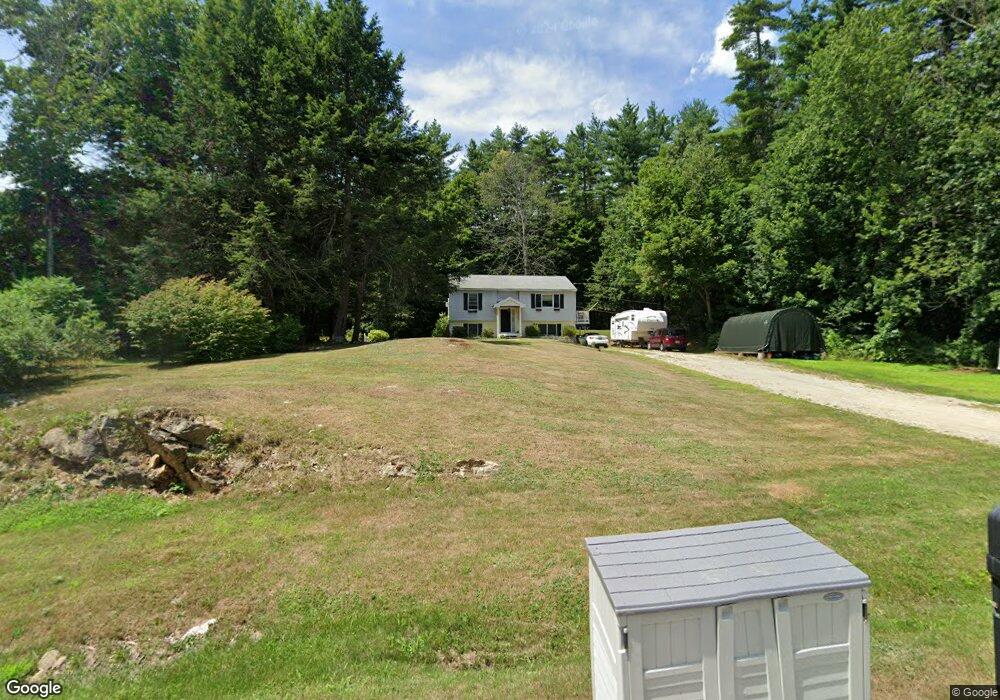
4 Devonshire Dr Nottingham, NH 03290
Estimated Value: $509,640 - $633,000
3
Beds
2
Baths
2,042
Sq Ft
$274/Sq Ft
Est. Value
About This Home
This home is located at 4 Devonshire Dr, Nottingham, NH 03290 and is currently estimated at $559,910, approximately $274 per square foot. 4 Devonshire Dr is a home located in Rockingham County with nearby schools including Nottingham Elementary School.
Ownership History
Date
Name
Owned For
Owner Type
Purchase Details
Closed on
Aug 4, 2003
Sold by
Demers Charles A and Demers Lisa M
Bought by
Smith Sean M and Smith Jocelyn L
Current Estimated Value
Home Financials for this Owner
Home Financials are based on the most recent Mortgage that was taken out on this home.
Original Mortgage
$213,500
Interest Rate
5.28%
Create a Home Valuation Report for This Property
The Home Valuation Report is an in-depth analysis detailing your home's value as well as a comparison with similar homes in the area
Home Values in the Area
Average Home Value in this Area
Purchase History
| Date | Buyer | Sale Price | Title Company |
|---|---|---|---|
| Smith Sean M | $266,900 | -- |
Source: Public Records
Mortgage History
| Date | Status | Borrower | Loan Amount |
|---|---|---|---|
| Open | Smith Sean M | $181,600 | |
| Closed | Smith Sean M | $60,600 | |
| Closed | Smith Sean M | $213,500 |
Source: Public Records
Tax History
| Year | Tax Paid | Tax Assessment Tax Assessment Total Assessment is a certain percentage of the fair market value that is determined by local assessors to be the total taxable value of land and additions on the property. | Land | Improvement |
|---|---|---|---|---|
| 2024 | $7,124 | $348,200 | $139,500 | $208,700 |
| 2023 | $7,465 | $348,200 | $139,500 | $208,700 |
| 2022 | $6,654 | $348,200 | $139,500 | $208,700 |
| 2021 | $6,762 | $348,200 | $139,500 | $208,700 |
| 2020 | $6,532 | $348,200 | $139,500 | $208,700 |
| 2019 | $6,055 | $269,100 | $90,400 | $178,700 |
| 2018 | $6,092 | $269,100 | $90,400 | $178,700 |
| 2017 | $5,669 | $270,600 | $90,400 | $180,200 |
| 2016 | $5,588 | $270,600 | $90,400 | $180,200 |
| 2015 | $5,504 | $270,600 | $90,400 | $180,200 |
| 2014 | $5,030 | $230,500 | $61,300 | $169,200 |
| 2013 | $4,967 | $230,500 | $61,300 | $169,200 |
Source: Public Records
Map
Nearby Homes
- 295 1st New Hampshire Turnpike
- 468 Mountain Ave
- 166 Old Turnpike Rd
- 61 Freeman Hall Rd
- 2 Yearling Dr Unit 1
- 0 Old Turnpike Rd Unit 1
- 25 Revolutionary Ln
- 641 & 647 First nh Turnpike
- 120 Estate Dr
- 56 Third St
- 170 Nottingham Rd
- Lot 70 Homestead Ln
- 0 1st New Hampshire Turnpike Unit 5026030
- 0 1st New Hampshire Turnpike Unit 5013320
- Lot 3 the Woodlands at Merry Hill
- Lot 1 the Woodlands at Merry Hill
- Map 3 Lot 18-2b and 18-2c Water St
- 369 Blakes Hill Rd
- 2 Oak Ct
- 26 Oak St
- 6 Devonshire Dr
- 3 Devonshire Dr
- 2 Devonshire Dr
- 1 Devonshire Dr
- 5 Devonshire Dr
- 7 Devonshire Dr
- 8 Devonshire Dr
- 228 Lucas Pond Rd
- 224 Lucas Pond Rd
- 15 Lucas Pond Rd
- 12 Lucas Pond Rd
- 225 Lucas Pond Rd
- 10 Devonshire Dr
- 10 Lucas Pond Rd
- 19 Lucas Pond Rd
- 11 Lucas Pond Rd
- 8 Lucas Pond Rd
- 7 Lucas Pond Rd
- 364 Stage Rd
- 15 Demerit Pond Rd
Your Personal Tour Guide
Ask me questions while you tour the home.