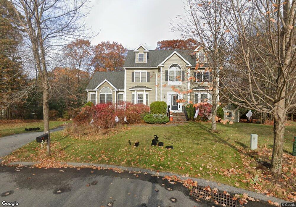
4 Devonshire Rd Amesbury, MA 01913
Estimated Value: $974,645 - $1,140,000
4
Beds
4
Baths
2,768
Sq Ft
$385/Sq Ft
Est. Value
About This Home
This home is located at 4 Devonshire Rd, Amesbury, MA 01913 and is currently estimated at $1,066,411, approximately $385 per square foot. 4 Devonshire Rd is a home located in Essex County with nearby schools including Amesbury High School.
Ownership History
Date
Name
Owned For
Owner Type
Purchase Details
Closed on
Oct 6, 2015
Sold by
Edney Paul A and Edney Susan A
Bought by
Paul A Edney Ret
Current Estimated Value
Purchase Details
Closed on
Aug 9, 2013
Sold by
Edney Paul A
Bought by
Edney Paul A and Edney Susan A
Home Financials for this Owner
Home Financials are based on the most recent Mortgage that was taken out on this home.
Original Mortgage
$329,619
Interest Rate
3.92%
Mortgage Type
Stand Alone Refi Refinance Of Original Loan
Purchase Details
Closed on
Aug 1, 2011
Sold by
Buslow Joseph and Buslow Louise
Bought by
Edney Paul A
Home Financials for this Owner
Home Financials are based on the most recent Mortgage that was taken out on this home.
Original Mortgage
$417,000
Interest Rate
4.52%
Mortgage Type
Purchase Money Mortgage
Purchase Details
Closed on
Dec 21, 2005
Sold by
Butterfield Dev Corp
Bought by
Buslow Joseph T
Create a Home Valuation Report for This Property
The Home Valuation Report is an in-depth analysis detailing your home's value as well as a comparison with similar homes in the area
Home Values in the Area
Average Home Value in this Area
Purchase History
| Date | Buyer | Sale Price | Title Company |
|---|---|---|---|
| Paul A Edney Ret | -- | -- | |
| Edney Paul A | -- | -- | |
| Edney Paul A | $545,000 | -- | |
| Buslow Joseph T | $622,000 | -- |
Source: Public Records
Mortgage History
| Date | Status | Borrower | Loan Amount |
|---|---|---|---|
| Previous Owner | Buslow Joseph T | $329,619 | |
| Previous Owner | Buslow Joseph T | $104,500 | |
| Previous Owner | Buslow Joseph T | $417,000 |
Source: Public Records
Tax History
| Year | Tax Paid | Tax Assessment Tax Assessment Total Assessment is a certain percentage of the fair market value that is determined by local assessors to be the total taxable value of land and additions on the property. | Land | Improvement |
|---|---|---|---|---|
| 2025 | $13,831 | $904,000 | $262,000 | $642,000 |
| 2024 | $13,177 | $842,500 | $247,200 | $595,300 |
| 2023 | $11,833 | $724,200 | $205,500 | $518,700 |
| 2022 | $11,355 | $641,900 | $178,700 | $463,200 |
| 2021 | $11,598 | $635,500 | $175,900 | $459,600 |
| 2020 | $10,767 | $626,700 | $169,200 | $457,500 |
| 2019 | $10,884 | $592,500 | $169,200 | $423,300 |
| 2018 | $10,448 | $550,200 | $161,100 | $389,100 |
| 2017 | $10,703 | $536,500 | $161,100 | $375,400 |
| 2016 | $11,132 | $548,900 | $189,800 | $359,100 |
| 2015 | $10,915 | $531,400 | $189,800 | $341,600 |
| 2014 | $10,592 | $505,100 | $189,800 | $315,300 |
Source: Public Records
Map
Nearby Homes
- 26 Bartlett's Reach Unit 26
- 19 Cutter Ln Unit 19
- 47 Cutter Ln Unit 47
- 60 Merrimac St Unit 504
- 21 Pond Hill Rd
- 4 Spindle Tree Ln
- 253 Main St
- 1 Hillside Ave Unit 3
- 382 Main St
- 4 Greenwood St
- 718 Main St
- 14 2nd St
- 24 1st St
- 10 Woodman Way Unit 8
- 21 River St
- 6 Woodman Way Unit 403
- 61 Spofford St
- 11 Lisa Cir
- 3 B St
- 7 Birchwood Pointe Unit 101
- 8 Devonshire Rd
- 5 Devonshire Rd
- 2 Devonshire Rd
- 3 Castlegate Rd
- 1 Castlegate Rd
- 1 Devonshire Rd
- 19 Riverfront Dr
- 3 Devonshire Rd
- 13 Riverfront Dr
- 18 Riverfront Dr Unit L 42
- 5 Castlegate Rd
- 2 Castlegate Rd
- 7 Castlegate Rd
- 16 Cabot Ct
- 11 Riverfront Dr
- 21 Riverfront Dr
- 14 Cabot Ct
- 23 Riverfront Dr
- 9 Riverfront Dr
- 12 Cabot Ct
Your Personal Tour Guide
Ask me questions while you tour the home.