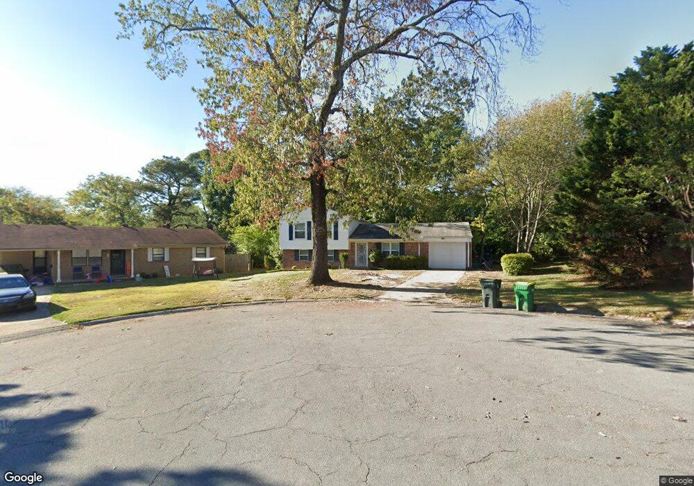
4 Eastbrook Cir Little Rock, AR 72205
West Markham NeighborhoodEstimated Value: $158,000 - $185,000
--
Bed
2
Baths
1,609
Sq Ft
$105/Sq Ft
Est. Value
About This Home
This home is located at 4 Eastbrook Cir, Little Rock, AR 72205 and is currently estimated at $168,499, approximately $104 per square foot. 4 Eastbrook Cir is a home located in Pulaski County with nearby schools including McDermott Elementary School, J.A. Fair K8 Preparatory School, and Henderson Middle School.
Ownership History
Date
Name
Owned For
Owner Type
Purchase Details
Closed on
Jul 16, 2012
Sold by
Sargent Paula J
Bought by
Pixel Properties Llc
Current Estimated Value
Home Financials for this Owner
Home Financials are based on the most recent Mortgage that was taken out on this home.
Original Mortgage
$75,150
Interest Rate
3.72%
Mortgage Type
Future Advance Clause Open End Mortgage
Purchase Details
Closed on
Apr 20, 2005
Sold by
Sargent Brenda Y
Bought by
Sargent Paula J
Home Financials for this Owner
Home Financials are based on the most recent Mortgage that was taken out on this home.
Original Mortgage
$88,305
Interest Rate
5.93%
Mortgage Type
FHA
Purchase Details
Closed on
Nov 10, 1999
Sold by
Sobin Nicholas J and Sobin Anna Marie
Bought by
Sargent Paula J and Sargent Brenda Y
Home Financials for this Owner
Home Financials are based on the most recent Mortgage that was taken out on this home.
Original Mortgage
$90,200
Interest Rate
7.88%
Mortgage Type
FHA
Create a Home Valuation Report for This Property
The Home Valuation Report is an in-depth analysis detailing your home's value as well as a comparison with similar homes in the area
Home Values in the Area
Average Home Value in this Area
Purchase History
| Date | Buyer | Sale Price | Title Company |
|---|---|---|---|
| Pixel Properties Llc | $84,000 | American Abstract & Title Co | |
| Sargent Paula J | -- | American Abstract & Title Co | |
| Sargent Paula J | $91,000 | American Abstract Title Co |
Source: Public Records
Mortgage History
| Date | Status | Borrower | Loan Amount |
|---|---|---|---|
| Closed | Pixel Properties Llc | $75,150 | |
| Previous Owner | Sargent Paula J | $88,305 | |
| Previous Owner | Sargent Paula J | $90,200 |
Source: Public Records
Tax History Compared to Growth
Tax History
| Year | Tax Paid | Tax Assessment Tax Assessment Total Assessment is a certain percentage of the fair market value that is determined by local assessors to be the total taxable value of land and additions on the property. | Land | Improvement |
|---|---|---|---|---|
| 2025 | $1,665 | $23,787 | $5,800 | $17,987 |
| 2024 | $1,665 | $23,787 | $5,800 | $17,987 |
| 2023 | $1,665 | $23,787 | $5,800 | $17,987 |
| 2022 | $1,665 | $23,787 | $5,800 | $17,987 |
| 2021 | $1,549 | $21,970 | $3,050 | $18,920 |
| 2020 | $1,538 | $21,970 | $3,050 | $18,920 |
| 2019 | $1,538 | $21,970 | $3,050 | $18,920 |
| 2018 | $1,538 | $21,970 | $3,050 | $18,920 |
| 2017 | $1,538 | $21,970 | $3,050 | $18,920 |
| 2016 | $1,485 | $21,210 | $3,800 | $17,410 |
| 2015 | $1,487 | $21,210 | $3,800 | $17,410 |
| 2014 | $1,487 | $21,210 | $3,800 | $17,410 |
Source: Public Records
Map
Nearby Homes
- 15 Brooklawn Dr
- 7 Brookfield Cove
- 9 Brookfield Cove
- 423 Brookside Dr
- 22 Nob Hill Cove
- 814 Shea Dr
- 8306 Louwanda Dr
- 22 Nob View Cir
- 4 Brookridge Cove
- 3 Edgestone Dr
- 8806 Mayflower Rd
- 409 Sunnymeade Dr
- 41 Brookridge Dr
- 8815 Cloverhill Rd
- 411 Burnside Dr
- 73 Reservoir Heights Dr
- 10 Reservoir Heights Dr
- 3 Lorine Cir
- 1204 Fawnwood Rd
- 8700 White Rock Ln
- 6 Eastbrook Cir
- 3 Northbrook Cir
- 2 Eastbrook Cir
- 00 Northbrook Dr
- 1 Northbrook Cir
- 17 Brooklawn Dr
- 19 Brooklawn Dr
- 5 Eastbrook Cir
- 4 Northbrook Cir
- 0 Northbrook Cir
- 0 Eastbrook Cir
- 21 Brooklawn Dr
- 11 Brooklawn Dr
- 3 Eastbrook Cir
- 0 Brookhaven Dr
- 8 Brookhaven Dr
- 10 Brookhaven Dr
- 2 Northbrook Cir
- 23 Brooklawn Dr
- 6 Brookhaven Dr