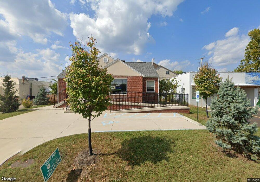
4 Euclid Dr Athens, OH 45701
Estimated Value: $268,409
2
Beds
1
Bath
958
Sq Ft
$280/Sq Ft
Est. Value
About This Home
This home is located at 4 Euclid Dr, Athens, OH 45701 and is currently estimated at $268,409, approximately $280 per square foot. 4 Euclid Dr is a home located in Athens County with nearby schools including East Elementary School, Athens Middle School, and Athens High School.
Ownership History
Date
Name
Owned For
Owner Type
Purchase Details
Closed on
Mar 2, 2010
Sold by
Conrath Larry F and Conrath Shelley R
Bought by
Endick Mitchell and Dollenmeyer Endick Ann
Current Estimated Value
Purchase Details
Closed on
Dec 13, 2005
Sold by
Conrath Larry F and Conrath Shelley R
Bought by
Endick Mitchell and Dollenmeyer Endick Ann
Home Financials for this Owner
Home Financials are based on the most recent Mortgage that was taken out on this home.
Original Mortgage
$120,000
Outstanding Balance
$67,420
Interest Rate
6.36%
Mortgage Type
Seller Take Back
Estimated Equity
$200,989
Purchase Details
Closed on
Oct 1, 1987
Create a Home Valuation Report for This Property
The Home Valuation Report is an in-depth analysis detailing your home's value as well as a comparison with similar homes in the area
Home Values in the Area
Average Home Value in this Area
Purchase History
| Date | Buyer | Sale Price | Title Company |
|---|---|---|---|
| Endick Mitchell | $120,000 | Attorney | |
| Endick Mitchell | $125,000 | None Available | |
| -- | $39,000 | -- |
Source: Public Records
Mortgage History
| Date | Status | Borrower | Loan Amount |
|---|---|---|---|
| Open | Endick Mitchell | $120,000 |
Source: Public Records
Tax History
| Year | Tax Paid | Tax Assessment Tax Assessment Total Assessment is a certain percentage of the fair market value that is determined by local assessors to be the total taxable value of land and additions on the property. | Land | Improvement |
|---|---|---|---|---|
| 2024 | $3,679 | $57,920 | $26,600 | $31,320 |
| 2023 | $3,345 | $57,920 | $26,600 | $31,320 |
| 2022 | $3,347 | $57,920 | $26,600 | $31,320 |
| 2021 | $3,343 | $57,920 | $26,600 | $31,320 |
| 2020 | $3,326 | $57,920 | $26,600 | $31,320 |
| 2019 | $0 | $50,040 | $20,900 | $29,140 |
| 2018 | $0 | $50,040 | $20,900 | $29,140 |
| 2017 | $3,978 | $50,040 | $20,900 | $29,140 |
| 2016 | $3,978 | $47,970 | $20,900 | $27,070 |
| 2015 | $3,978 | $43,560 | $20,900 | $22,660 |
| 2014 | $3,978 | $43,560 | $20,900 | $22,660 |
| 2013 | $3,255 | $36,630 | $20,900 | $15,730 |
Source: Public Records
Map
Nearby Homes
- 14 Euclid Dr
- 0 E State St Unit 226002681
- 37 Euclid Dr
- 44 Strathmore Blvd
- 58 Strathmore Blvd
- 12 McGuffey Ln
- 305 E State St
- 104 Sunnyside Dr
- 121 Morris Ave
- 41 Briarwood Dr
- 1 Northwood Dr
- 10 Joneswood Dr
- 123 Grosvenor St
- 64 Franklin Ave
- 0 Strouds Run Unit 2433166
- 11 Forest St
- 80 Court
- 0 Columbus Rd
- 193 N Lancaster St
- 71 W Washington St
- 5 Euclid Dr
- 10 Euclid Dr
- 12 Euclid Dr
- 9 Euclid Dr
- 6 Avon Place
- 11 Euclid Dr
- 690 E State St
- 8 Avon Place
- 11 Charles St
- 10 Avon Place
- 8 Charles St
- 13 Euclid Dr
- 16 Euclid Dr
- 12 Avon Place
- 13 Charles St
- 15 Euclid Dr
- 0 E State St Unit 3358068
- 0 E State St Unit 3358069
- 0 E State St Unit 3396650
- 0 E State St Unit 3396648
Your Personal Tour Guide
Ask me questions while you tour the home.