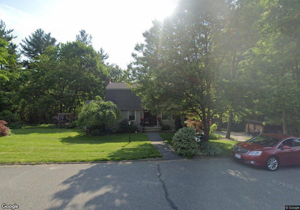
4 Grant Ave Southampton, MA 01073
Estimated Value: $450,507 - $534,000
4
Beds
2
Baths
1,713
Sq Ft
$281/Sq Ft
Est. Value
About This Home
This home is located at 4 Grant Ave, Southampton, MA 01073 and is currently estimated at $481,627, approximately $281 per square foot. 4 Grant Ave is a home located in Hampshire County with nearby schools including William E Norris School, White Oak School, and Westfield Christian Academy.
Ownership History
Date
Name
Owned For
Owner Type
Purchase Details
Closed on
Jun 29, 2006
Sold by
Cimineri Deborah J and Sholly Deborah J
Bought by
Sholly Deborah J
Current Estimated Value
Purchase Details
Closed on
Mar 15, 1993
Sold by
Murphy Kevin M and Murphy Linda A
Bought by
Cimineri Deborah J and Cimineri Ronald E
Home Financials for this Owner
Home Financials are based on the most recent Mortgage that was taken out on this home.
Original Mortgage
$73,000
Interest Rate
7.8%
Mortgage Type
Purchase Money Mortgage
Create a Home Valuation Report for This Property
The Home Valuation Report is an in-depth analysis detailing your home's value as well as a comparison with similar homes in the area
Home Values in the Area
Average Home Value in this Area
Purchase History
| Date | Buyer | Sale Price | Title Company |
|---|---|---|---|
| Sholly Deborah J | -- | -- | |
| Cimineri Deborah J | $123,000 | -- |
Source: Public Records
Mortgage History
| Date | Status | Borrower | Loan Amount |
|---|---|---|---|
| Previous Owner | Cimineri Deborah J | $25,000 | |
| Previous Owner | Cimineri Deborah J | $66,500 | |
| Previous Owner | Cimineri Deborah J | $73,000 | |
| Previous Owner | Cimineri Deborah J | $250,000 |
Source: Public Records
Tax History Compared to Growth
Tax History
| Year | Tax Paid | Tax Assessment Tax Assessment Total Assessment is a certain percentage of the fair market value that is determined by local assessors to be the total taxable value of land and additions on the property. | Land | Improvement |
|---|---|---|---|---|
| 2025 | $5,111 | $360,700 | $122,400 | $238,300 |
| 2024 | $4,988 | $350,000 | $122,400 | $227,600 |
| 2023 | $4,692 | $327,400 | $122,400 | $205,000 |
| 2022 | $4,631 | $307,300 | $121,000 | $186,300 |
| 2021 | $4,422 | $276,900 | $113,600 | $163,300 |
| 2020 | $4,381 | $276,900 | $113,600 | $163,300 |
| 2019 | $4,303 | $263,800 | $113,600 | $150,200 |
| 2018 | $4,060 | $242,800 | $102,300 | $140,500 |
| 2017 | $3,962 | $242,800 | $102,300 | $140,500 |
| 2015 | $3,717 | $236,600 | $95,200 | $141,400 |
Source: Public Records
Map
Nearby Homes
- Lot 5 Brickyard Rd
- 119 Brickyard Rd
- 369 College Hwy
- Lot 5 Gil Farm Rd
- Lot 6 Gil Farm Rd
- 117 Russellville Rd
- 216 College Hwy
- Lot 57 White Loaf Rd
- 45 Jaeger Dr
- 47 Jaeger Dr
- 100 Fomer Rd
- 150 Middle Rd
- 132 North Rd
- 336 Russellville Rd
- 94 Pequot Rd (Rear)
- 64 Old Stage Rd
- 4 Fitch Farm Way
- 232 Russellville Rd
- 36 County Rd
- 868 Southampton Rd Unit 18
- 8 Grant Ave
- 9 Grant Ave
- 5 Grant Ave
- 4 Madison Ave
- 155 Brickyard Rd
- 157 Brickyard Rd
- 159 Brickyard Rd
- 6 Madison Ave
- 153 Brickyard Rd
- 8 Madison Ave
- 156 Brickyard Rd
- 161 Brickyard Rd
- Lot 4 Brickyard Rd
- 177 & 178 Brickyard Rd
- 154 Brickyard Rd
- 9 Coolidge Dr
- 158 Brickyard Rd
- 163 Brickyard Rd
- 11 Madison Ave
- 160 Brickyard Rd