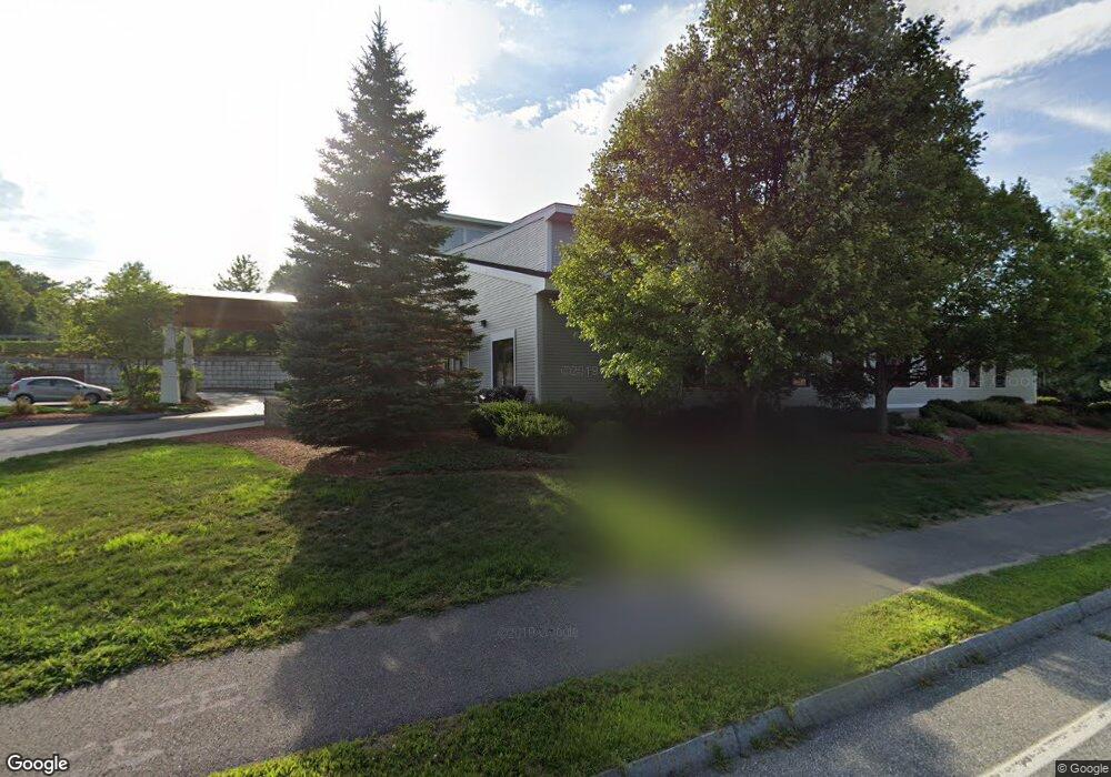
4 Hawthorne Dr Bedford, NH 03110
Bedford NeighborhoodEstimated Value: $21,120,536
--
Bed
13
Baths
30,576
Sq Ft
$691/Sq Ft
Est. Value
About This Home
This home is located at 4 Hawthorne Dr, Bedford, NH 03110 and is currently estimated at $21,120,536, approximately $690 per square foot. 4 Hawthorne Dr is a home located in Hillsborough County with nearby schools including Mckelvie Intermediate School, Ross A. Lurgio Middle School, and Bedford High School.
Ownership History
Date
Name
Owned For
Owner Type
Purchase Details
Closed on
Apr 16, 2019
Sold by
Spine Realty Llc
Bought by
Mmac 150 Bedford Nh Llc
Current Estimated Value
Purchase Details
Closed on
Aug 29, 2003
Sold by
May-Bed Dev Llc
Bought by
Spine Realty
Home Financials for this Owner
Home Financials are based on the most recent Mortgage that was taken out on this home.
Original Mortgage
$4,050,000
Interest Rate
5.69%
Mortgage Type
Commercial
Create a Home Valuation Report for This Property
The Home Valuation Report is an in-depth analysis detailing your home's value as well as a comparison with similar homes in the area
Home Values in the Area
Average Home Value in this Area
Purchase History
| Date | Buyer | Sale Price | Title Company |
|---|---|---|---|
| Mmac 150 Bedford Nh Llc | $11,740,000 | -- | |
| Spine Realty | $550,000 | -- |
Source: Public Records
Mortgage History
| Date | Status | Borrower | Loan Amount |
|---|---|---|---|
| Previous Owner | Spine Realty | $649,196 | |
| Previous Owner | Spine Realty | $498,584 | |
| Previous Owner | Spine Realty | $400,000 | |
| Previous Owner | Spine Realty | $4,050,000 |
Source: Public Records
Tax History Compared to Growth
Tax History
| Year | Tax Paid | Tax Assessment Tax Assessment Total Assessment is a certain percentage of the fair market value that is determined by local assessors to be the total taxable value of land and additions on the property. | Land | Improvement |
|---|---|---|---|---|
| 2024 | $59,591 | $3,769,200 | $728,100 | $3,041,100 |
| 2023 | $55,784 | $3,769,200 | $728,100 | $3,041,100 |
| 2022 | $64,909 | $3,688,000 | $724,800 | $2,963,200 |
| 2021 | $63,212 | $3,688,000 | $724,800 | $2,963,200 |
| 2020 | $69,329 | $3,463,000 | $688,700 | $2,774,300 |
| 2019 | $65,624 | $3,463,000 | $688,700 | $2,774,300 |
| 2018 | $68,230 | $3,344,600 | $688,700 | $2,655,900 |
| 2017 | $63,246 | $3,344,600 | $688,700 | $2,655,900 |
| 2016 | $74,013 | $3,308,600 | $589,800 | $2,718,800 |
| 2015 | $75,304 | $3,308,600 | $589,800 | $2,718,800 |
| 2014 | $74,444 | $3,308,600 | $589,800 | $2,718,800 |
| 2013 | $73,352 | $3,308,600 | $589,800 | $2,718,800 |
Source: Public Records
Map
Nearby Homes
- 29 Pebble Beach Dr
- 15 Spyglass Point Cir
- 145 Fox St
- 67 Murphy St
- 12 Knoll Crest Dr Unit Lot 5 - The Hannah
- 112 Riverdale Ave
- 34 Chatham Dr
- 545 Calef Rd Unit 26
- 700 S Beech St
- 34 Briston Ct
- 412 W Mitchell St
- 82 Pilgrim Dr
- 161 Flint St
- 35 W Mitchell St
- 80 Billings St
- 3 Churchill Ct Unit UN111
- 60 W Elmwood Ave
- 202 Mitchell St
- 56 Robert Ct Unit H
- 87 Harrington Ave
- 258 S River Rd Unit 10
- 258 S River Rd Unit 9
- 258 S River Rd Unit 8
- 258 S River Rd Unit 7
- 258 S River Rd Unit 6
- 258 S River Rd Unit 5
- 258 S River Rd Unit 4
- 258 S River Rd Unit 3
- 258 S River Rd Unit 2
- 258 S River Rd Unit 1
- 258 S River Rd
- 37 Hawthorne Dr Unit 217
- 37 Hawthorne Dr Unit 306
- 37 Hawthorne Dr Unit 415
- 37 Hawthorne Dr Unit 208
- 37 Hawthorne Dr Unit 405
- 37 Hawthorne Dr Unit 305
- 37 Hawthorne Dr Unit 214
- 37 Hawthorne Dr Unit 100
- 37 Hawthorne Dr Unit 308